

本文由Julie Margot design授权mooool发表,欢迎转发,禁止以mooool编辑版本转载。
Thanks Julie Margot design for authorizing the publication of the project on mooool, Text description provided by Julie Margot design.
Julie Margot design:2018年6月9日,在明尼阿波利斯举行的年度庆典上,魁北克的两家公司civiliti和Julie Margot Design赢得了体验平面设计协会( SEGD )的一项大奖。他们的项目Discovery Halts,从来自世界各地的353份参赛作品中脱颖而出,获得了一项荣誉大奖。该方案结合了景观设计、路径导示和诗歌,为19世纪弗雷德里克·劳·奥姆斯特德(Frederick Law Olmsted)设计的著名皇家公园增添了一层神秘的色彩。
评审团评论道:“他们将愉快而迷人的体验优雅地融入了环境中。”
Julie Margot design:On June 9, 2018, two Quebec firms civiliti and Julie Margot Design won a prestigious award from the Society for Experiential Graphic Design (SEGD) during its annual gala held in Minneapolis. Their project, Escales découvertes (Discovery Halts), was selected for a Honor Award among 353 entries submitted from numerous countries around the world. The scheme combines landscape architecture, wayfinding and poetry, adding a subtle layer to the much-celebrated Mount-Royal Park designed by Frederick Law Olmsted in the 19th century.
“A delightful and engaging experience integrated gracefully into the environment” comments the jury.
蒙特利尔以其历史建筑和充满活力的城市生活而闻名,也因其位于圣劳伦斯河上的独特环境和从市中心升起的虽小但极具象征意义的山峰而闻名。众所周知,皇家山一直是蒙特利尔人的旅游胜地,长年吸引着游客前往。
Montreal, celebrated for its historical architecture and its vibrant urban life, is also recognized for its unique setting on the St. Lawrence River and for its small, but highly emblematic, mountain rising from the downtown core. Mount Royal, as it is known, is a year-long destination for Montrealers and has always been a magnet for visitors.
▼平面图 Site plan
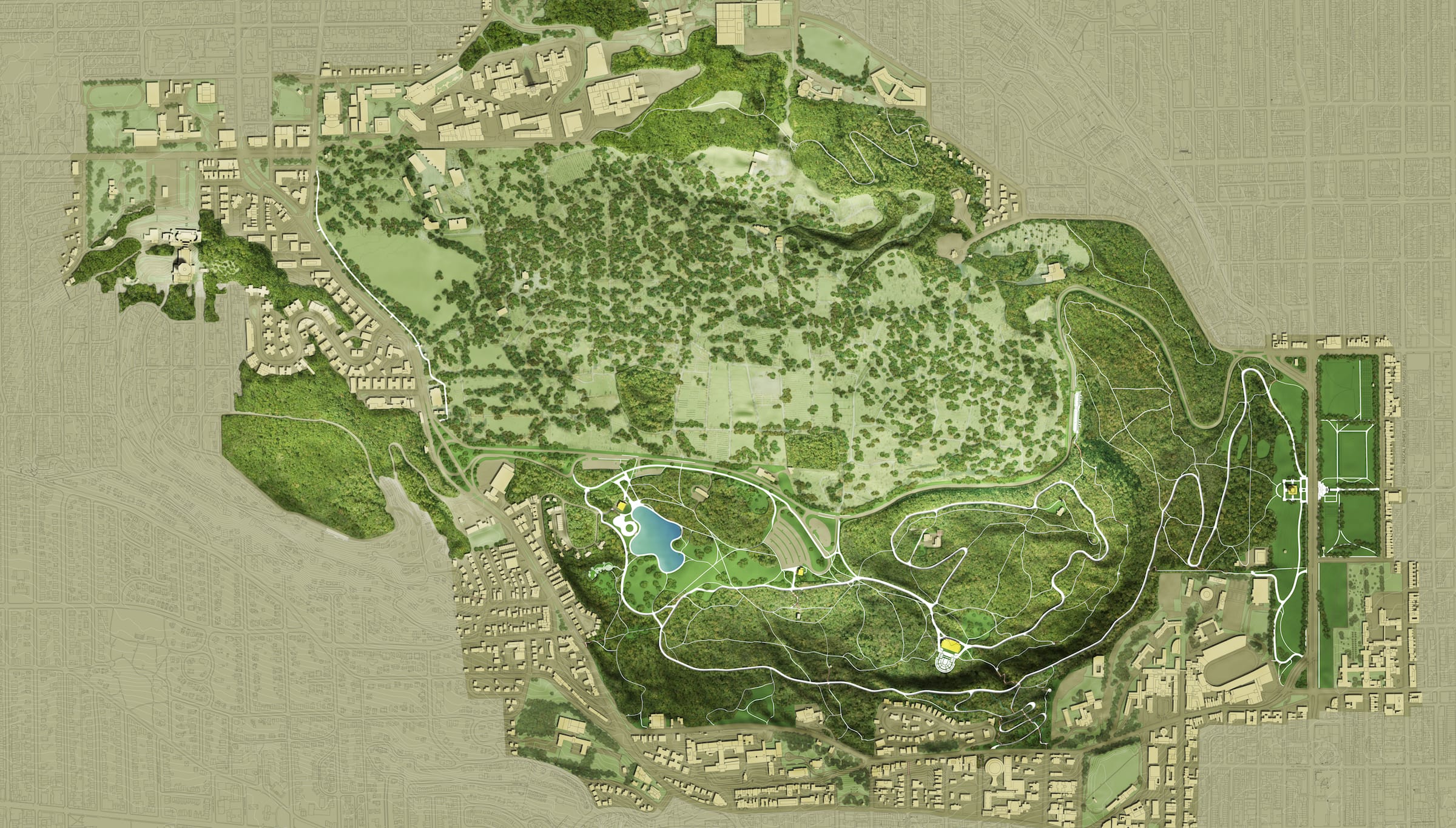
奥姆斯特德(Frederick Law Olmsted)在19世纪将这片面积495英亩的土地改造成了一座公园,这个公园是一个面积更大、更不为人知的1850英亩皇家山遗址的一部分。它包括三个不同的山峰、5个墓地、2个大学校园和一些重要的历史建筑。和古老的蒙特利尔一样,这个文化遗址也是该市最“受保护”的地区之一。
The 495-acre area transformed into a park in the 19th century by Frederick Law Olmsted is part of a larger and lesser-known 1850-acre territory, designated as the Mount-Royal Heritage Site. It encompasses three distinct summits, 5 cemeteries, 2 university campuses and significant historical buildings. Along with Old Montreal, this heritage site is one of the city’s most ‘protected’ sectors.
2017年,在举办67届世博会50年后,蒙特利尔开始通过一系列城市干预措施来庆祝其375周年。这个名为Discovery Halts的项目是为皇家山遗址设计的,它与其他技术性的纪念项目形成鲜明对比,它是关于连接、发现和互动的。谨慎而大胆,从一开始就打算为游客提供一个全新的体验,让人们对山的自然和历史特征有一个更清晰的理解。
In 2017, fifty years after hosting Expo 67, Montreal set out to celebrate its 375th anniversary with a series of urban interventions. This project called Escales decouvertes (Discovery Halts) was designed for the Mount Royal site and it stands in sharp contrast with other more technologically savvy commemorative projects. It is about connecting, discovering and interacting. Discreet yet audacious, it was intended from the start to provide visitors with an entirely new experience and a clearer understanding of the mountain’s natural and historical features.
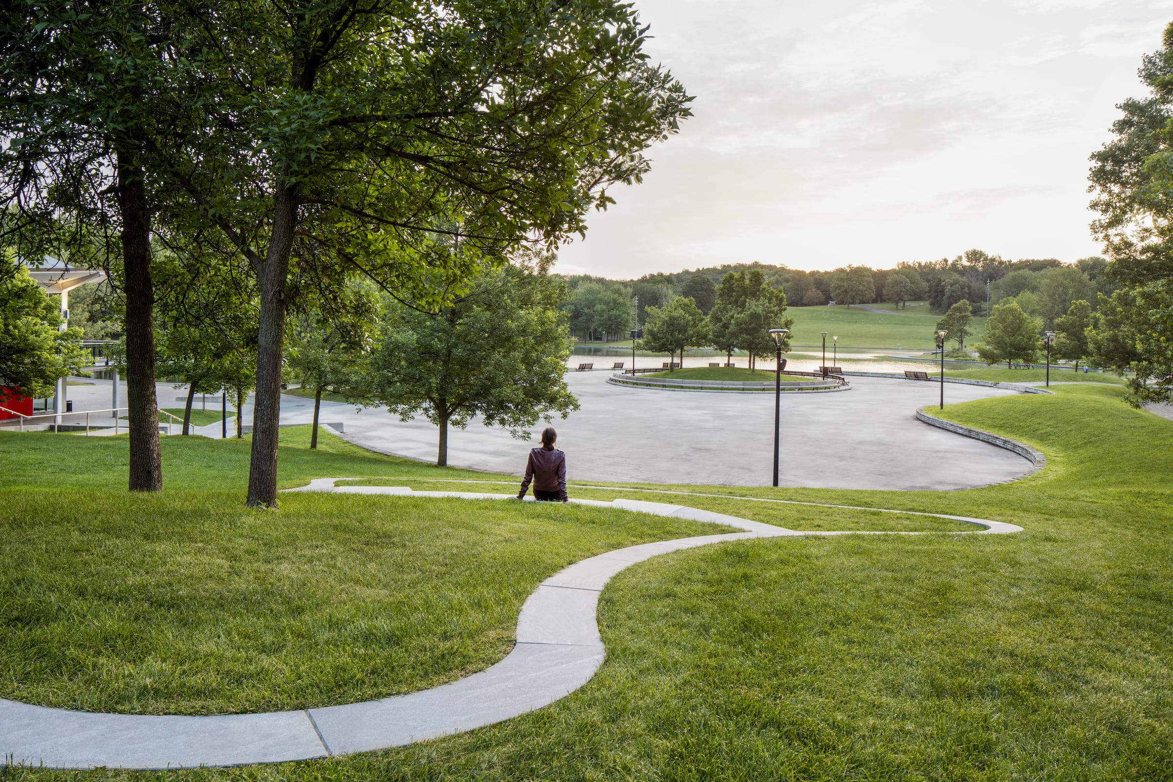
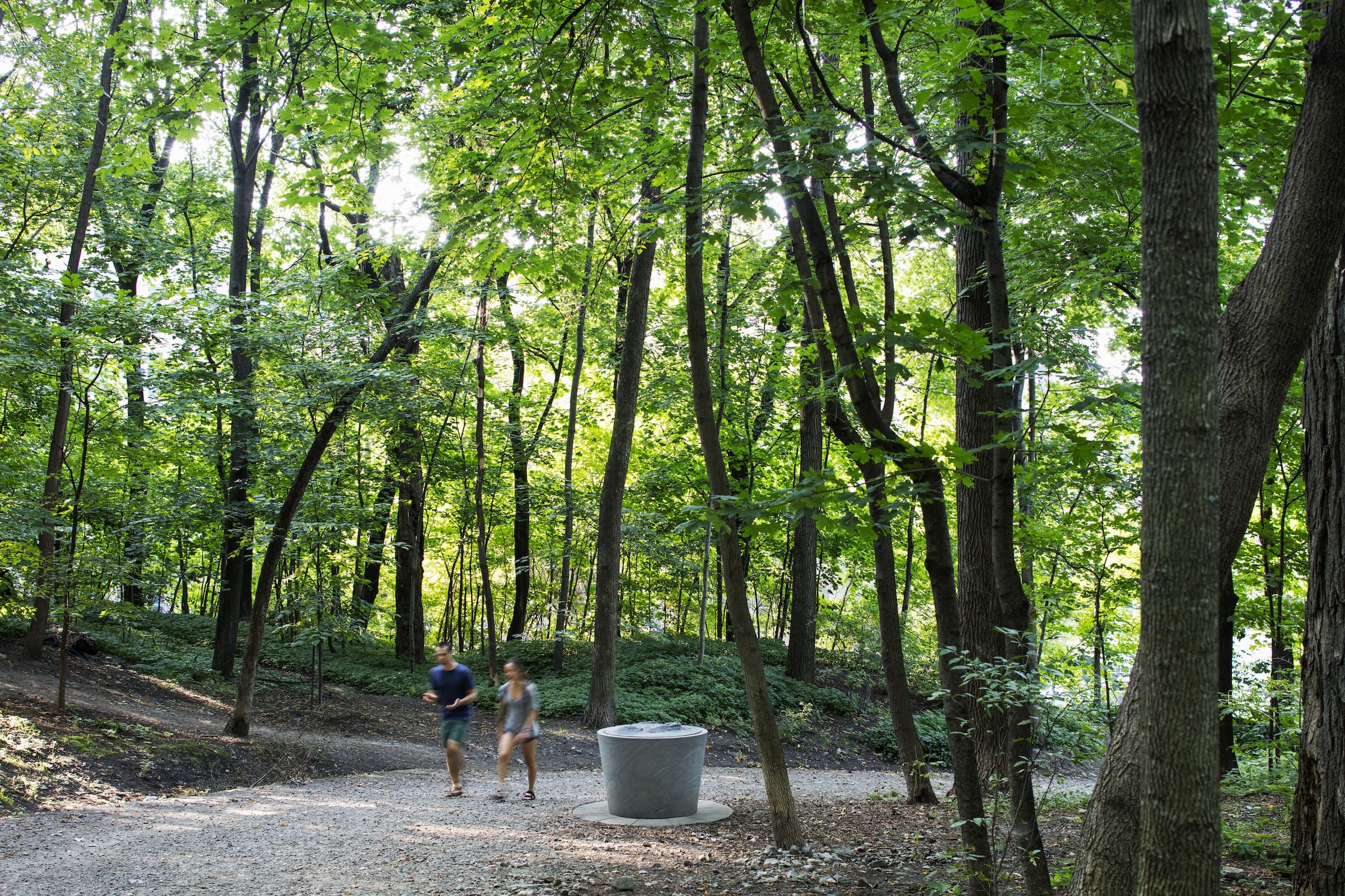
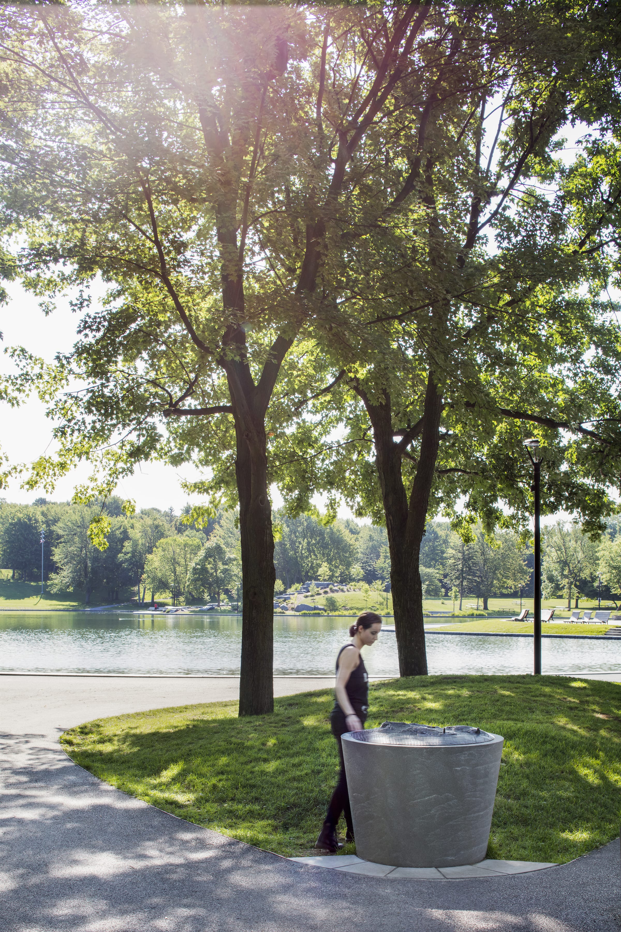
由civiliti和Julie Margot design组成的设计团队没有采用传统的路径导示方式,如直线路线、方向标志或纪念标志,而是选择了一种开放式的方式,主要利用自然特征作为寻路线索。根据该遗址特殊的文物地位而产生的要求,开发了一系列的物品。这些导示雕塑由花岗岩和青铜制成,安装在整个公园及其周边地区。它们旨在让游客对基地的特性有一个感性和直观的认识。在SEGD网站编辑的采访中,civiliti的彼得·索兰解释道:“我们开始谈论物品本身,而不是导示标牌。景观中出现的物体是神秘的,会吸引人们的注意力。
Staying away from traditional wayfinding options, such as linear trails, directional signage or commemorative markings, the design team made up of civiliti and Julie Margot design opted instead for an open-ended approach using mostly natural features as wayfinding clues. A family of objects was developed in keeping with requirements deriving from the site’s special heritage status. Designed in granite and bronze, these were installed throughout the park and its immediate surroundings. They are meant to engage visitors in a sensorial and intuitive discovery of the site’s features. Interviewed by the SEGD website’s editors, civiliti’s Peter Soland explained: “We started talking about objects, rather than signage. Objects appearing in the landscape would be enigmatic and attract people to them.”

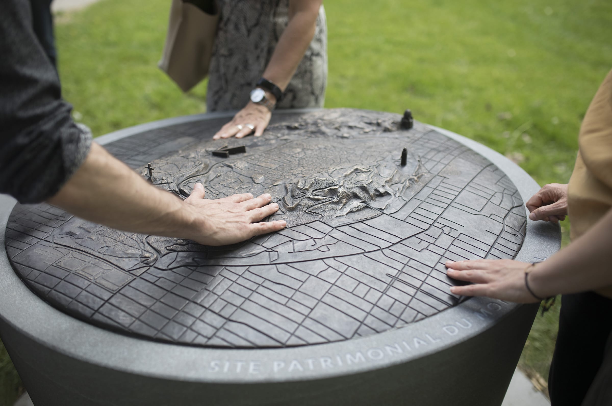
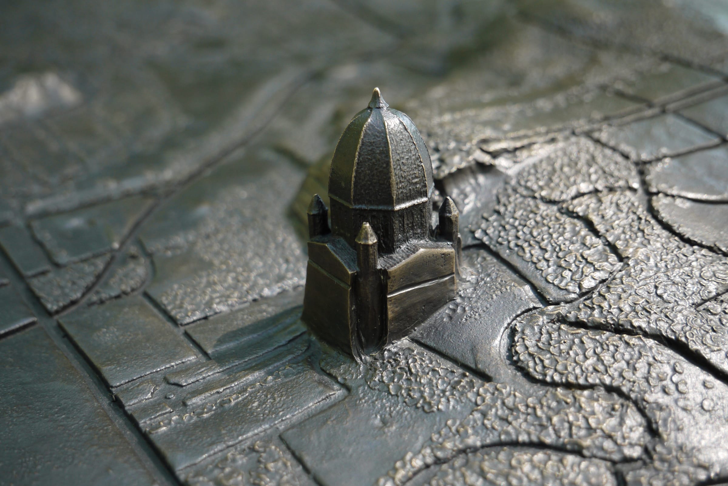
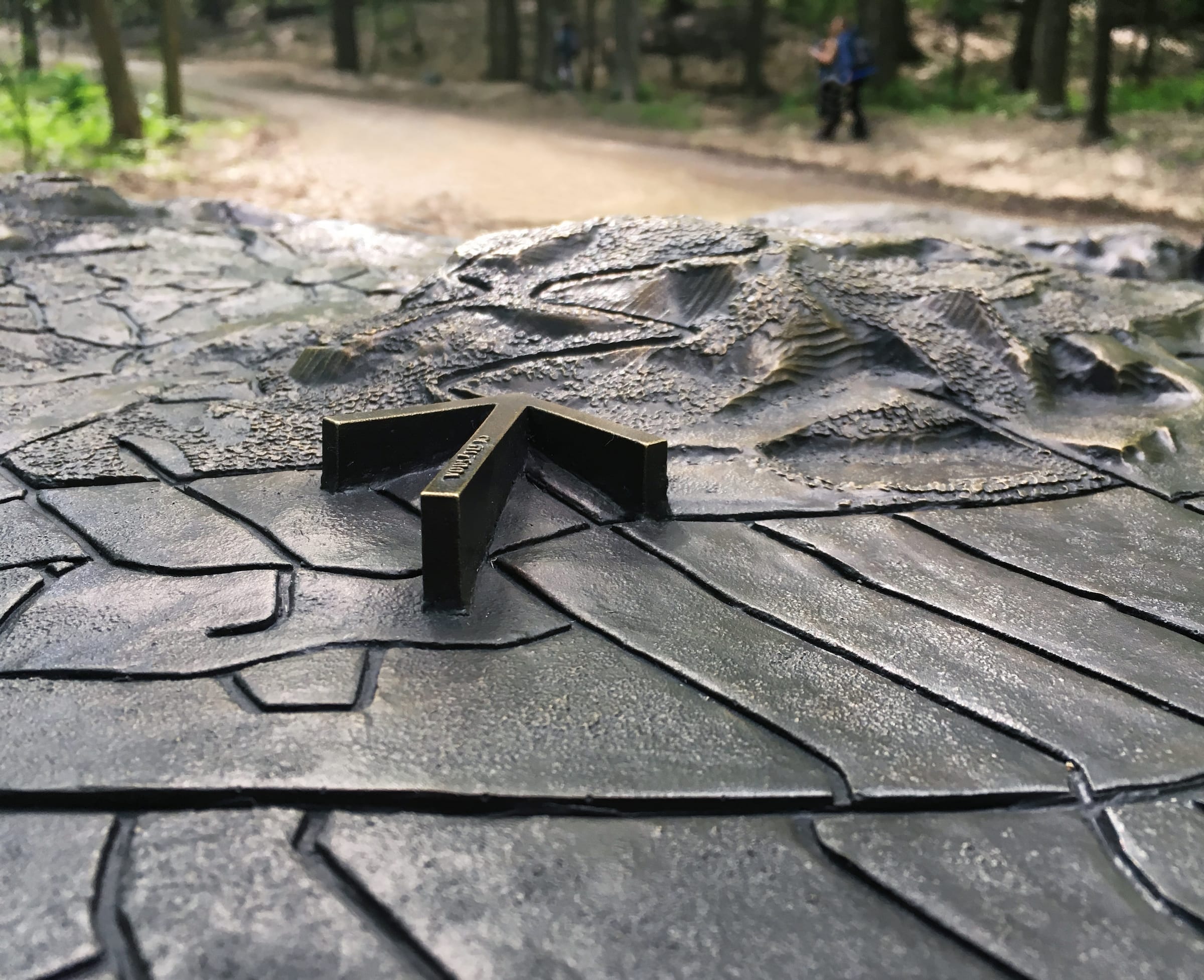
我们共创造了三种类型的物体:设计成定向装置的立体地图、在景观中用作位置标记的小圆锥形石头、以及更大的类似于观景台的半圆形障碍物。这些青铜地图,每张都镶嵌在花岗岩基座上,战略性地放置在十二个入口点。每幅地图都在城市坐标方格之上清楚地标示出皇家山的三个不同的山峰以及三个已建成的地标的位置。它们共同帮助游客在视觉和触觉上理解山的地理特征。
Three types of objects were created: tridimensional maps designed as orientation devices, low conical stones serving as place-markers in the landscape, and larger belvedere-like halts. The bronze maps, each set on a granite base, were strategically placed at twelve access points. Each map clearly identifies Mount Royal’s three distinct summits, rising above the city grid, and three built landmarks. Together they provide visitors with a visual and tactile understanding of the mountain’s geographical identity.

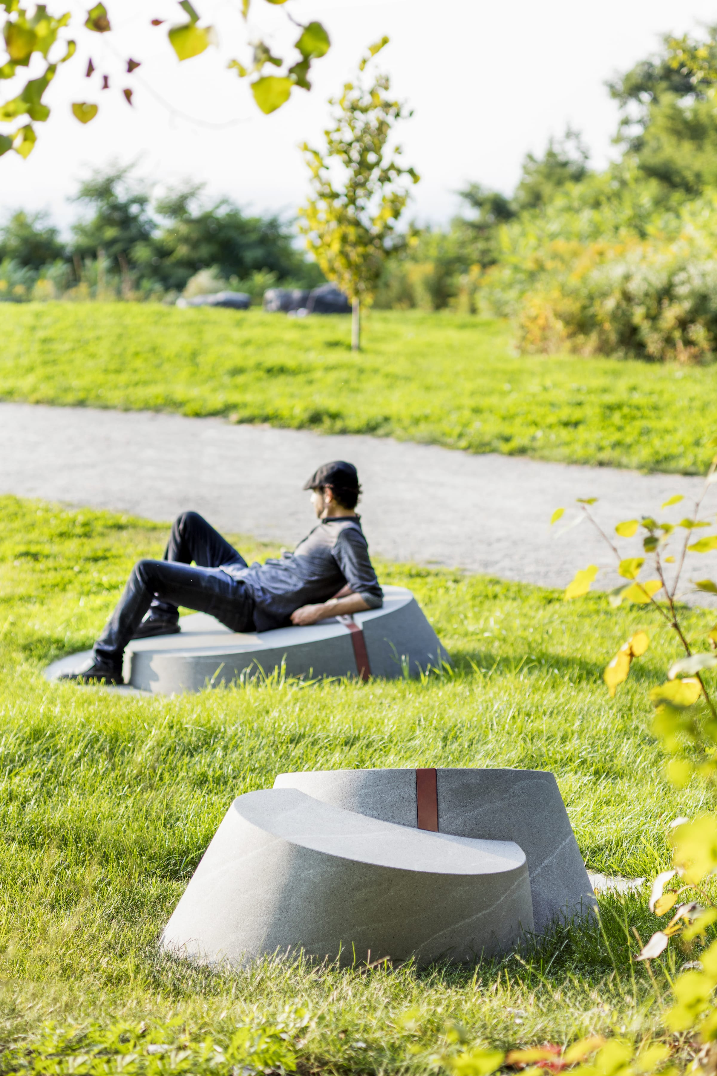
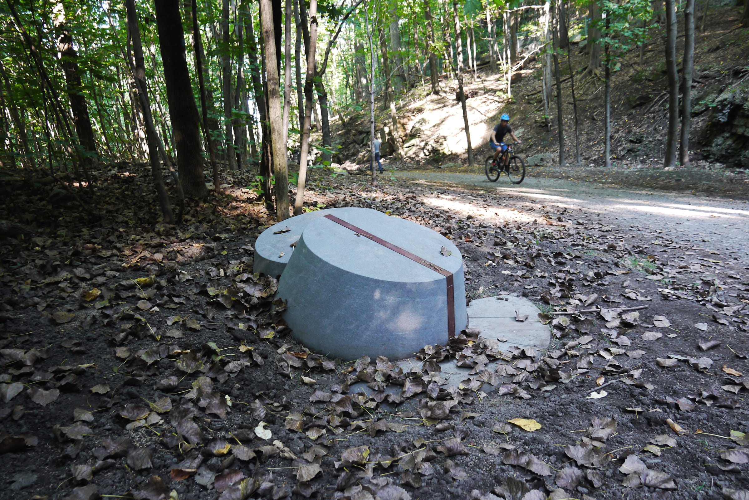
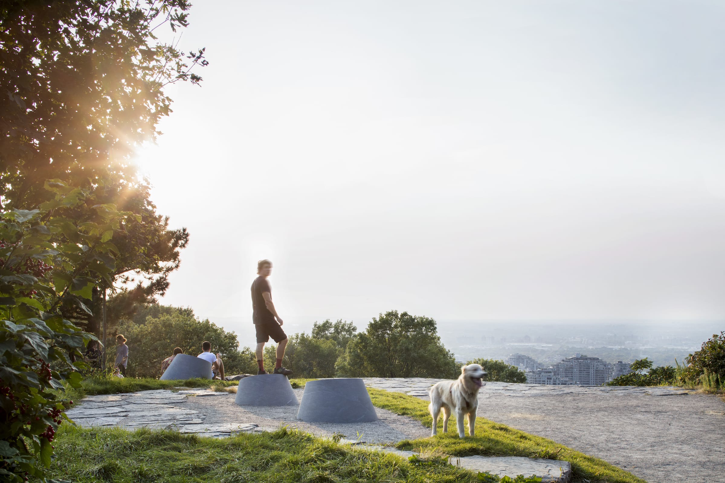
圆锥形的位置标记以两到三个为一组,大小不一,有的小如踏脚石,有的大到可以坐下或靠在上面。他们的青铜铭文为这座山的历史和自然特征提供了更为亲密的线索,如著名的岩层、草原、现在埋藏的河流痕迹或消失的滑雪坡。其中25个花岗岩圆锥体簇最初是为该项目而设计的。
The conical place-markers, clustered in groups of two or three, vary in size, some as small as stepping-stones, others large enough to sit or lean on. With their bronze inscriptions, they provide clues to the more intimate characteristics of the mountain’s historical and natural features such as notable rock formations, prairies, the trace of a now-buried river or a vanished ski slope. Twenty-five of these granite cones clusters were initially planned for the project.

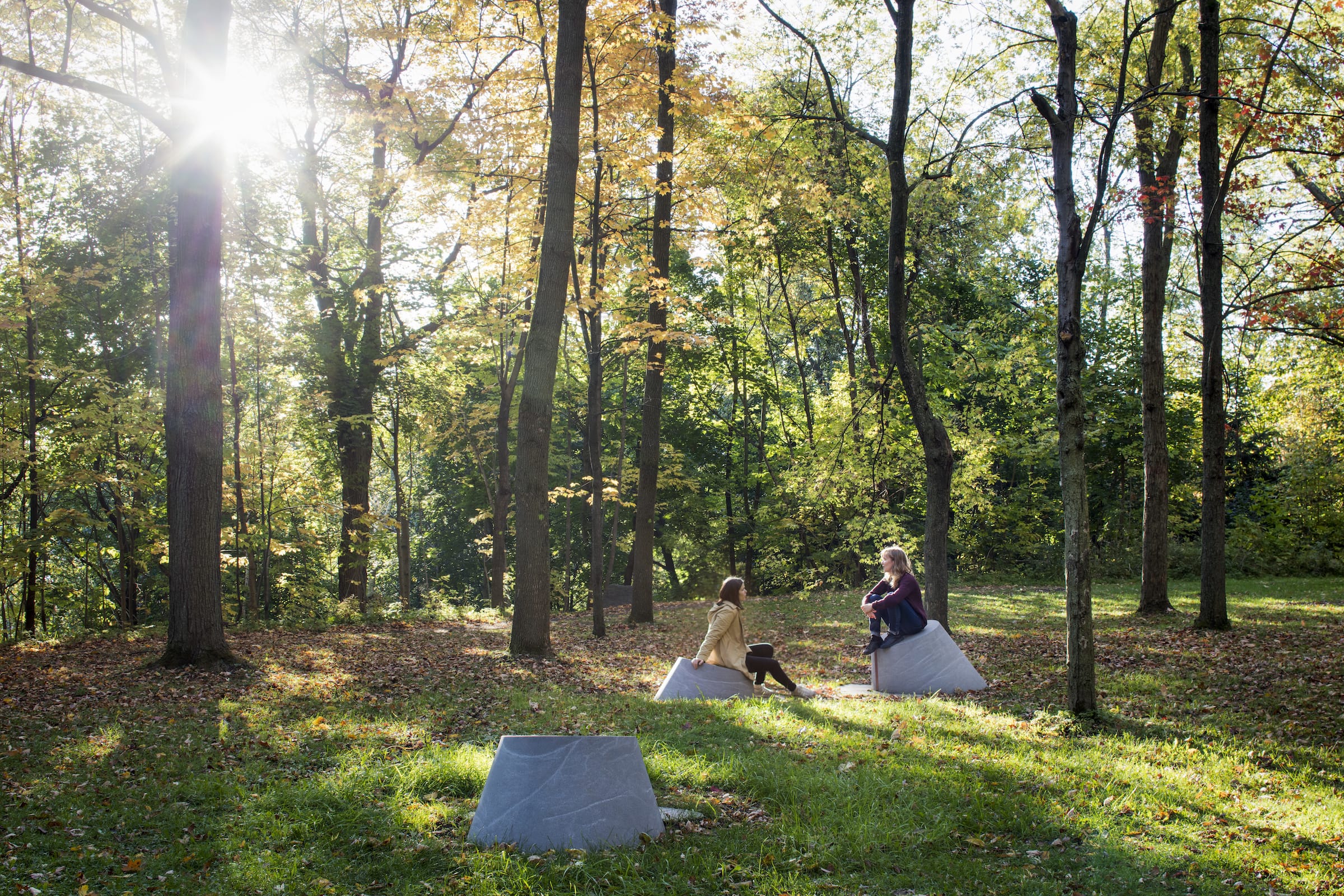
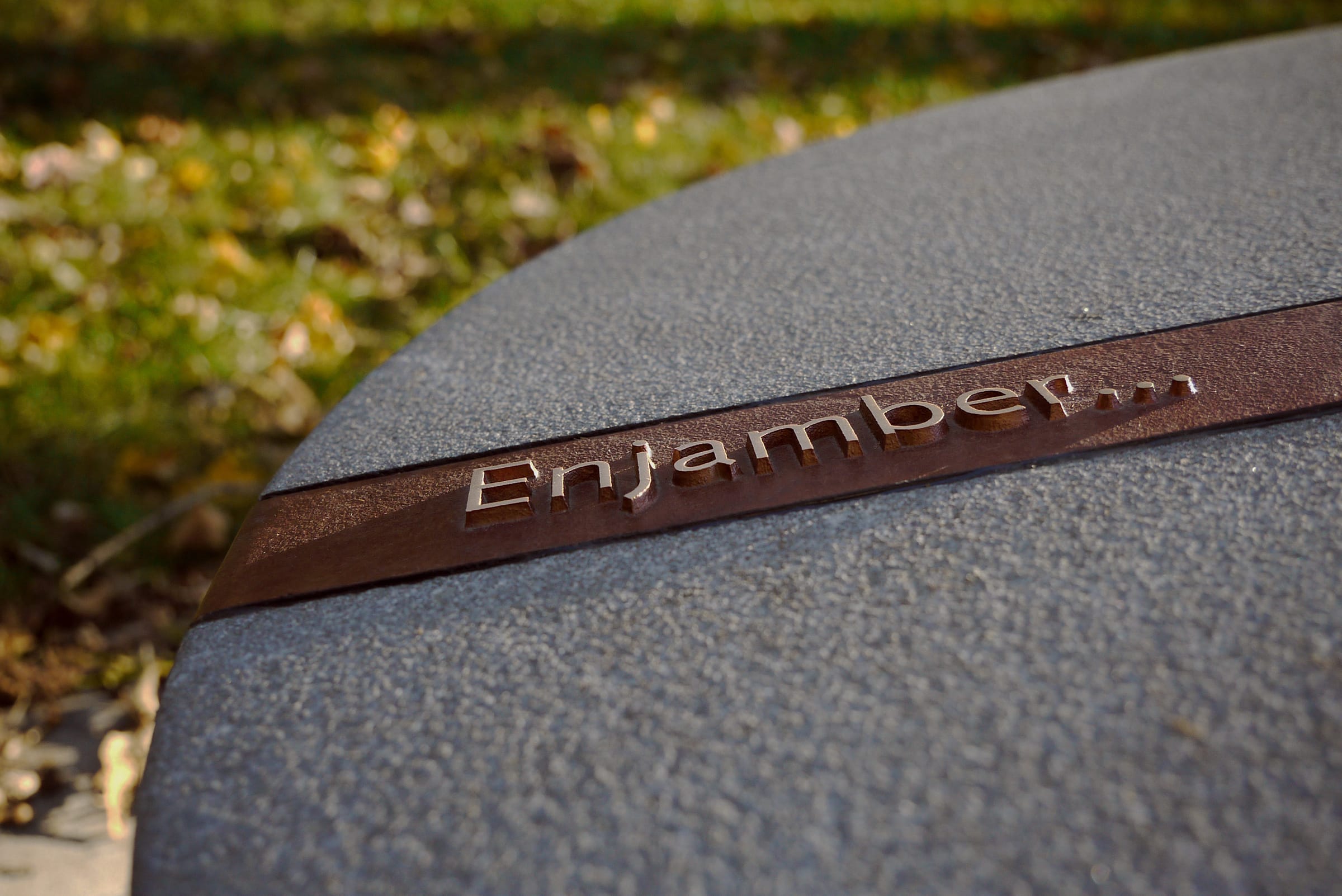
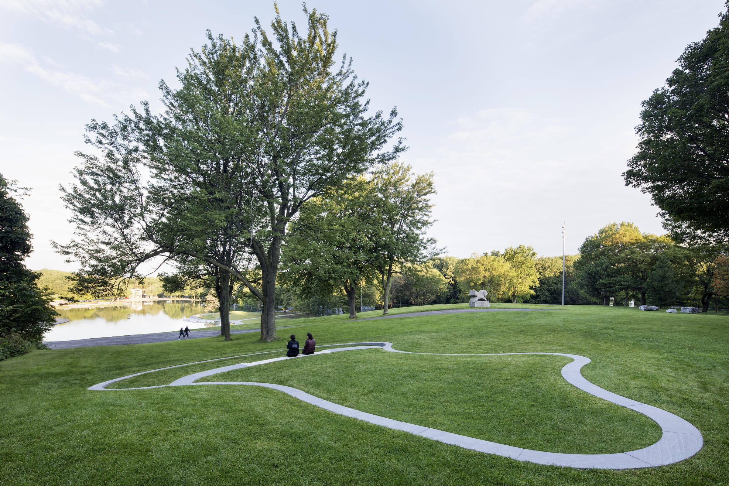
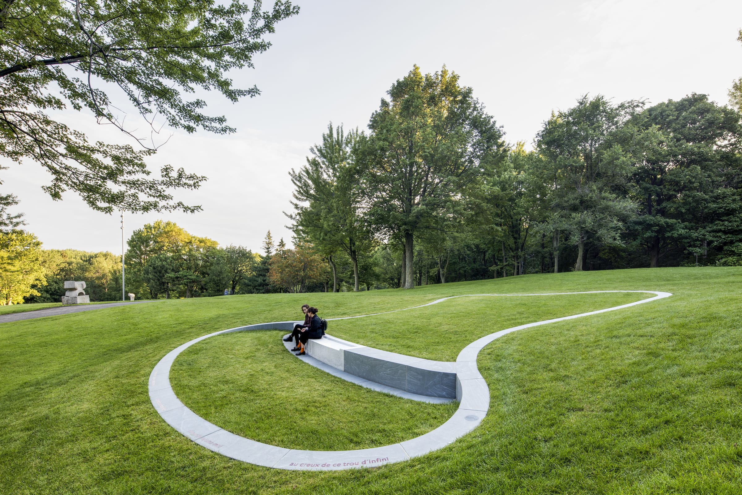
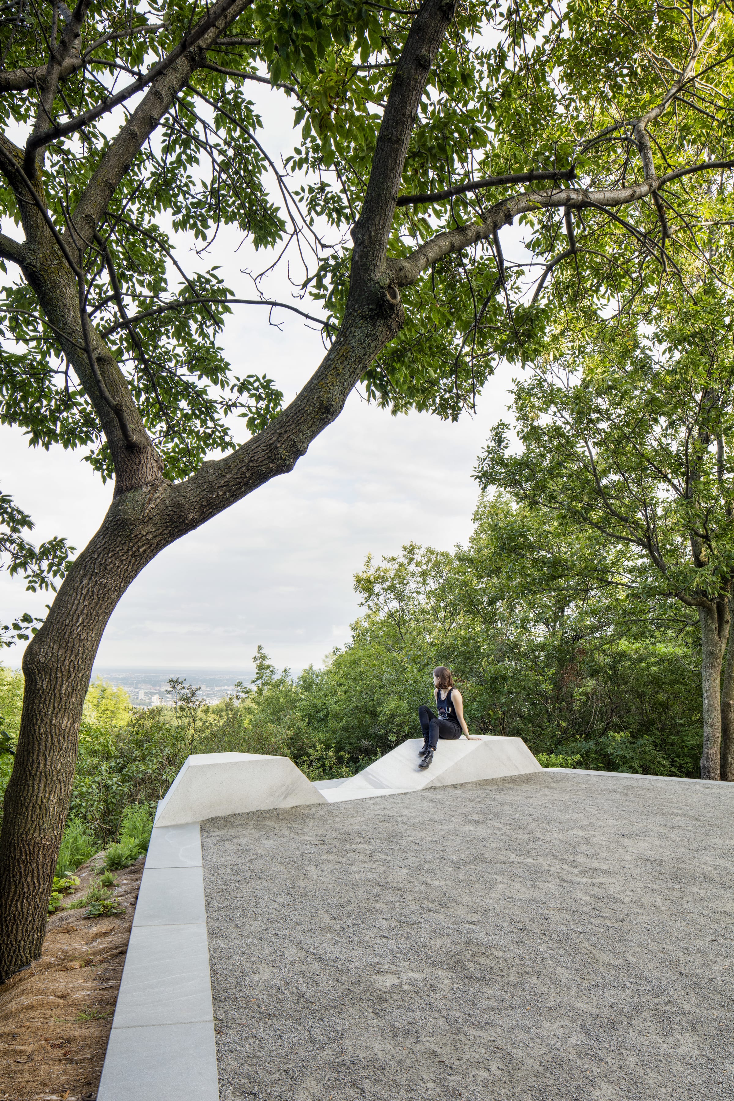
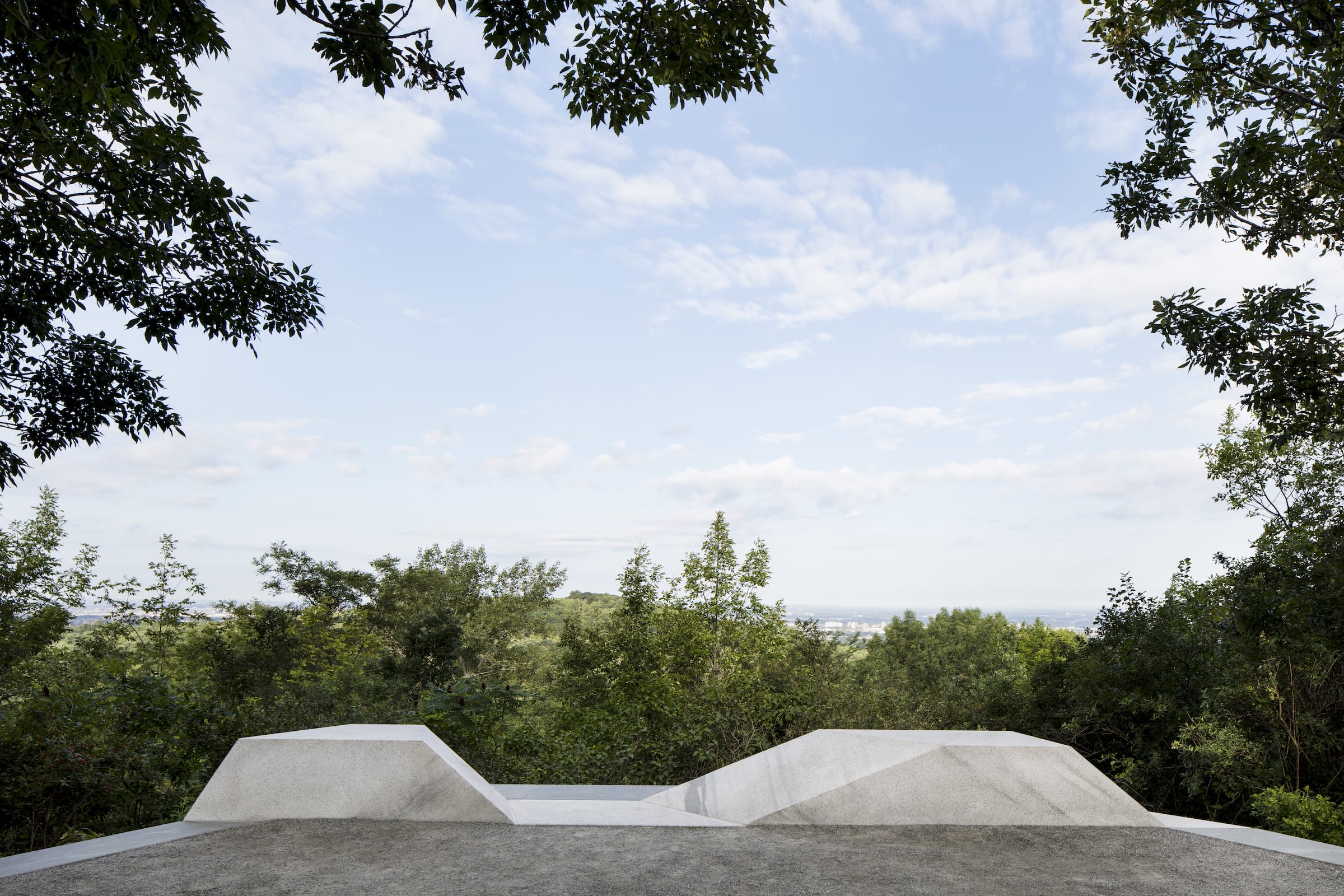
这个系列的最后一部分由十个类似于观景台的障碍物构成。他们要么被固定在地面上,要么从悬崖上延伸出来。它们也是由花岗岩边界定义的,它们的共同特点是由同一个蒙特利尔诗人专门为该地点写的诗句。这些石台有时呈曲线,有时呈角度放置,都有内置座椅,部署在战略性位置,可以俯瞰皇家山的内部景观。
The last segment of this family of objects consists in a series of ten landscaped belvedere-like halts. Each one is either anchored in the ground or projecting from a cliff. It is also defined by a granite border featuring a verse written specifically for the location by an assigned Montreal poet. The halts, at times curvilinear, at times angular, all with built-in seating, are located in strategic locations with privileged views of Mount Royal’s interior landscapes.
每个干预措施的地点都来自严格的场地和景观分析,包括四季摄影调查。每一个拟议的场址都提交给由不同利益相关者组成的委员会审查。我们的另一个挑战是确保这些物体被放置在整个场地上,能够让游客充分地欣赏到这座山。
Locations for each intervention derived from rigorous site and landscape analyses, which included four-season photographic surveys. Each of the proposed sites was submitted to a committee composed of various stakeholders. An additional challenge consisted in making sure the objects were positioned throughout the entire site to ensure full appreciation of the mountain.
在SEGD网站的采访中,该项目的首席视觉设计师朱莉·玛戈特(Julie Margot)解释了这一概念的演变过程:“我们希望摆脱‘方向’和‘导向’,鼓励对不同空间和地点的直观体验。”
In the SEGD website interview, Julie Margot, the project’s lead visual designer, explains how the concept evolved: “We wanted to move away from ‘direction’ and ‘directing’ and encourage an intuitive experience of the different spaces and places.”

客户:Ville de Montréal, Service des grands parcs, du verdissement et du Mont-Royal
设计团队
civiliti
Julie Margot design
Vlan paysages
景观设计师Luu Nguyen
顾问
土木工程:Les Services Exp
工业设计:Messier Designers
雕塑:Jules Lasalle
建筑
总承包:Aménagement Côté Jardin
青铜字母印刷制造:Pontbriand
青铜地图制造:Artcast
花岗岩采石场:Rock of Ages
石刻:Premier Jet
Client: Ville de Montréal, Service des grands parcs, du verdissement et du Mont-Royal
Design Team
civiliti
Julie Margot design
Vlan paysages
Luu Nguyen, landscape architect
Consultants
Civil engineers: Les Services Exp
Industrial designers: Messier Designers
Sculptor: Jules Lasalle
Construction
General Contractor: Aménagement Côté Jardin
Manufacturer, Bronze Letters: Pontbriand
Manufacturer, Bronze Map: Artcast
Granite Quarry: Rock of Ages
Stone Engravers: Premier Jet
更多 Read more about: Julie Margot design


0 Comments