

本文由Sasaki授权mooool发表,欢迎转发,禁止以mooool编辑版本转载。
Thanks Sasaki for authorizing the publication of the project on mooool, Text description provided by Sasaki.
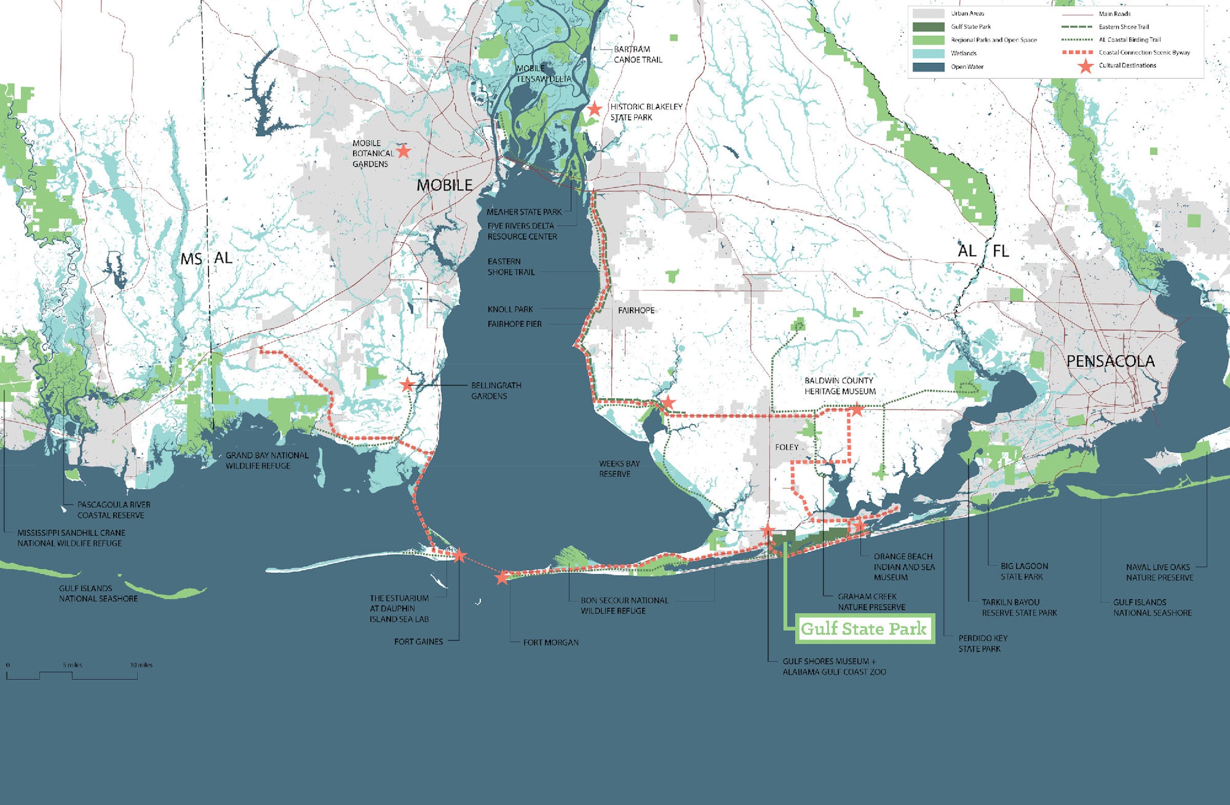
Sasaki:2010年墨西哥湾漏油事故对附近大范围海洋造成严重破坏,事故不但导致阿拉巴马州的许多海滩关闭,也造成持续至今的经济影响。占地达2,490公顷的海湾州立公园是墨西哥湾沿岸面积最大的开放保护区,公园如同阿拉巴马州的滨海走廊,每年都吸引大量本地与外地游客到访。这个极受欢迎的旅游景点为当地所带来的巨额收益足以支撑整个阿拉巴马州公园系统的运营。Sasaki的总体规划方案建基于海湾州立公园独一无二的优厚条件,制定符合国际水平的可持续环境发展和经济发展模型。
Sasaki: In 2010, the Deepwater Horizon Oil Spill devastated the Gulf Coast. In Alabama, beaches were closed, and the economic impacts were long-lasting. At 6,150 acres, Gulf State Park is the largest preserved open space on the Gulf of Mexico. The park serves as Alabama’s front porch on the Gulf, drawing visitors from the state and beyond. Its popularity as a tourist destination generates park revenue that supports the rest of the Alabama State Park system. Sasaki’s Master Plan builds on the park’s unique assets to transform it into an international model of environmental and economic sustainability.

创造经济韧性 Economic Resilience
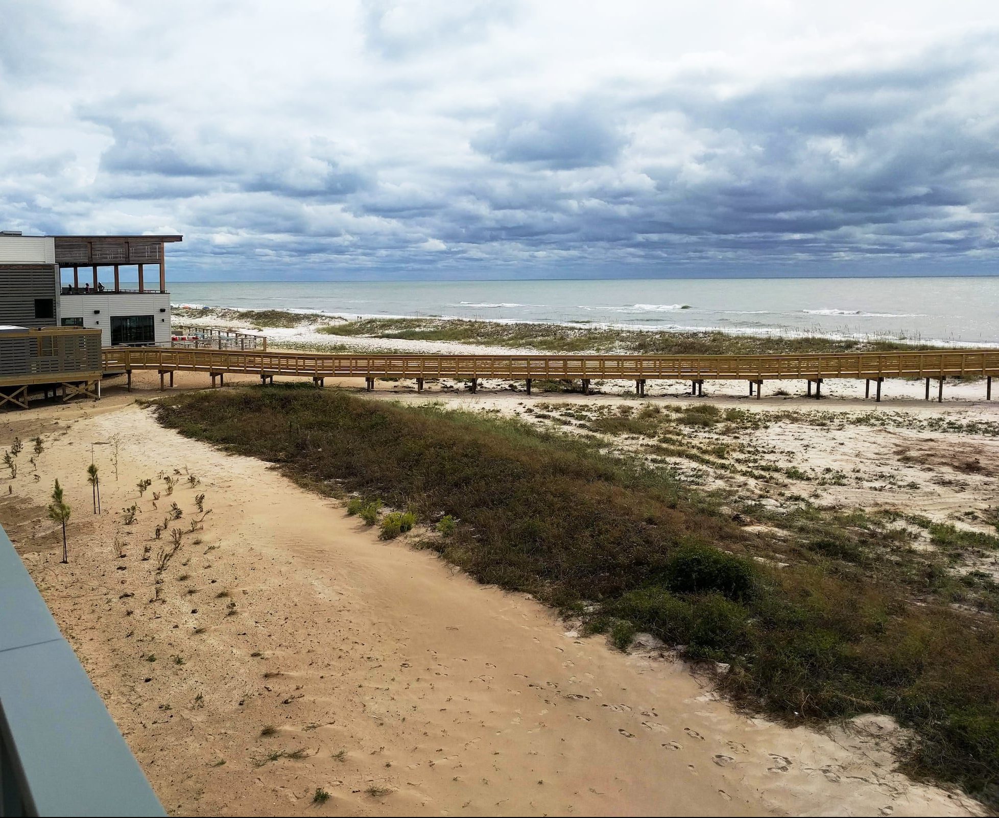
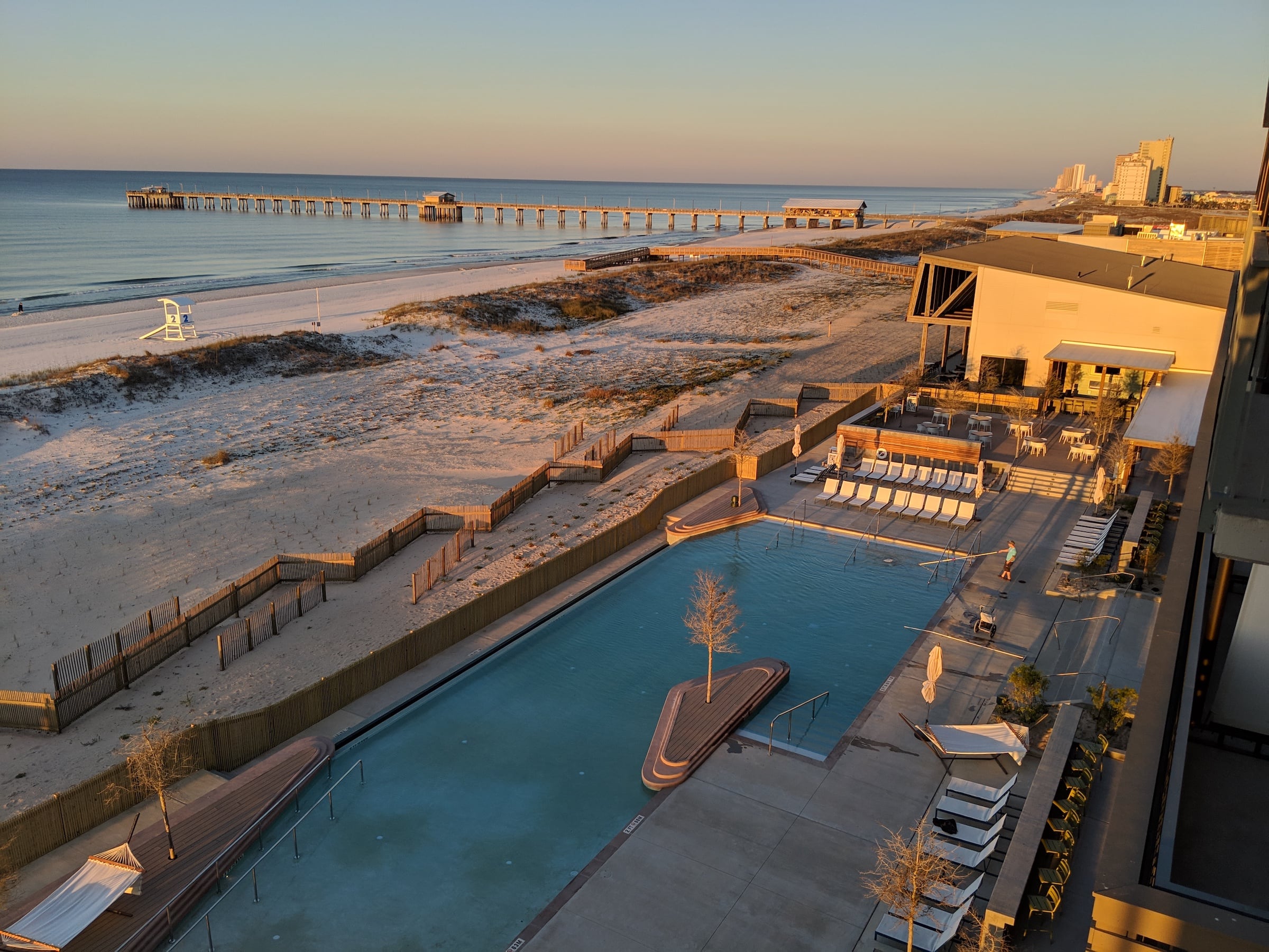
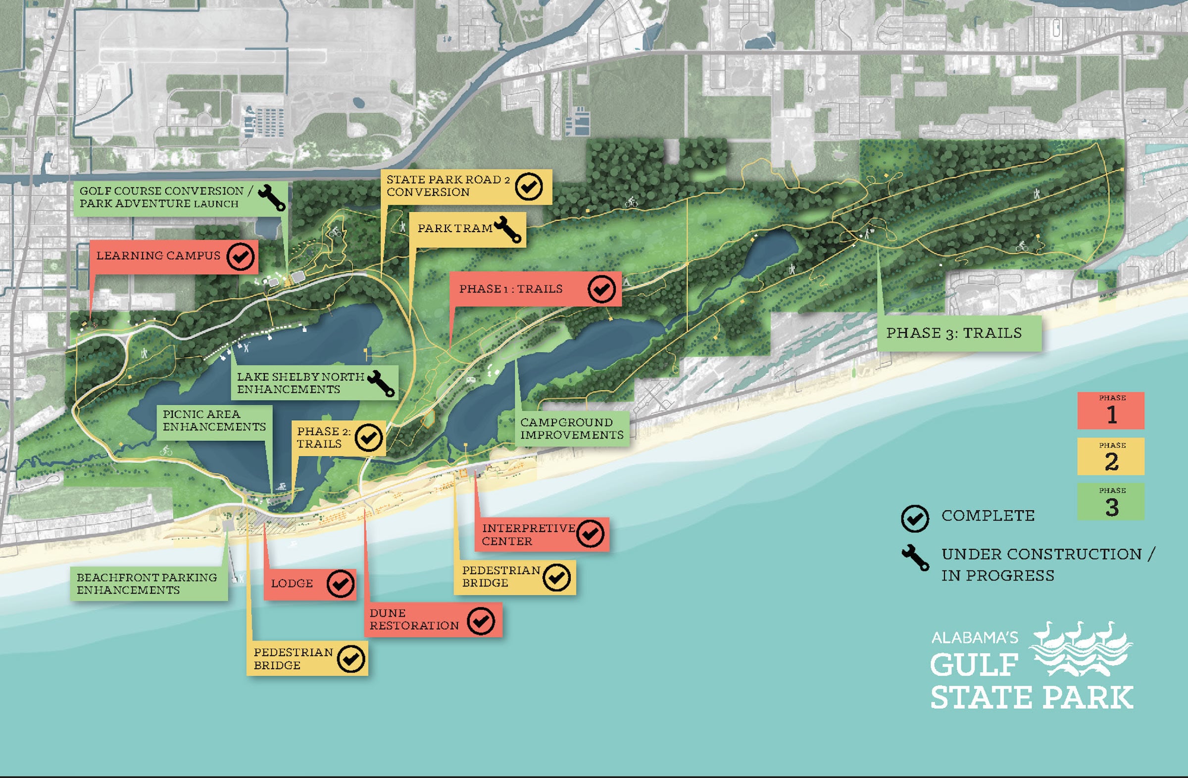
阿拉巴马州的旅游业收益占美国国内生产总值约7%,创造经济韧性无疑是当地的首要任务。为加强外界对海湾州立公园的认识,公园范围里的三个新项目——度假村The Lodge、游客教育中心及学习园区,都将肩负重大使命。新建的The Lodge与附近人烟较稠密的旅游胜地保持距离,住客因此可在静谧的环境中欣赏无边际海景,度假村一侧与海滩直接相连,另一侧通往贯穿公园的43公里自然步道,提供多样化的出游体验。
In a state where tourism makes up about seven percent of the GDP, economic resilience has been a top priority for Alabama. Three new projects within the park—the Lodge, the Interpretive Center, and the Learning Campus-—aid in expanding access to the area. Set away from more crowded vacation destinations nearby, the Lodge offers serene views of the ocean, with immediate access to the beach on one side and 27 miles of trails through the park on the other.
▼从度假村往外看 View from the Lodge
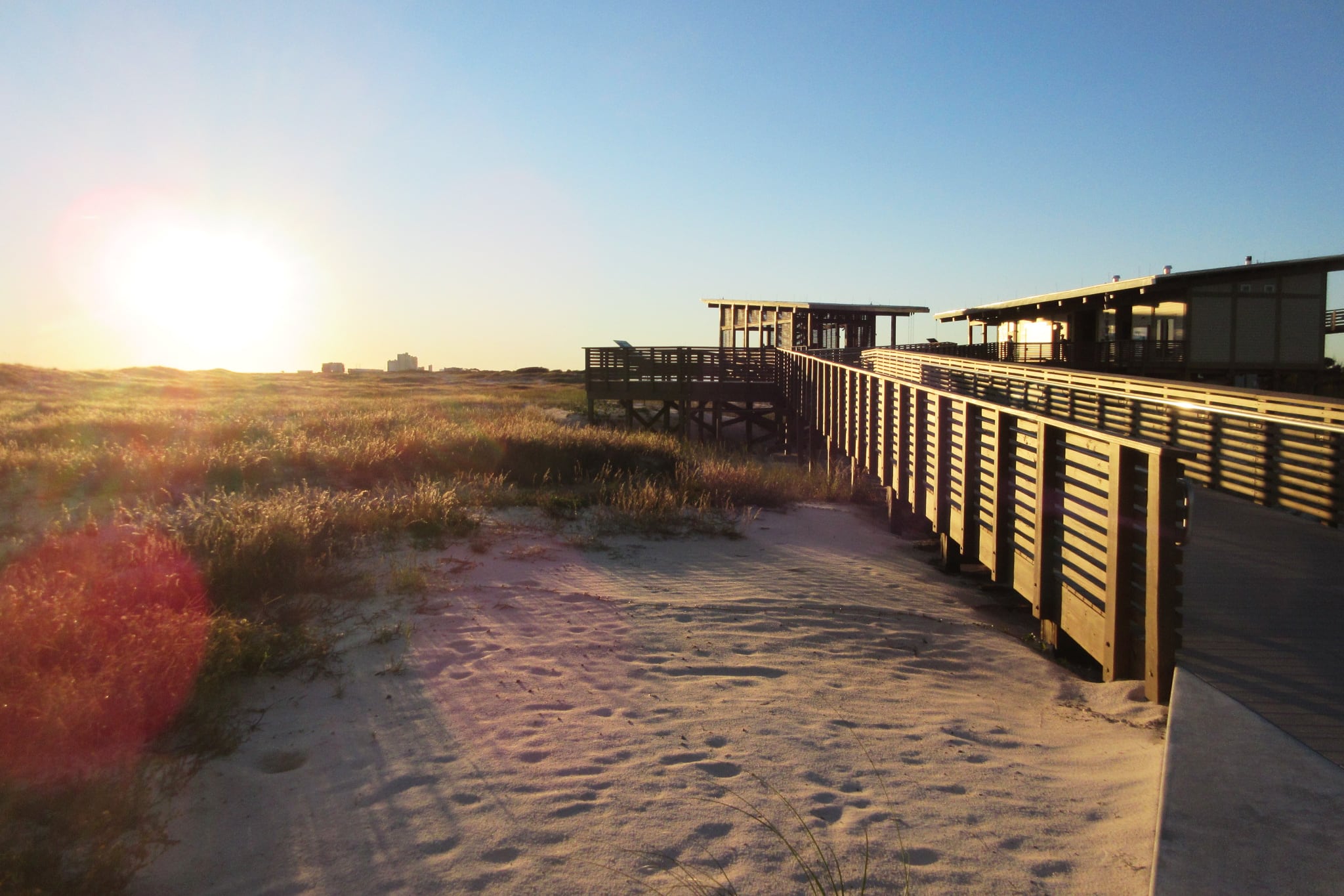
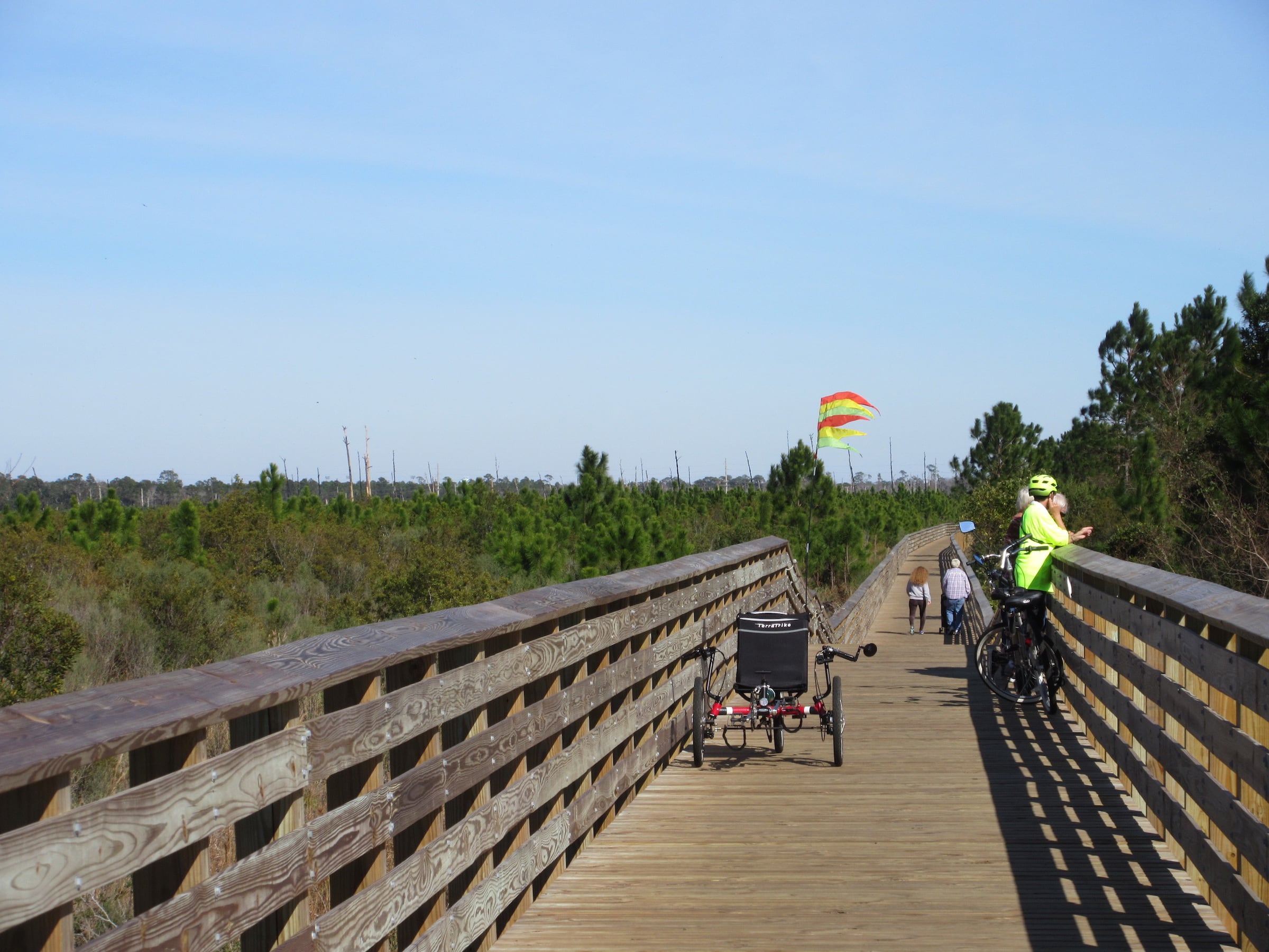
按照规划方案,24公里新建和整修后的步道以蜿蜒曲折的姿态贯通偌大的海湾公园,同时把度假村连接到游客教育中心、学习园区以及更多目的地和生态系统。游客教育中心详尽介绍公园里的七大生态系统,坐落于公园西北角、以倡导学习为概念的园区,与多家学校相邻,地理位置优越。当中一系列双层床卧室、咖啡茶座以及三所配备完善的实验室和教学空间,更可鼓励中小学生到访公园,探索动植物栖息地的一事一物。由Sasaki团队牵头制定的总体规划策略旨在厘定这些设施与现有公园景点的最佳整合方案,以维持公园环境的健康状况。
As laid out in the master plan, 15 miles of new and enhanced trails weave through the park, connecting the Lodge to the Interpretive Center, the Learning Campus, and other park destinations and ecosystems. The Interpretive Center serves as an introduction to the park’s seven different ecosystems. In the north-west corner of the park lies the Learning Campus, located conveniently close to local schools. The Learning Campus consists of bunk rooms, a café, three full laboratories and classroom space with the intention that K-12 students will spend time in the park studying the habitats. The Sasaki team led the master planning effort to identify how these facilities could best compliment the existing park destinations while supporting park’s environmental health.
▼游客教育中心 The Interpretive Center
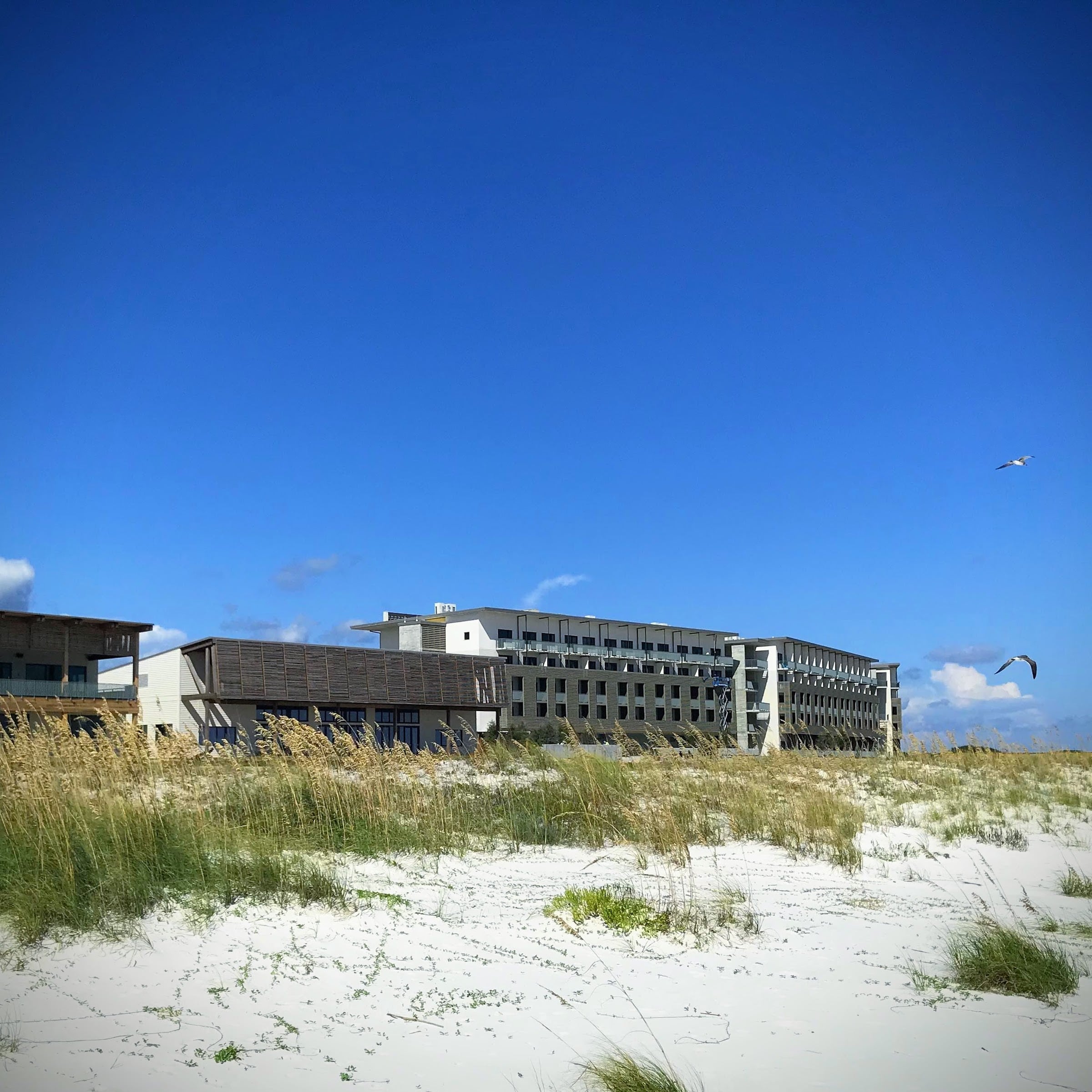
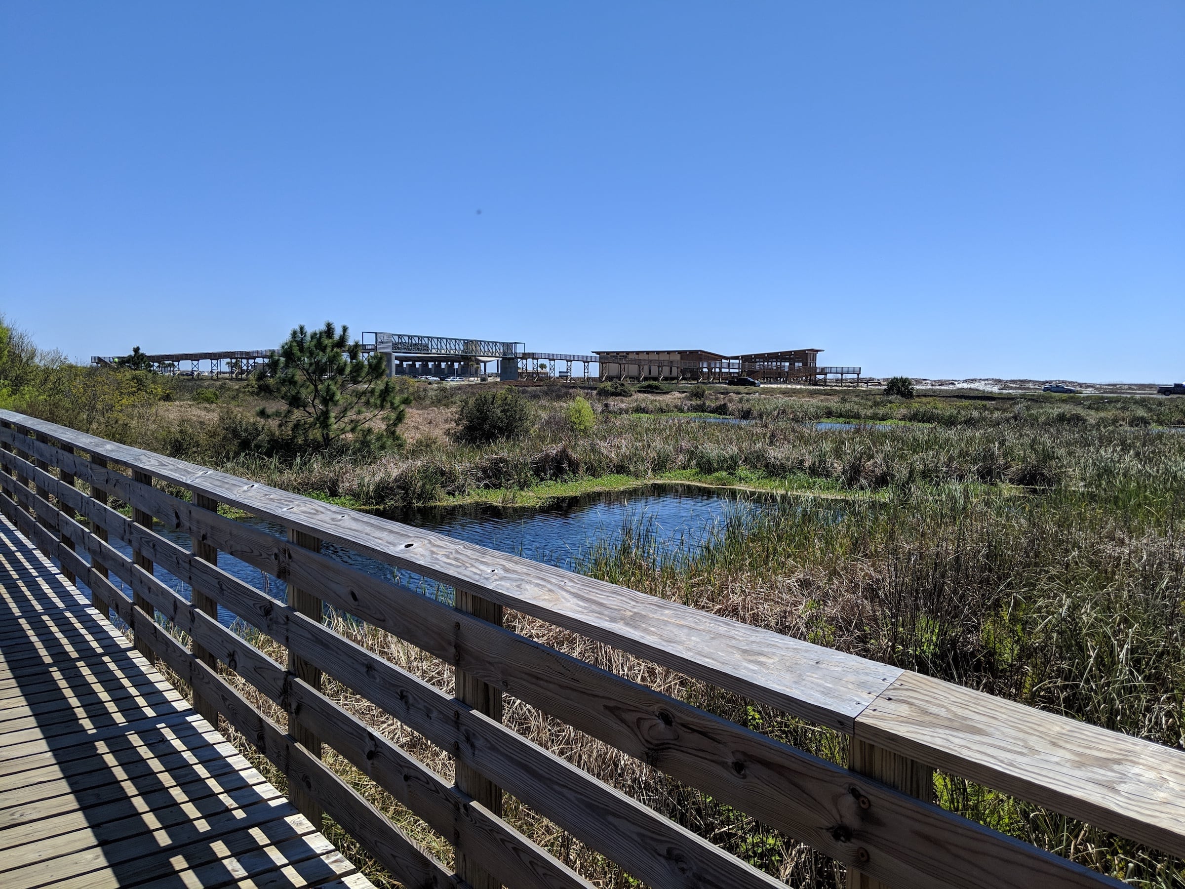
全新的学习园区将提供各种教育活动和研究项目,新增的住宿设施为学生团体、研究人员和游客营造不一样的造访体验,其附属的餐饮设施则服务于园内访客和广大市民。学习园区选址于现有的公园办公总部附近,便捷的地理位置鼓励区内市民和学生参与公园所举办的教学活动。新建的游客教育中心集合了聚会空间与教学环境,其设计以“生态建筑”为概念,并以教育用途为重心,在室内、外举行互动展览。上述两个项目目前均在施工中。
A new learning campus for the Park will provide a variety of educational and research programs. Additional lodging options will create flexibility for student groups, researchers, and park visitors, and a dining facility will serve all communities and park visitors. The learning campus will be located near the current park headquarters to encourage educational and programmatic connections with regional communities and schools. A new interpretive center will feature indoor and outdoor interactive exhibits, meeting space and educational environments. This “living building” will be overtly educational in its construction. Both of these projects are also underway.


复兴生态环境 Environmental Restoration
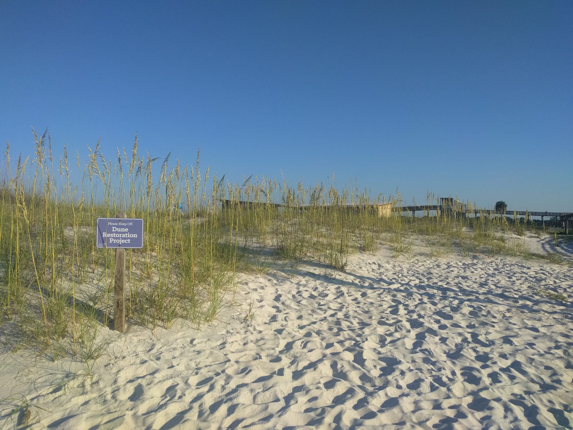
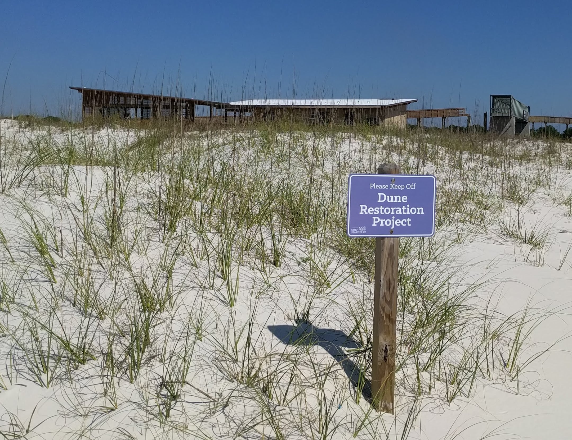
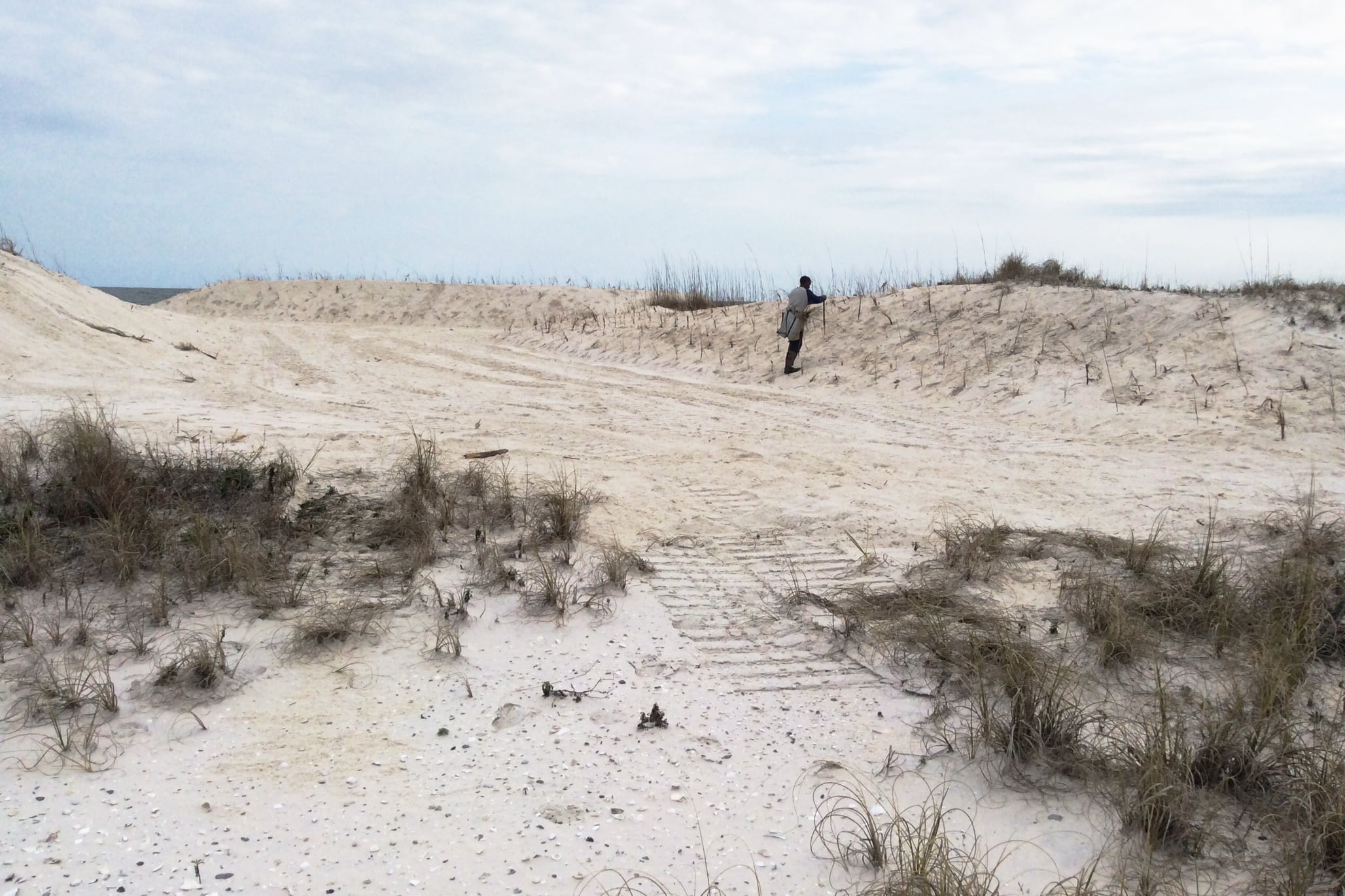
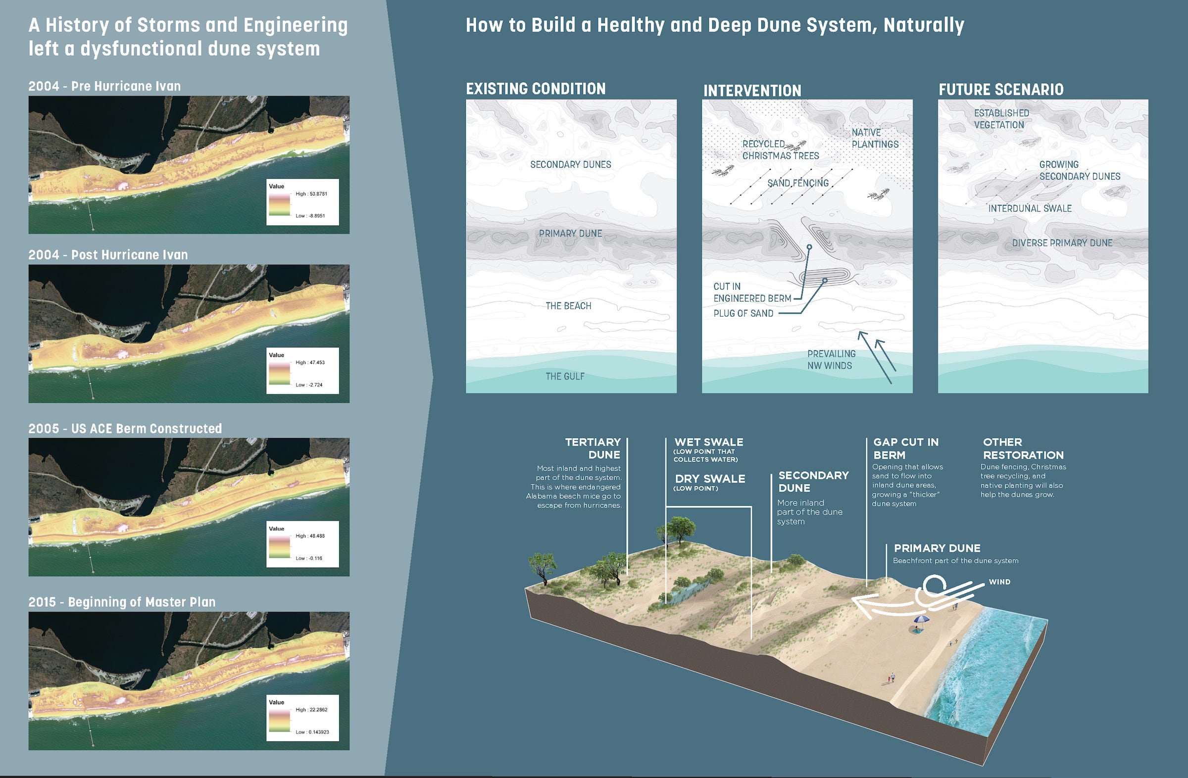
对公园本身而言,经济与生态环境的复兴工作是相辅相成的,两者唇齿相依,相互牵引。规划方案提出的主要建议之一是对基地的一片大型人造沙丘进行重新配置,以抵御未来海洋风暴潮可能造成的破坏。尽管现有的人造护坡道是利用取自天然的沙粒而非混凝土造成,但团队却证明了这人工构筑物切实限制了沙丘栖息地的自然增长,继而导致包括一种濒危海滩鼠类在内的许多动植物缺乏生存空间。团队最终移除了大部分护坡道,并且小心翼翼地种回沙丘草,以恢复上述的自然过程。
For the park, economic resilience and ecological restoration fell hand-in-hand—the success of one goal relied on the success of the other. One major recommendation of the plan was the reconfiguration of a large man-made dune created in defense of future damage of ocean storm surge. Despite using naturally occurring materials—sand, as opposed to concrete levies—the team showed how the engineered berm actually restricted the natural growth of sand dunes habitats that are crucial for a variety of plants and animals, including an endangered species of beach mouse. As a result, a large section of the berm was removed and dune grass was carefully planted in order to reinstate these natural processes.
▼修复护坡道 Berm restoration
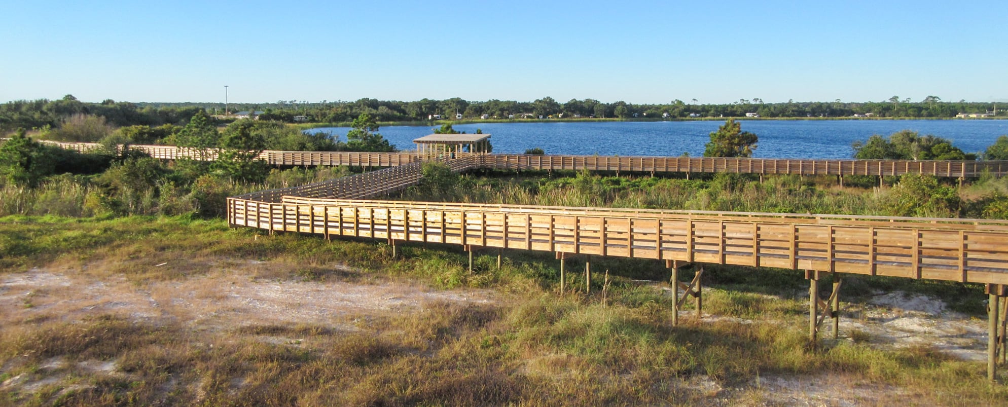
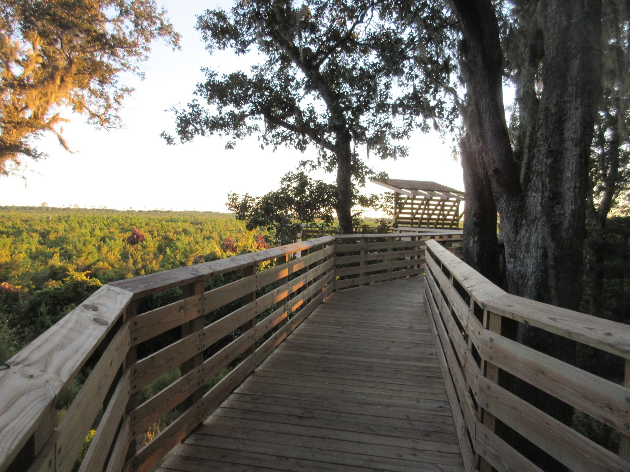
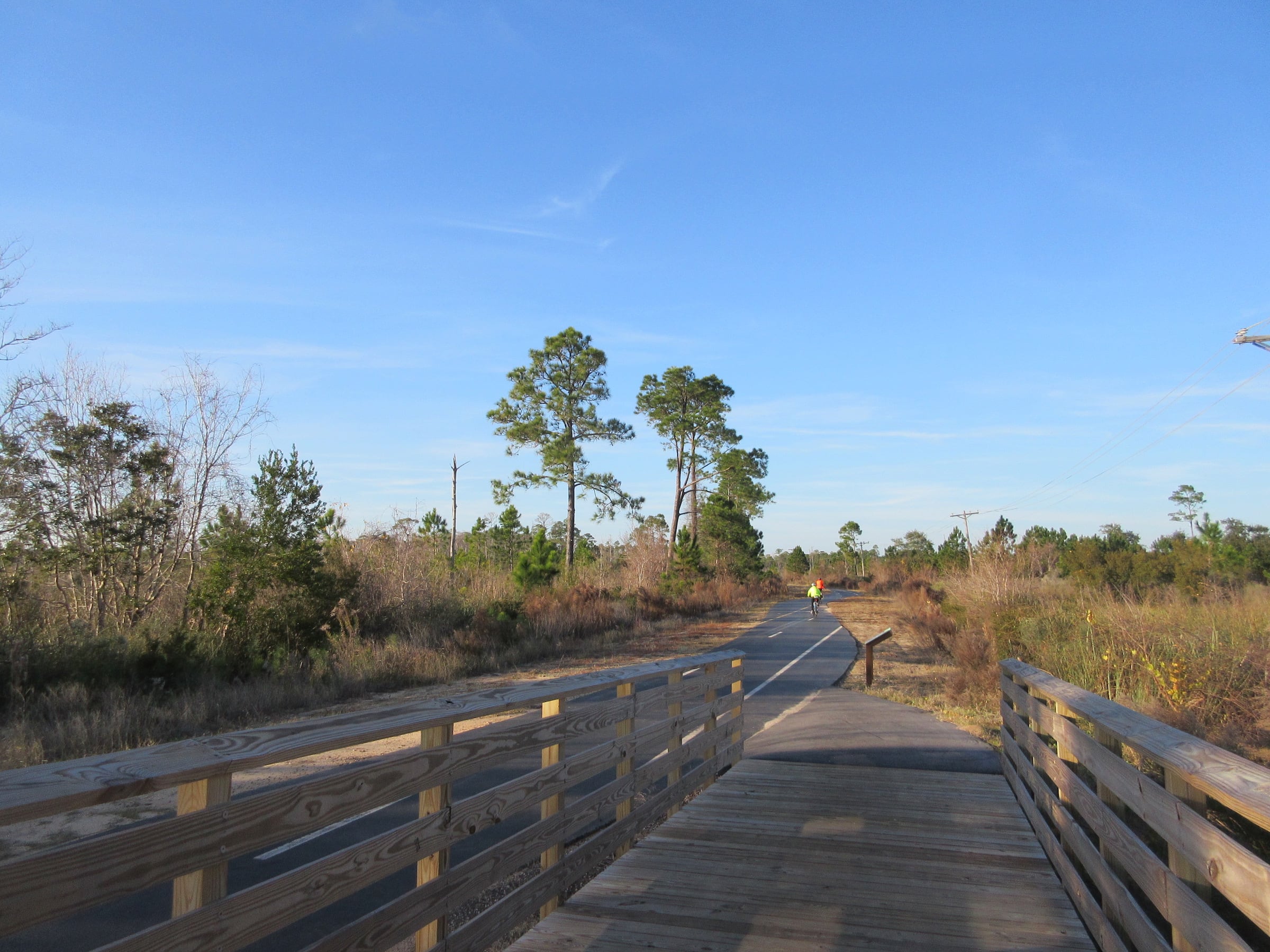
按照方案提出的公园生态修复策略,一段长1.6公里的行车道将被关闭,改建为人行道和自行车道,此举不但能够重现州立公园的自然景观,也为行人和骑自行车者提供更安全的环境,同时令整个公园更加连贯接通,实现无障碍设计。
Part of restoring the ecology for the park required closing a mile-long stretch of road and converting it to a pedestrian and bicycle trail. Closing the road meant not only allowing the natural landscape to reclaim an essential part of the state park, but also increasing safety for pedestrians and cyclists while emphasizing connectivity and accessible design throughout the park.


无障碍设计 Accessible Design
为了向每一位访客呈现公园最优美的自然面貌,确保他们在园内通行无阻,项目团队非常注重无障碍设计。自然步道的铺装和坡度的设计适合各类使用者,对轮椅使用者而言也甚为方便。
The project team’s focus on accessible design was to ensure everyone would be able to get out and enjoy the park’s natural beauty. The trails’ surfaces and grades are designed to be accessible to all, including individuals in wheelchairs.

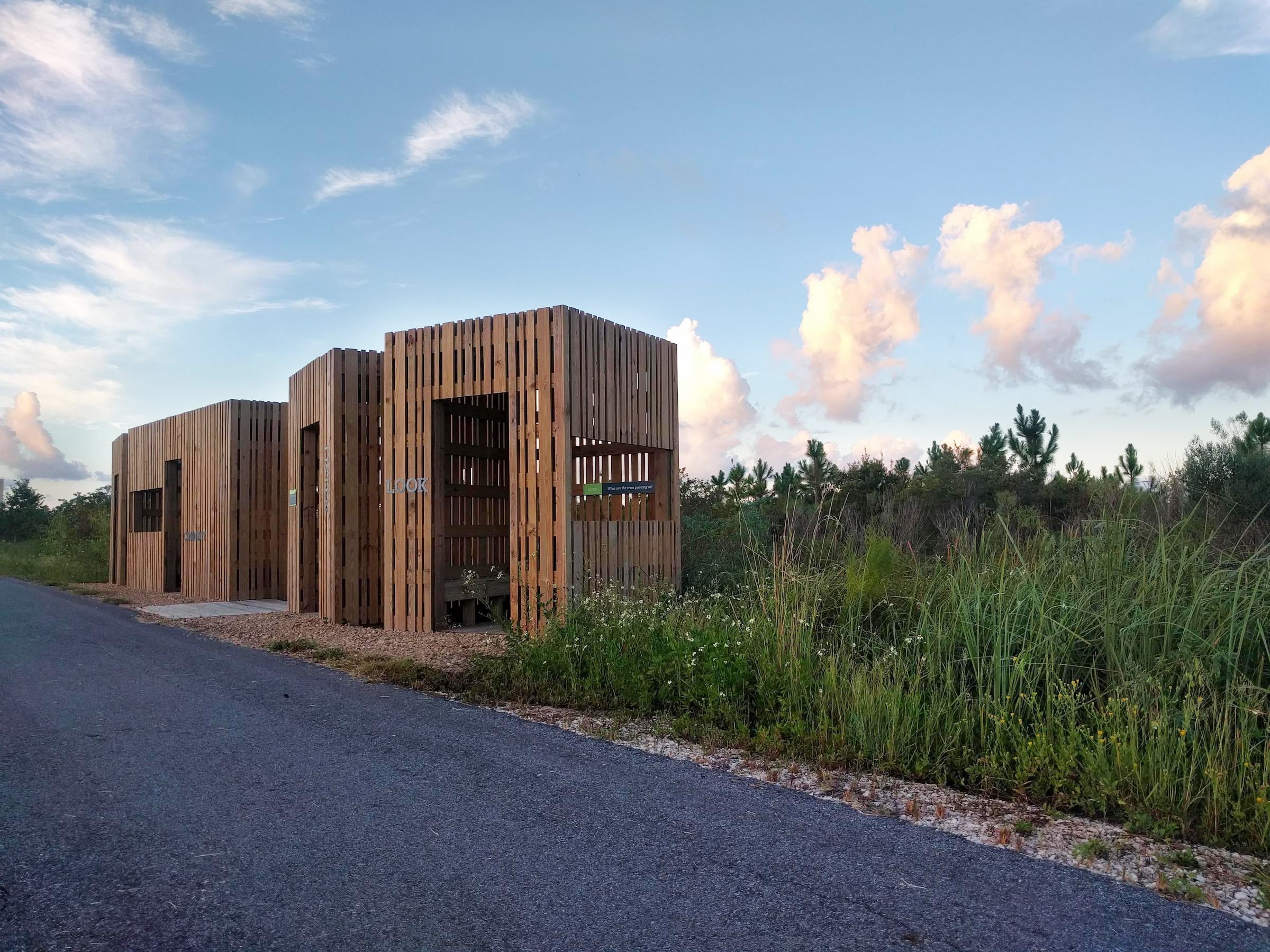
此外,公园管理局也和莱克舒尔基金会(Lakeshore Foundation)以及美国残奥会国家队的训练场组成伙伴关系,以伯明翰为基地的莱克舒尔基金会专注为残疾人士提供更多机会,该会在自然步道的评估工作上给予了不少意见,例如对步道的横坡、铺装类型搭配比例和最大坡度等具体规格进行仔细度量,这些数据将标示每条步道开端的指示牌,以助访客清晰了解步道状况。
The park partnered with the Lakeshore Foundation, a Birmingham-based organization focused on increasing opportunities for individuals with physical disabilities and a training site for the US Paralympic teams. Lakeshore Foundation helped with a trails assessment that measured specific criteria about the trails, such as cross slopes, percentage of each surface type, and maximum grade. This data will be included on park signs at the beginning of each trail to help visitors better understand trail conditions.
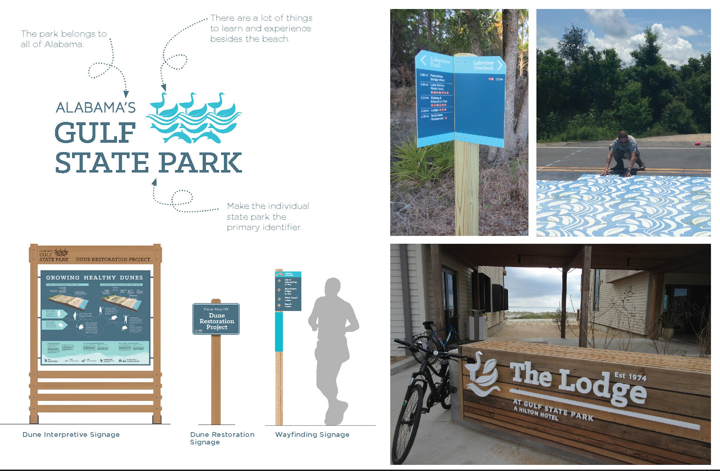
▼场地中的各类标识牌 All kinds of signs in the site


为保护公园自然区域中的核心栖息地,本次总体规划所划定的发展范围集中在已开垦的区域。与此同时,未来任何开发项目也将以绿色建筑标准为作业基础,从而保护甚至为公园环境带来裨益。各种规划元素为海湾州立公园构建出经济上持续可行的运营方案,以产生足够资金作景观维护和修复之用,甚至能为整个阿拉巴马州的公园系统提供经济支持。
New development defined by the Master Plan is concentrated within already disturbed areas, preserving core habitat in the park’s natural areas. At the same time, any future development will model green building practices that are friendly, and even beneficial, to the park’s environment. Taken together, these projects create an economically sustainable park, ensuring sufficient funding for landscape maintenance and restoration, as well as fiscal support for conservation across the State Park system.
▼项目区位 Project location
▼总体规划 Master plan


▼场地分析 Site Analysis

▼项目愿景及规划阐述 Vision and state


▼效果图 Visualization


项目名称:海湾州立公园总体规划
项目位置:美国阿拉巴马州海岸地区
业主名称:阿拉巴马大学
现况: 总体规划设计於2016年完成
规模: 2940公顷
服务范围:规划及城市设计、景观建筑
Project name: Gulf State Park Master Plan
Project location: Costal Alabama, USA
Client name: The University of Alabama
Size: 6,150 acres
Status: Masterplan completed in 2016
Services: Planning and Urban Design, Landscape Architecture
更多 Read more about:Sasaki


0 Comments