

本文由 SWA Group 授权mooool发表,欢迎转发,禁止以mooool编辑版本转载。
Thanks SWA Group for authorizing the publication of the project on mooool, Text description provided by SWA Group.
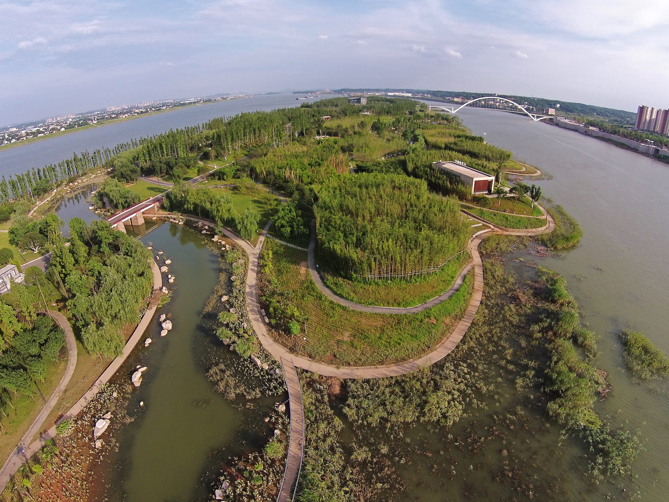
SWA Group:长沙巴溪洲是湘江中的众多洲岛之一。原先场地遍布着白杨树和废弃的建筑结构。项目南北长约3500米,东西平均宽约300米,岸线长约7000米,总面积91公顷。几个世纪以来,湘江蜿蜒穿过中国华南地区,塑造了沙洲地形和岛屿生态系统。在最近几十年中,出于防洪考虑,过去大量的洲岛项目都以堤围环绕岛屿,使人们失去了亲水的体验,同时也阻断了岛屿与河流的生态联系。这些地形地貌与混凝土墙联接排列以控制季节性洪水。由于岛屿的自然边缘被混凝土消磨,河流和沙洲受到了不同程度的负面影响,其中包括生物多样性的减少。当地政府规划一处总长约2英里(约3.22km)的侵蚀沙洲——巴溪洲作为长沙市的新中央公园。
SWA Group:Baxi River Forest Island, one of the numerous islands in Xiang River is located in Chasha City, China. Plentiful white poplar trees and abandoned architectural structures were once there on the site. The project is across 3500m from north to south in length and 300m from east to west in width, equal to 91 hectare in area. The complete coastline is as long as 7000m. For centuries the Xiang River is meandering through the landscapes in Southern China sculpturing landforms as sand bars and islands. In recent decades these formations were turned over by concrete walls as a means of controlling seasonal flooding. Consequently people were deprived of access to water, as ecological connections broke between the river and the islands. Caused by elimination of natural edges along islands, the river and its sandbars saw negative environmental impacts of different levels, including decrease in biodiversity. In view of this local government identified a two-mile-long eroded sandbar to establish a new park for the city Changsha.
▼视频 Video © SWA Group
SWA的设计目标是恢复和重塑岛屿生态,并向市民展示河流四季变化的自然之美。对生态设计原则的遵循和对文化内涵的挖掘贯穿整个项目设计。通过地形的营造,项目再现河流塑造岛屿自然植物的多形态的过程。项目采用大量本地乡土耐水性植物,建立滨河生物栖息地,并保证样性和抗灾性。一系列富于本地特色的散步道、花园、广场、池塘贯穿洲岛,为长沙增添了一处自然特色浓郁的现代市民公园。
The goal of design by SWA Group is to restore and reform island ecology while presenting seasonal natural beauty of the river to citizens. Being amenable to ecological design disciplines and exploring content of culture are thoroughly exemplified through the project. The project represents the process of how the river influences island vegetation through designing its topology. Plenty of local native water-resistant plants are used to establish riverine ecological habitat and prevent future possible disasters. Meanwhile a series of locally-characteristic strolling paths, gardens and plazas is spread over the site, rendering the park natural but also recreational for serving the city Changsha.
设计遵循洪泛规律,利用自然地形,引导涨水流通或淹没岛屿。设计新增种植了20000棵乡土树木,改造湿生台地,建立多元道路系统,成功塑造了一处绿洲公园。巴溪洲公园凸显了地形的水流变化,也是人们逃离城市的好去处,同时满足建立教育和研究中心兼休闲的各类需求。
The River Forest Island respects flooding regimes. The nature of landform designed directs water to flow through or over the island. The project also re-establishes 20,000 native trees, creates wetland terraces, and integrates an extensive trail system and program. The combination of those mentioned strategies leads to a successful park. The island celebrates river seasonal changes and provides a tranquil escape from the city and accessibility to recreational opportunities, while fulfilling education and research needs.

▼视频 Video © SWA Group
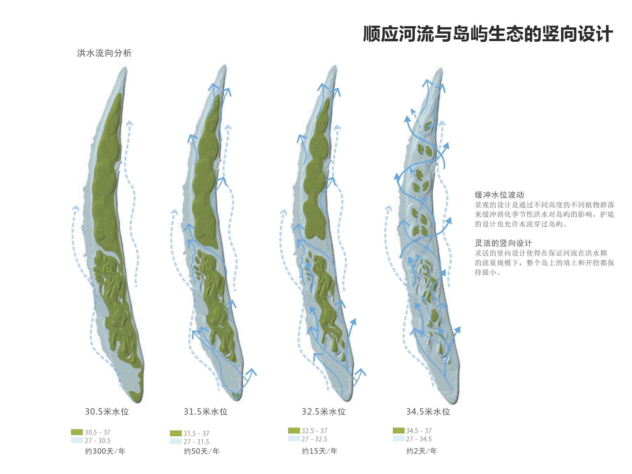
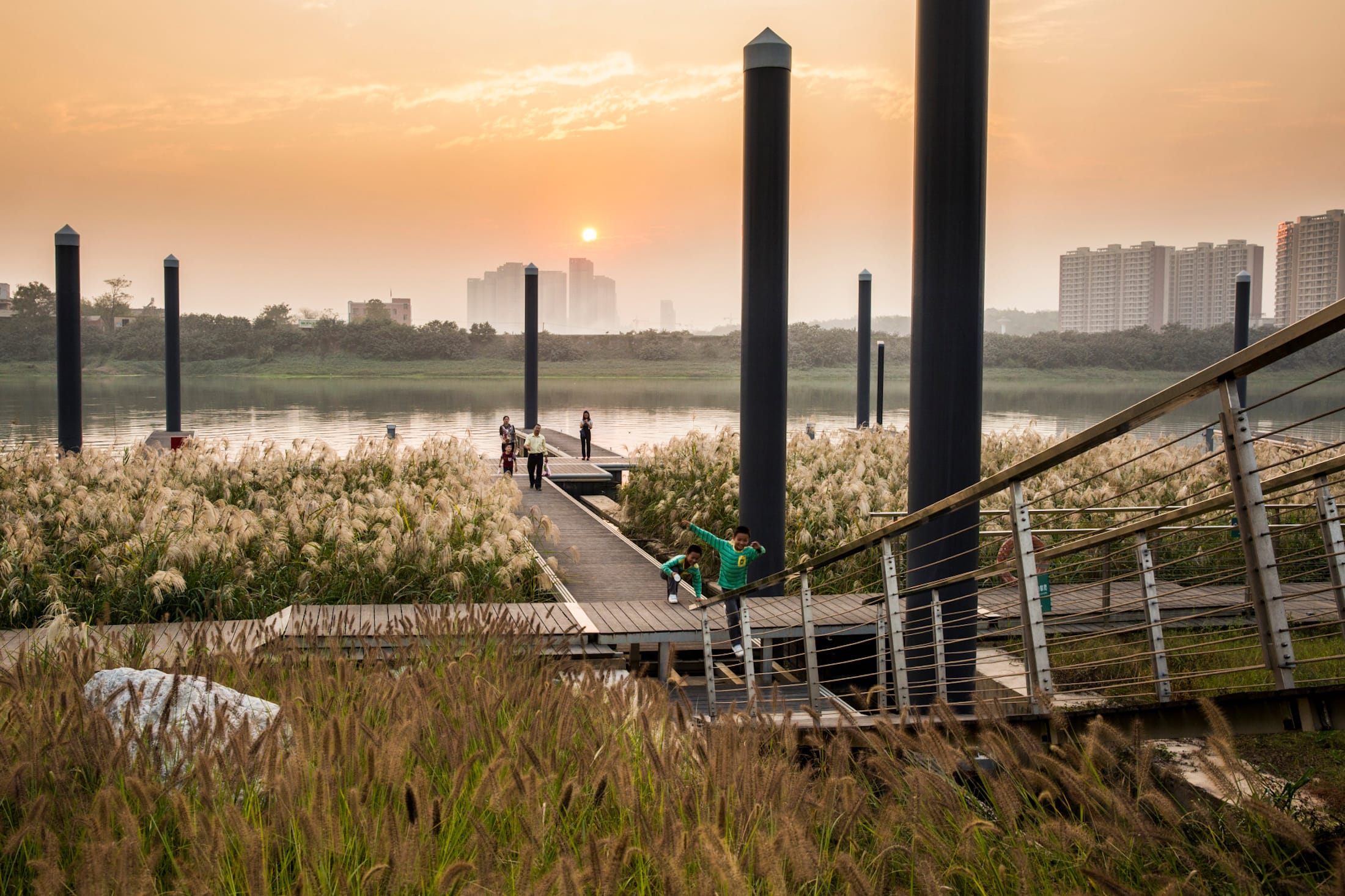
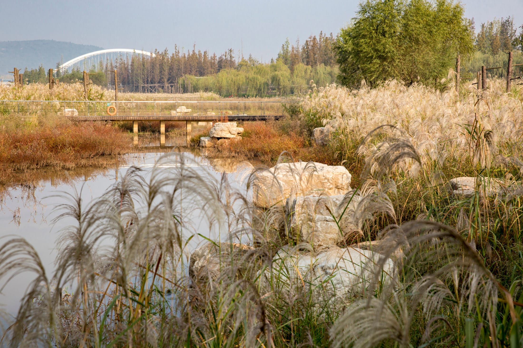
在沙洲东部存在与边缘平行的高速河流,不过水下堤坝工程保证了湿生台地的安全建设。在侵蚀最严重的东岸,深根性水生植物起着重要屏障作用。这种植物线性网络有助于在高水位期减慢水的流速,为东岸溪滩提供保护。水草丰盈的洲岸成为鸟类和野生动物青睐的栖息地。而沙洲西部边缘河流流速较低,沉降严重。使得其必须保持自然边缘,并扩大了湿地范围,且在季节性洪流影响下形成不同标高的台地和斜坡蜿蜒地形。
Where the east side of the island exists river flows of high velocity which parallel to the river edge, a submerged engineered embankment guarantees security of wetland terraces. Deeper rooting wetland plants serve as a green screen along the east bank where erosive force is the greatest. This linear network of grasses helps slowing down water velocity during high water periods and protecting the stream bank of the east side of the island. The vegetative bank also functions as habitats for birds and wildlife. The west edge is influenced by lower river velocity and higher degree of sedimentation. The design preserves its natural edges and extends the area of existing wetlands. The impact from seasonal flooding is further utilized to create terraces of varied elevation and meandering topology with slope.
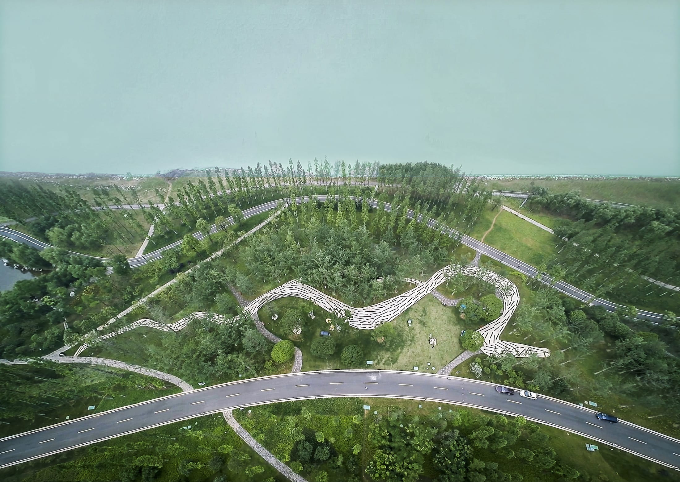
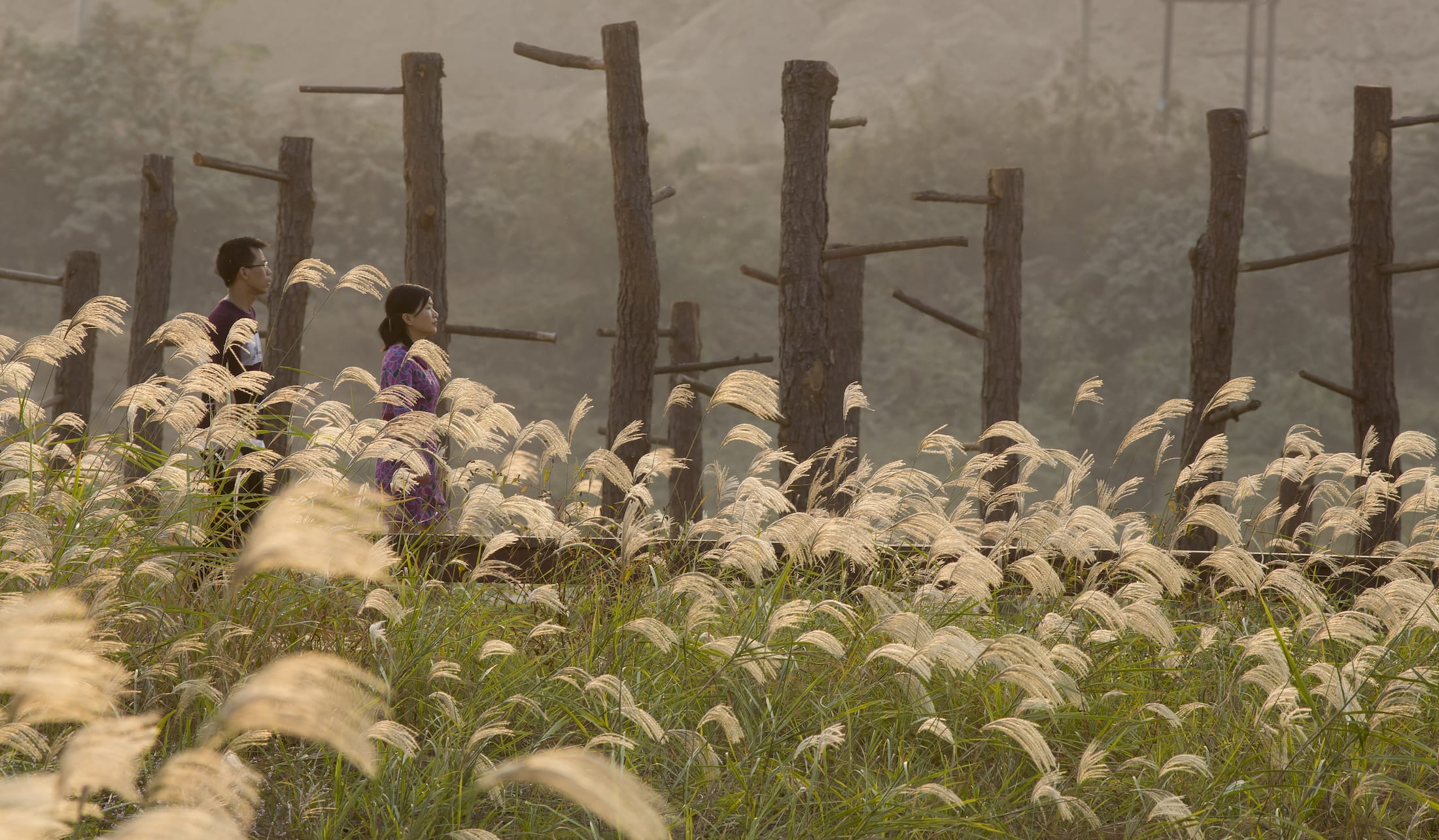
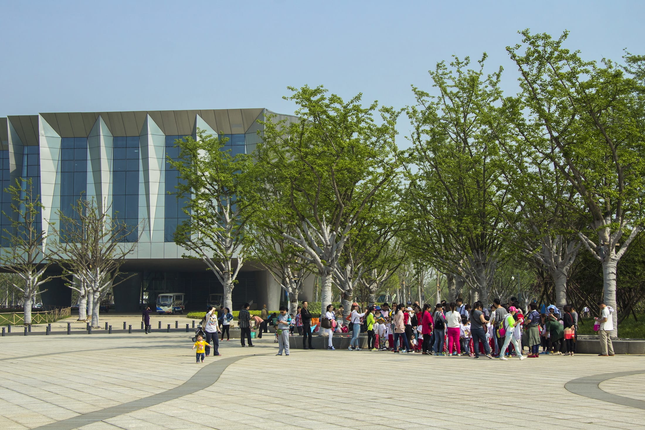
项目的概念设计是创建一个生态的网络。以蜿蜒曲折的步道连接一个又一个的景观平台,其设计目的是为了提高场地的防洪能力。梯田式的边缘创造出了多层次的环岛湿地系统,同时又为生态复苏提供了场地和机遇。位于场地南侧湿地的海拔要比岛上其他的方的略低一些。当高水位期来临之时,场地水位的提高形成的自然湿地结合不同种类的挺水植物营所营造出的丰富且变化的湿地景观。另一方面,岛上私人的别墅和网球场的设施坐落于相对高处的位置。他们的设计可做到可持续发展的需求,同时结合场地景观,隐与花丛树林之间。 根据现存的沙洲地形和6m水位波动高差,进行分级设计,保证土方平衡,使河流在汛期的承载能力不变。整体上还原并适当强化湘江冲积沙洲的自然形态,游道起伏有致。角度与地形都经过精心设计的洲岸允许流水自由贯穿及部分淹没,其上种植水杉、柳树、观赏草等乡土植物。高处台地规划建设公共设施、休息亭和博物馆等构筑物。
The design concept is to compose a ecological network. Weaved and strolling paths connect one and another landscape platform in order to enhance the capacity of flooding control. Terraced edges not only creates multi-layered wetland systems but also provides place and opportunities for ecological restoration. The altitude of south-side is relatively lower than the rest of the island. When water elevation goes high, the wetlands and different types of emerged vegetation are formed creating rich and diversified wetland landscapes. Variously, private villas and a tennis course are located higher. The design of them meets sustainable design demands and integrates environmental landscapes to hide themselves. Based upon existing island topography and six meters annual river level fluctuations, the grading design balances cut and fill, leaving the river’s carrying capacity unchanged at flood season. The overall gesture reclaims and slightly enhances the natural forms when the Xiang river slapping the islands generating an organized water flow.
Directional berms sculpted to allow rising waters to flow through and over it are planted with native trees such as Metasequoia, willows and native grasses. Higher terraces are created for building facilities, pavilions, and museum.
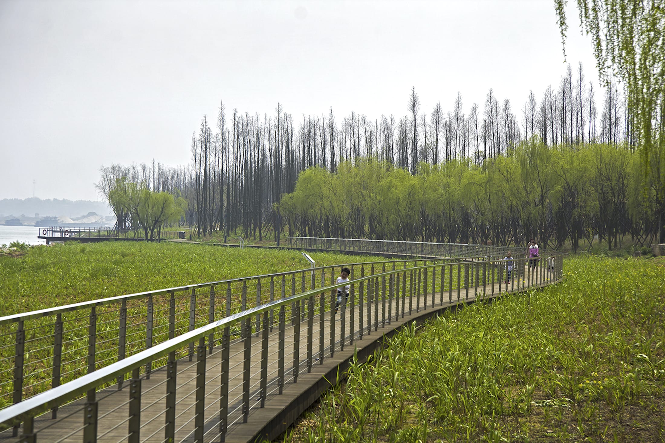

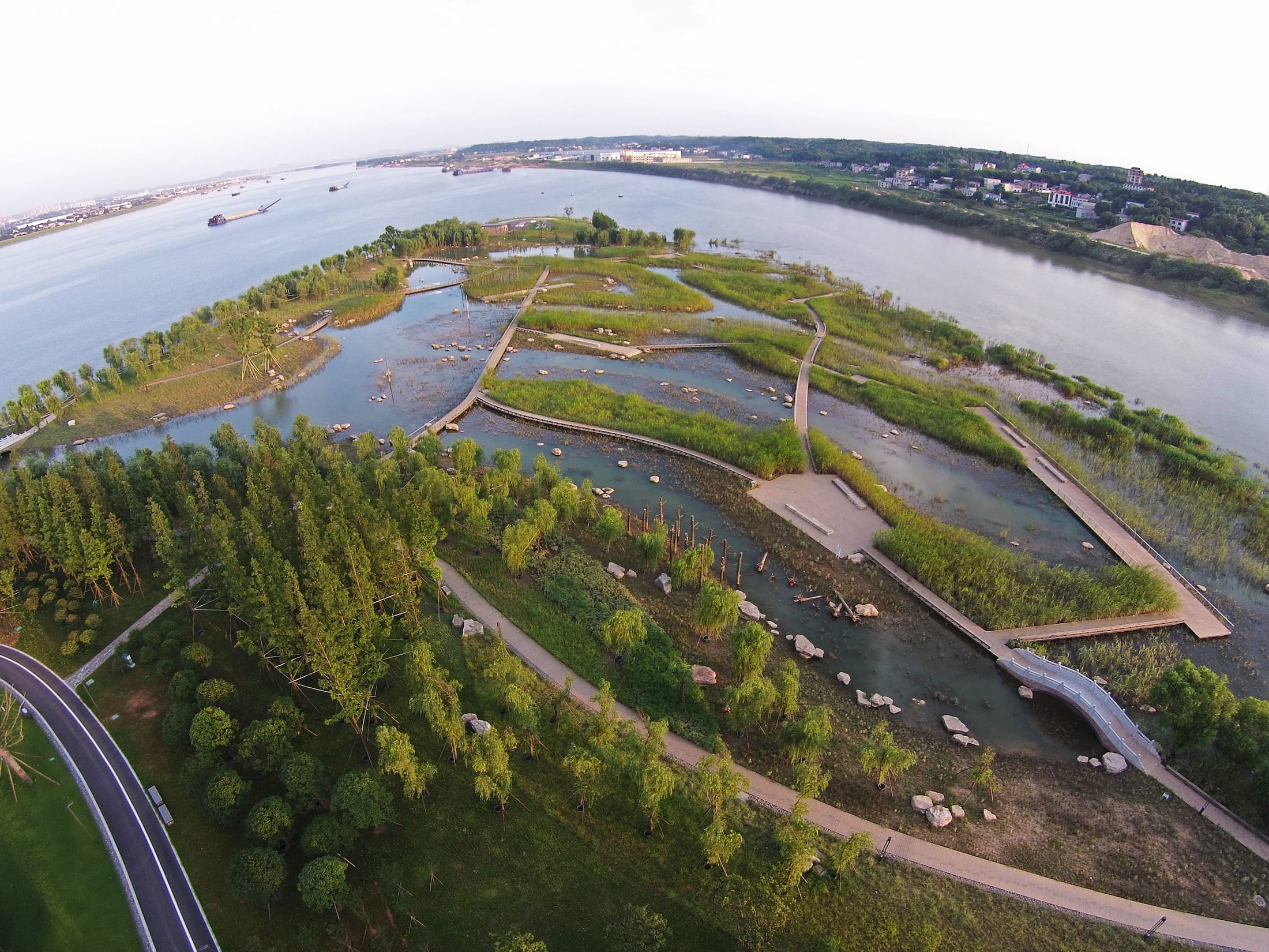
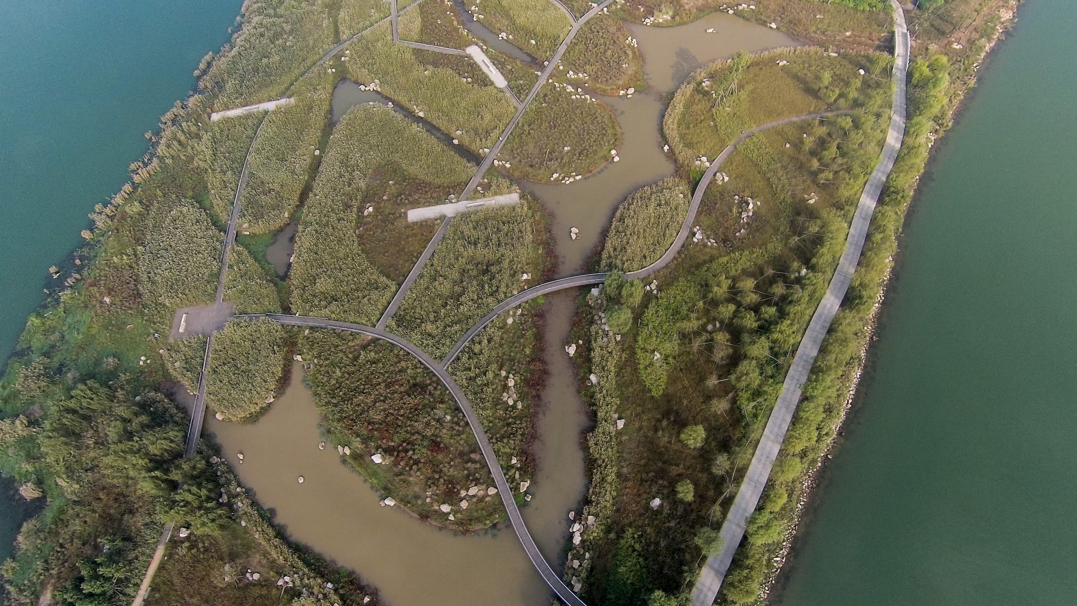
项目大量种植湖南原生的乡土植物,基本不需维护,呈现一种未经人工雕琢的场地环境。。种植设计考虑了波动的水位,土壤雷响,生境多样性,景观审美等多方面的因素。湿地区域由多种湿地草本群落,低矮灌木以及沼泽组成,逐渐过渡到高处的季节性森林。沙洲中心包含一个较小的湿地岛屿和各类半岛,自然生长着各类湿地植物群落。岛屿之间由蜿蜒的木栈道网络联系。沙洲东,西两岸试图对营造出不同种类的湿地植物群落,不过都是作为抵御水流的缓冲保护只用。石块被放置在湿地内部的河道边缘,用于稳定河道,也可以作为野生动动物的栖息地。生态多样性与地形变化性增强了沙洲生态系统看得弹性恢复力。原生河岸树种成为了低地森林的骨干树种,如水杉,柳树等树种,这些树在中国河流及运河区域很常见。本地竹类,香樟,银杏,樱花则占据了沙洲地势比较高的地方。
The project plants plentiful Hunan-native-born vegetation, which requires low maintenance yet represents endemic and innate site environment. The planting design takes multi-faceted consideration such as water fluctuation, soil and weather, ecological biodiversity and landscape aesthetics.The wetland area is consisted of multiple wetland grass communities intermingled with clusters of low shrub and marsh zones, and transitions to a seasonal forest at the upper elevation. The central island contains a blend of smaller wetland islands and peninsulas which support various emergent wetland plant communities combined with clusters of low shrub and marsh zones, which transition to a seasonal forest at the upper elevations—all linked by a meandering boardwalk network. The east and west sides of the island are stepped to create wetlands planted with various species, and act as a protection buffer against river currents. Boulders are placed along the inner channel edges in wetlands, stabilizing the channel bank and providing important habitat for wildlife. The dynamic variability and landforms of the wetland, riparian lowland and highland design increase the resilience of the ecosystems of the island. Native riparian trees form the backbone of the lowland forest, such as Metasequoia and Salix species, the tree common to the rivers and canals of China. Native bamboo, camphor, gingko and cherry occupy higher elevations.
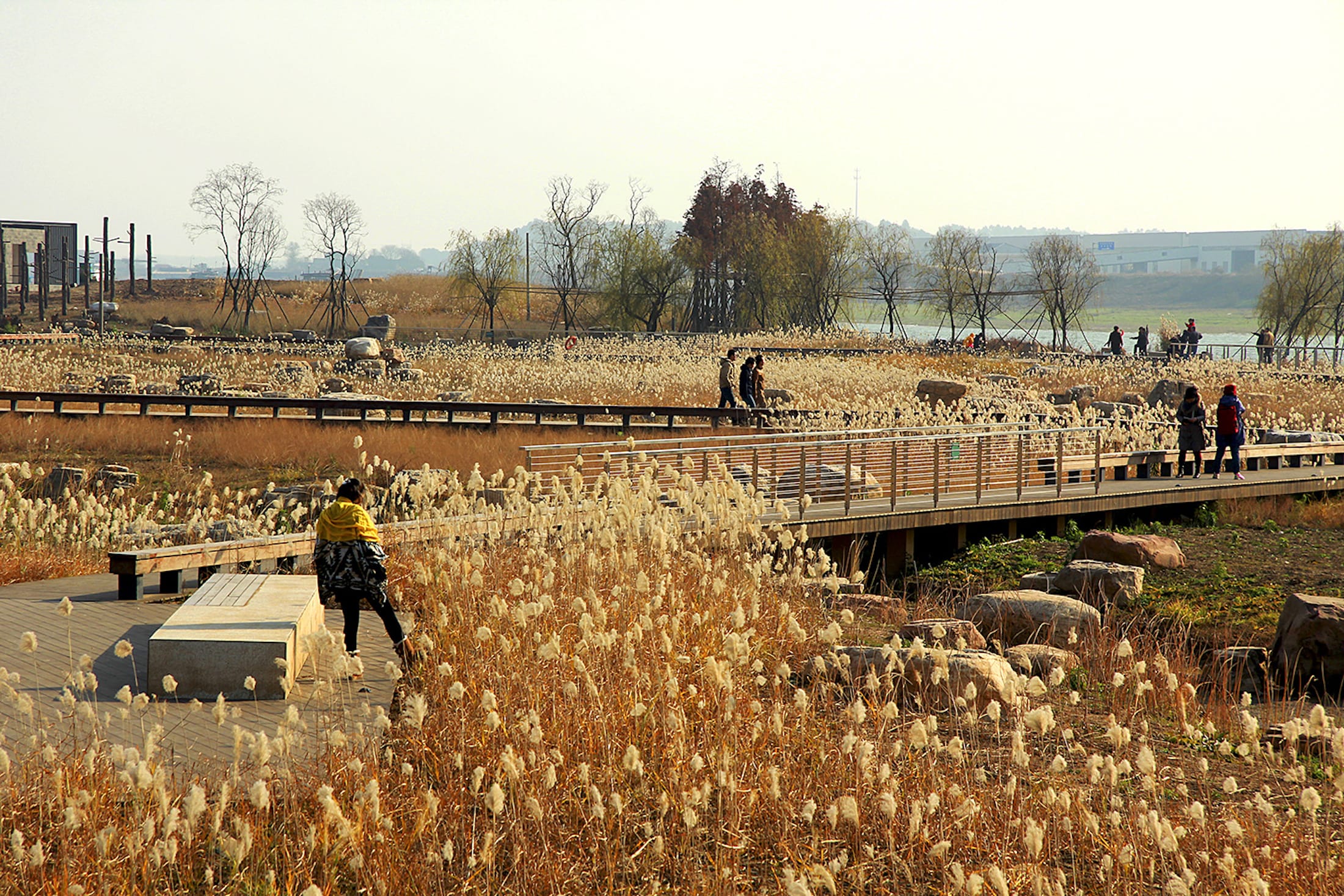

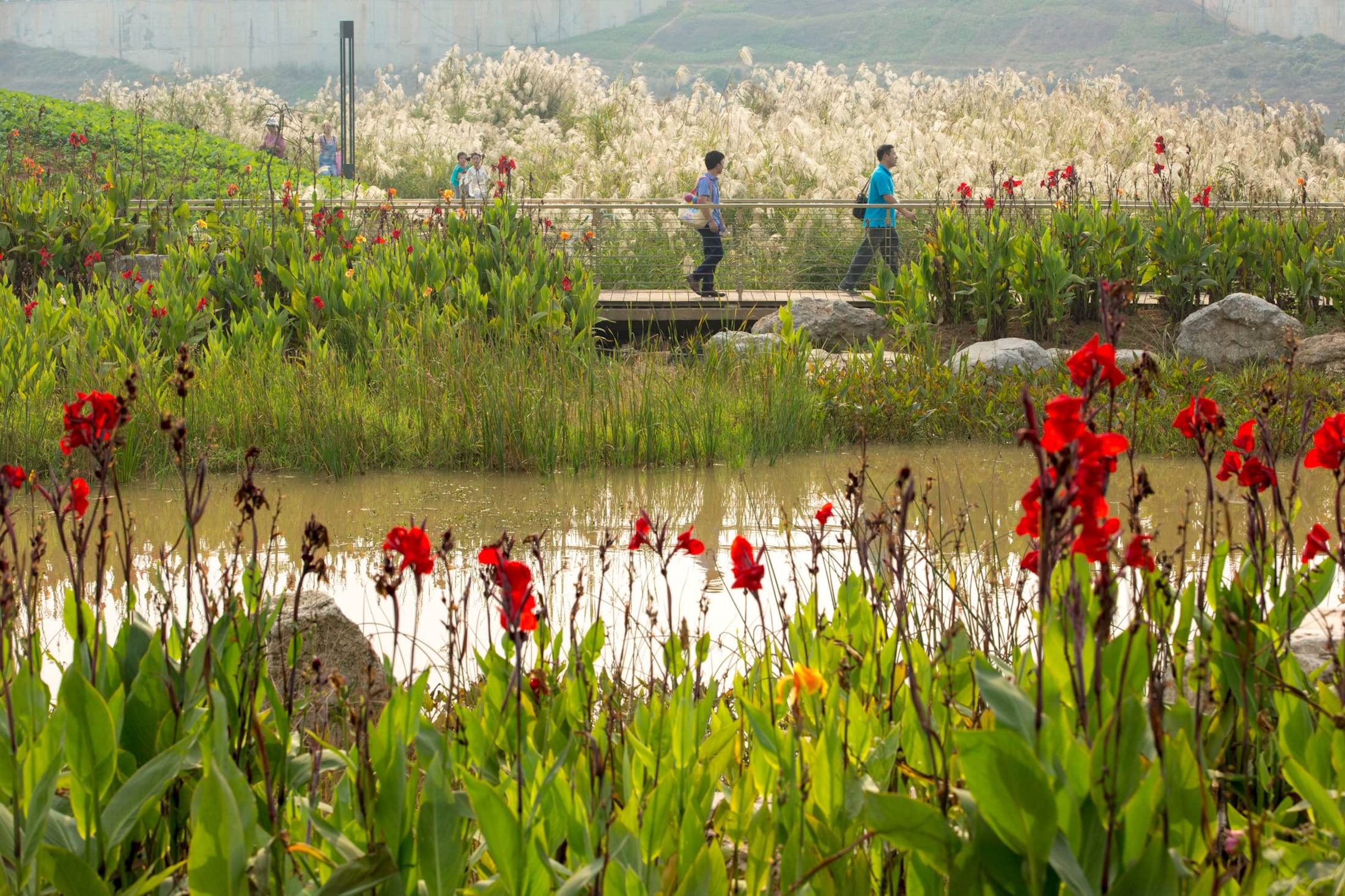
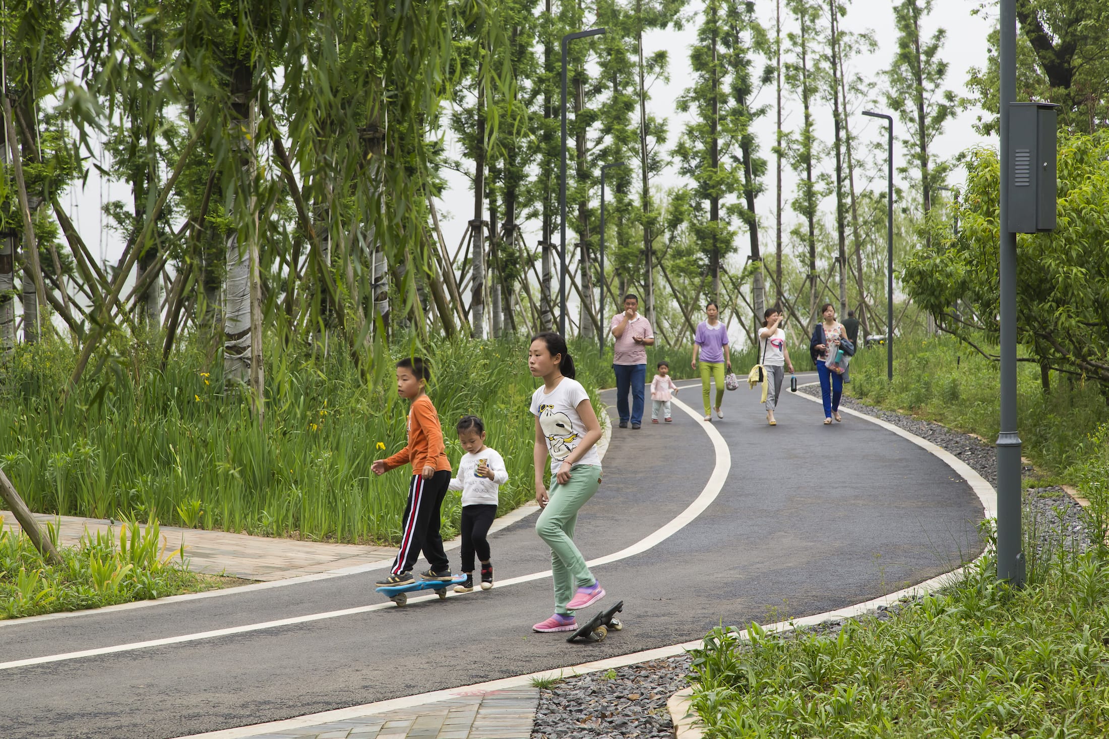
巴溪洲融合了自然系统,地方文化和美学艺术,是滨河公共空间设计的典范。提供了一个远离城市的室外桃源,包含休闲,教育和研究等多种功能。蜿蜒的地形塑造了花园路径系统的框架。游园道路层级明晰,游客们在这个蜿蜒路径里有多种发现之旅的选择,包括使用当地压实竹材铺设的5.5公里长的滨水木栈道,近7公里的自行车到,7.5公里的私密森林小径,连接着一系列的花园,广场,博物馆,娱乐和教育中心等。
Blending natural systems, local culture, and art, River Forest Island is a model for designing riverfront public space. It provides tranquil escape from the city and accommodates recreational, educational, and research needs. The meandering landform frames a system of trails and gardens. A clear hierarchy of trails and boardwalks – 3.4 mile of which are made of locally- condensed bamboo material, 4.3 miles bicycle trail, and 4.7 miles intimate forest trail- are guiding visitors along a meandering journey of discovery. The meandering landform and trails connect a series of gardens, plazas, museums, plus recreational and educational centers.

景观师在该项目里扮演了一个重要的角色,即是设计师又整合多学科团队的讯息。与长沙当地政府沟通时,设计师首次提出一个尊重基地生态,顺应变化中水位的的公园,多层台地和驳岸处理策略分别由SWA的设计师和湖南省建筑设计院进行测试,SWA设计的景观桥,休憩亭等的构筑物也为整个项目增色不少。
Landscape architects play a critical role as designer and multi-disciplinary team leader. Working with local Changsha government, the designers at SWA Group firstly envisioned an island park respecting local ecology and adapting to changes of water elevation of medium level. Various terracing and berming strategies were accordingly tested by the designers at SWA Group and Hunan Architectural Design institute. At River Forest Island, regime and science of nature are blended into an artful experience, creating a new river oasis in the heart of the city.
项目名称:长沙巴溪州公园
客户:长沙先导土地开发建设有限公司
项目地址:长沙巴溪州
项目设计 & 完成年份:2013-2014
设计面积:91公顷
设计公司:SWA Group
设计主创:郑潇, Sean O’Malley
合作方:
建筑:湖南省建筑设计院有限公司
Green Earth Operations Team: Mark Merkelbach, Nian She, and Bob Li
摄影:David LLoyd,Tom Fox,Xiang Luo,Cheng Luo
Project name: Baxi River Forest Island
Client: changsha pioneer land development and construction co., LTD
Project address: Changsha Baxi Island, China
Project design & completion year: 2013-2014
Design area: 91 ha
Design company: SWA Group
Design creators: Zheng Xiao, Sean O’Malley
Partner:
Architects: Hunan architectural design institute co., LTD
Green Earth Operations Team: Mark Merkelbach, Nian She, and Bob Li
Photography: David LLoyd, Tom Fox, Xiang Luo, Cheng Luo
项目中的材料运用 Application of materials in this project


更多 Read more about: SWA Group


杂草丛生
可是我认为很美
去过,真的非常棒。
文章开头简介中英文注释疑有误“located in Chasha”