

本文由 Zaha Hadid Architects 授权mooool发表,欢迎转发,禁止以mooool编辑版本转载。
Thanks Zaha Hadid Architects for authorizing the publication of the project on mooool, Text description provided by Zaha Hadid Architects.
Zaha Hadid Architects:该长廊坐落于圣保利码头和Baumwall地铁站之间的Niederhafen易北河畔,这条625米的升级滨河长廊同时也是加固德国汉堡现代化城市防洪系统的重要组成部分。
Zaha Hadid Architects:Located at Niederhafen on the Elbe River between St. Pauli Landungsbrücken and Baumwall in Hamburg, the upgraded 625 metre river promenade is integral to the modernisation and reinforcement of the city’s flood protection system.

自1962年2月那场导致315人死亡,60000居民的家园被毁的风暴潮洪水过后,汉堡市便利用1964年至1968年的两年时间,在Niederhafen的易北河沿岸修建了一道可抗高于海平面7.2米的洪水侵袭的防洪堤。但现代水文和计算机模拟技术分析预测表明,Niederhafen易北河沿岸还需增加0.8米的河堤高度,才可保护汉堡免受未来冬季风暴潮和极端大潮的侵袭。
2006年,对尼德哈芬现有防洪堤的检查表明,现有结构的支撑构件荷载过重,其基础仍需大量加固,因此同年晚期,汉堡市便组织了一场重新开发防洪堤的设计竞赛,随后扎哈·哈迪德建筑师事务所赢得了该项设计竞赛。
In the aftermath of storm surge floods in February 1962 that caused 315 fatalities and destroyed the homes of 60,000 residents, between 1964 and 1968 Hamburg developed a barrier on the banks of the Elbe at Niederhafen to protect the city against floods up to a height of 7.20m above sea level. Modern hydrology and computer simulations have since analysed and forecast the city’s flooding characteristics with greater accuracy; calculating that an increase in the barrier height of 0.80m was required to protect Hamburg from future winter storm surges and extreme high tides.
Inspections of Niederhafen’s existing flood barrier in 2006 determined that supporting elements of the existing structure were overburdened and its foundations needed significant reinforcement. Later that year, the city of Hamburg organised a competition to design the redeveloped flood barrier and subsequently awarded the project to Zaha Hadid Architects.
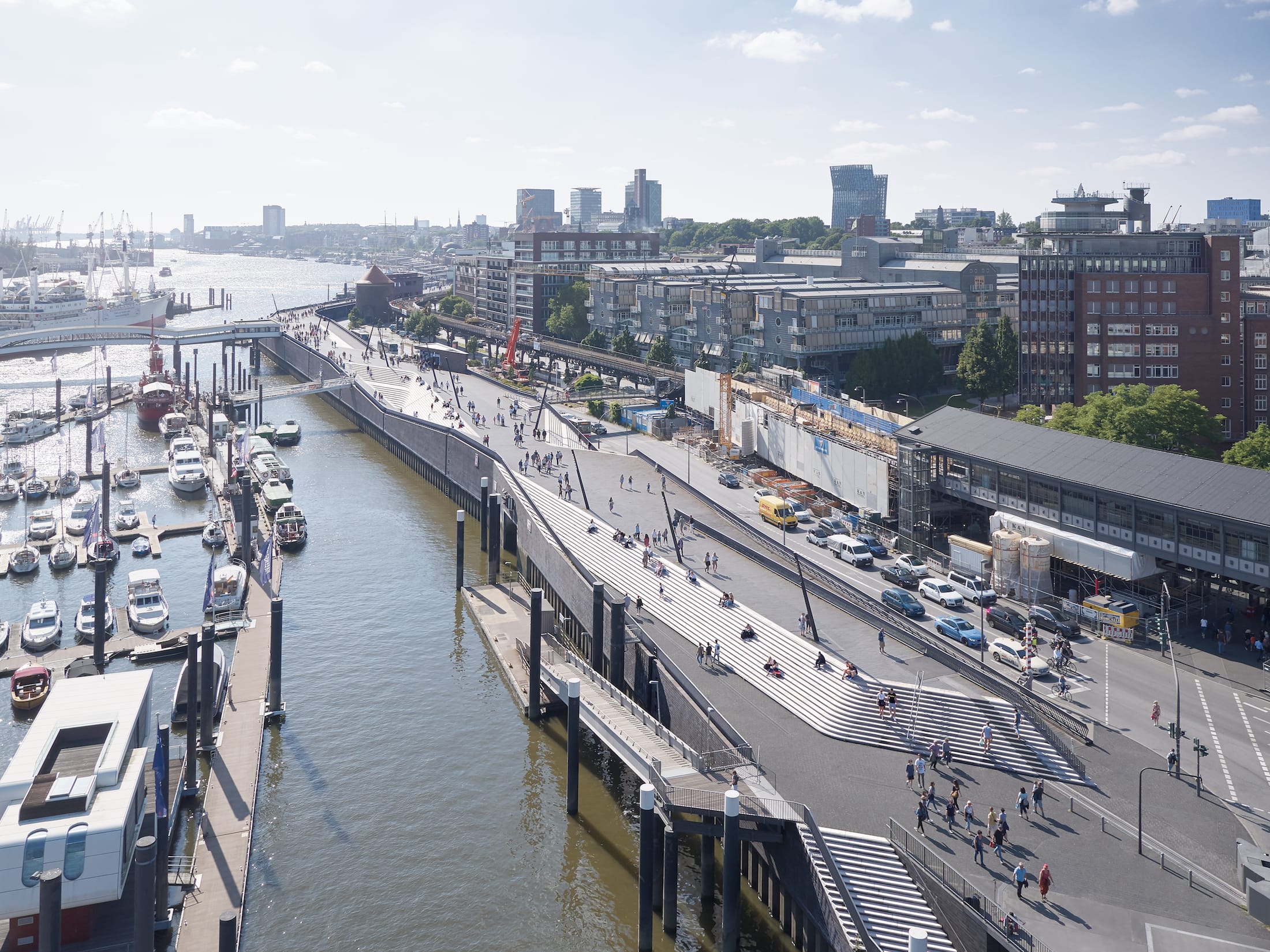
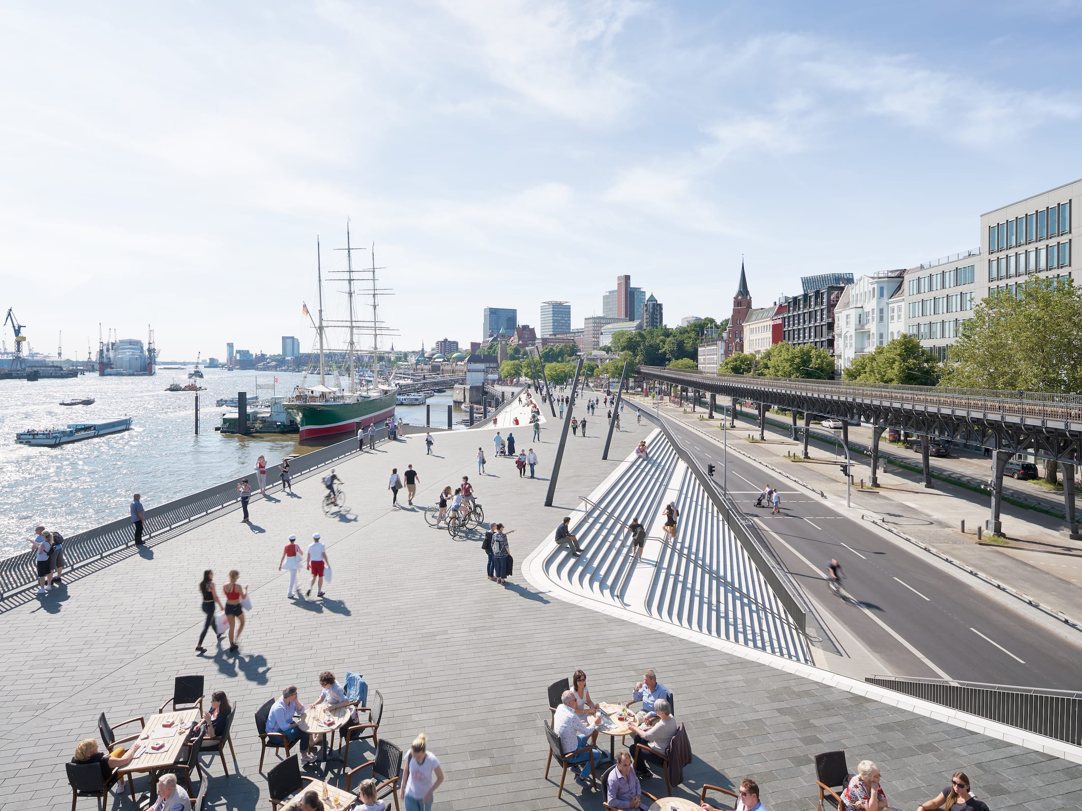
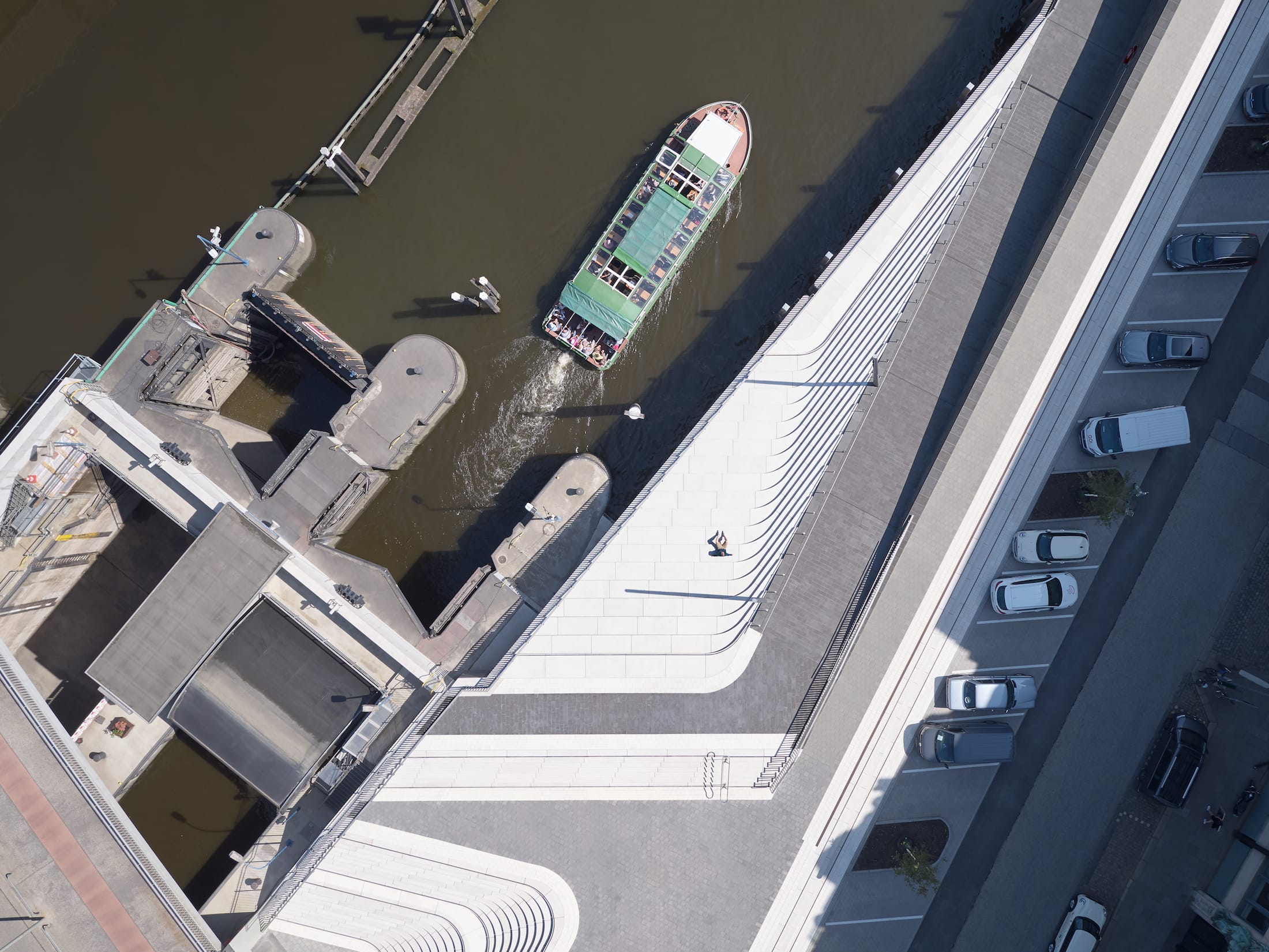
汉堡的尼德哈芬防洪堤位于该市著名滨江走道的显要位置——一个吸引游客的主要景点和汉堡最重要的公共空间之一。长廊位于防洪堤的顶部,可纵览易北河和港口的宁静景色。
随着所有阶段建设的落地,汉堡的尼德哈芬防洪堤的再开发项目重新连接了其河岸步道与周围的城市结构,并与邻近街区建立联系,成为了一个大受欢迎的滨河人行道。
Hamburg’s Niederhafen flood protection barrier is in a prominent location that incorporates the city’s renowned riverside promenade – a major attraction for tourists and one of Hamburg’s most important public spaces. Situated on top of the flood protection barrier, the promenade provides undisturbed views of the Elbe and the port.
With construction of all phases now complete, the redevelopment of Hamburg’s Niederhafen flood protection barrier re-connects its river promenade with the surrounding urban fabric of the city; serving as a popular riverside walkway while also creating links with adjacent neighbourhoods.
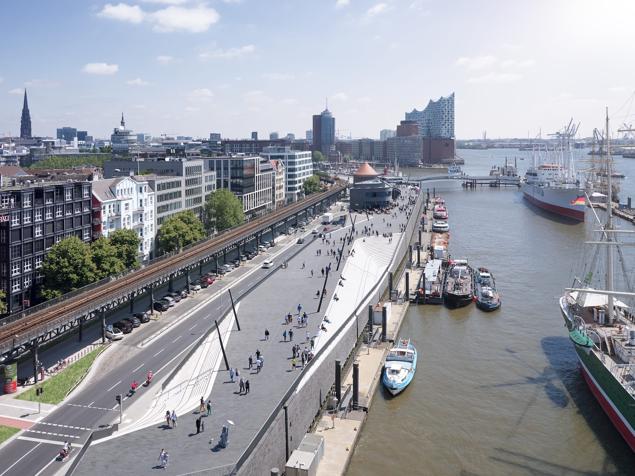
该线性长廊东段高于海平面8.60米,西段高于海平面8.90米,可保护城市免受冬季风暴潮和极端涨潮的侵害。
The linear structure is 8.60m above sea level in its eastern section and 8.90m above sea level in its western section to protect the city from maximum winter storm surges and extreme high tides.

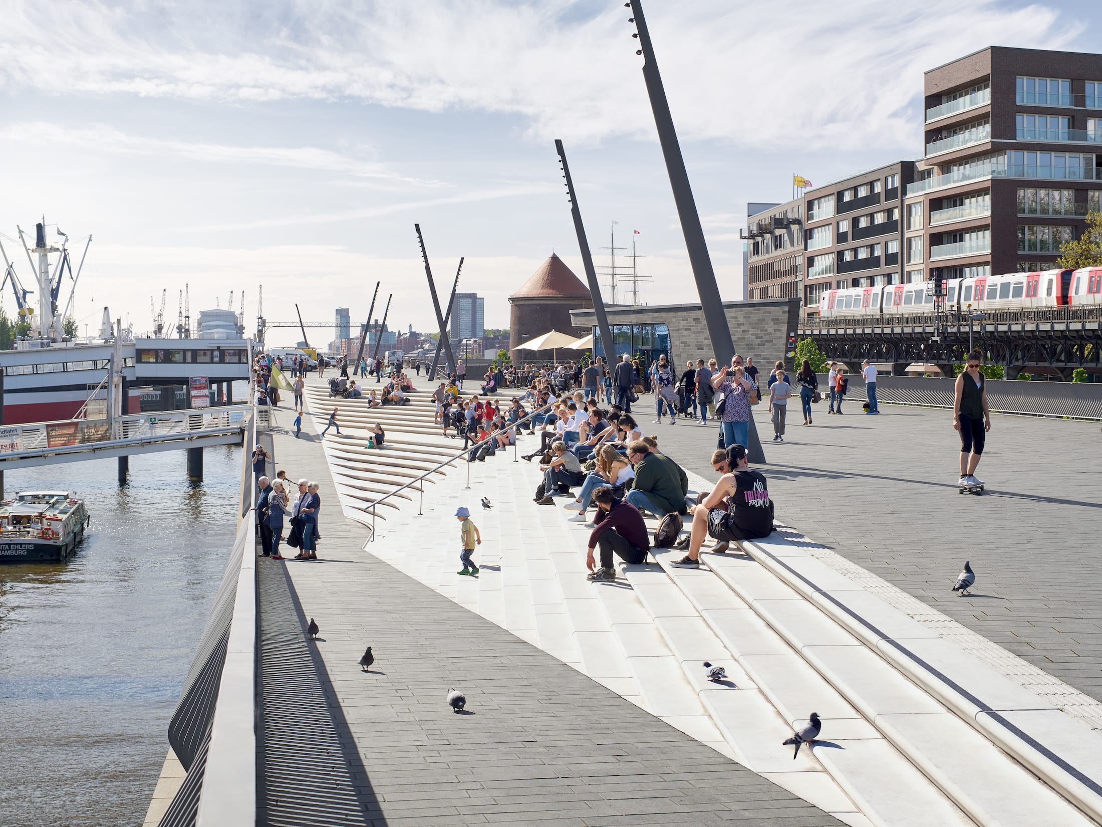
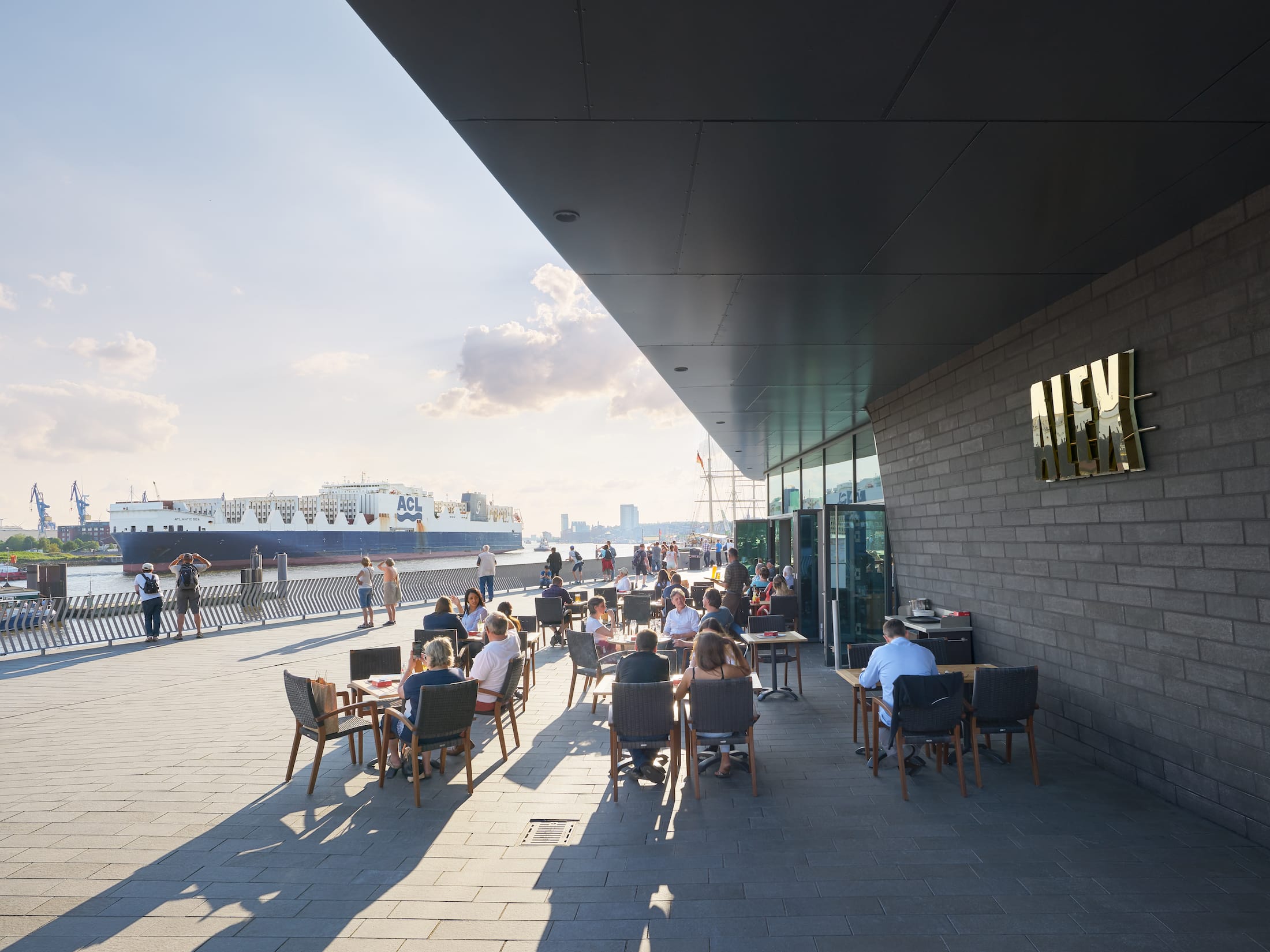
同时,为确保这条大受欢迎的滨河步道可为行人、慢跑者、街头表演者、小吃摊和咖啡馆提供足够宽敞的公共空间,河边长廊的最小设置宽度为10米,其他商店和公共设施也被安置在面向城市的街道上。
A minimum width of ten metres ensures this popular riverside promenade offers generous public spaces for pedestrians, joggers, street performers, food stalls and cafes. Shops and public utilities are also accommodated within the structure at street level facing the city.
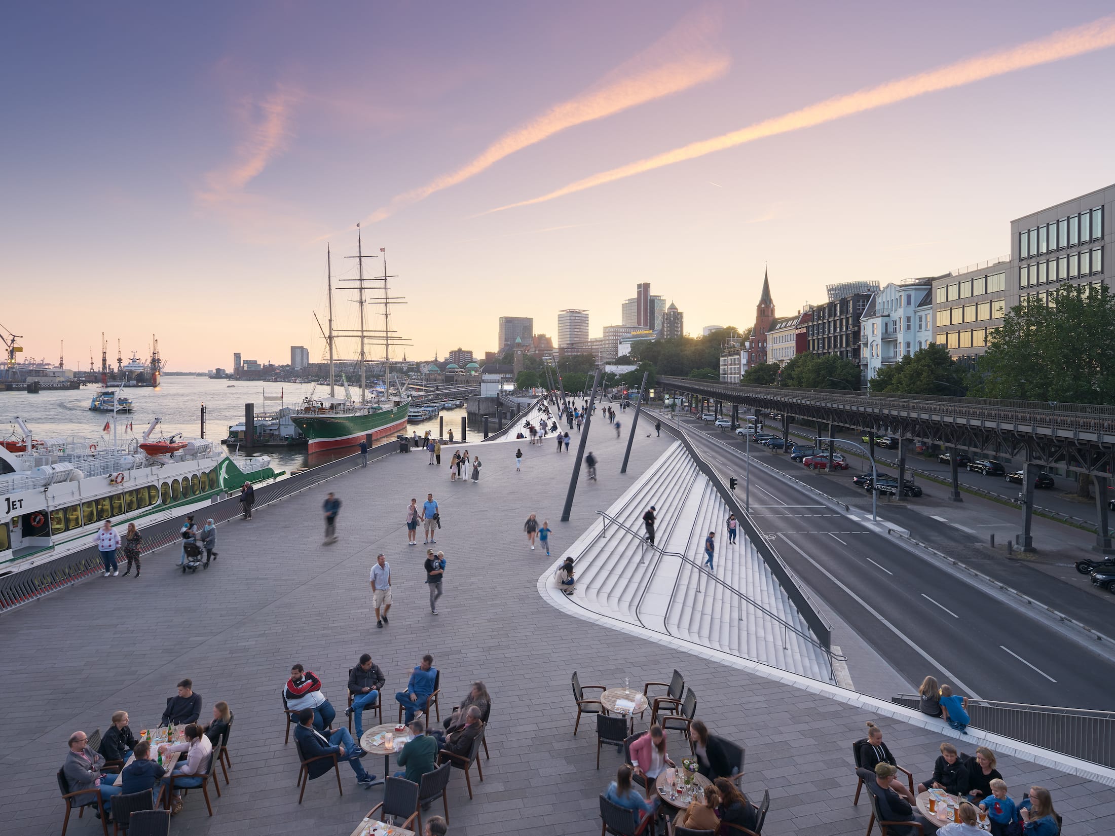
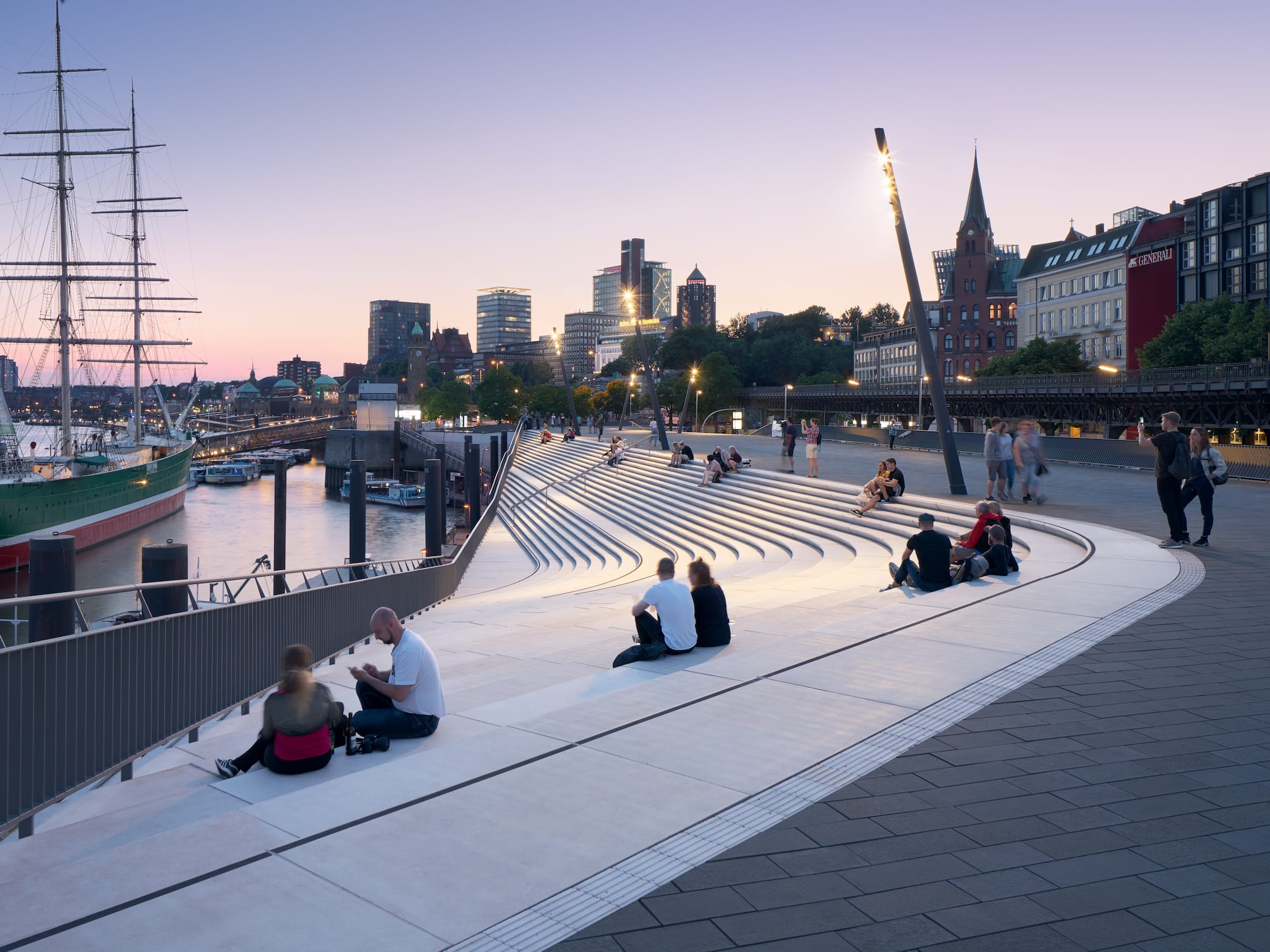
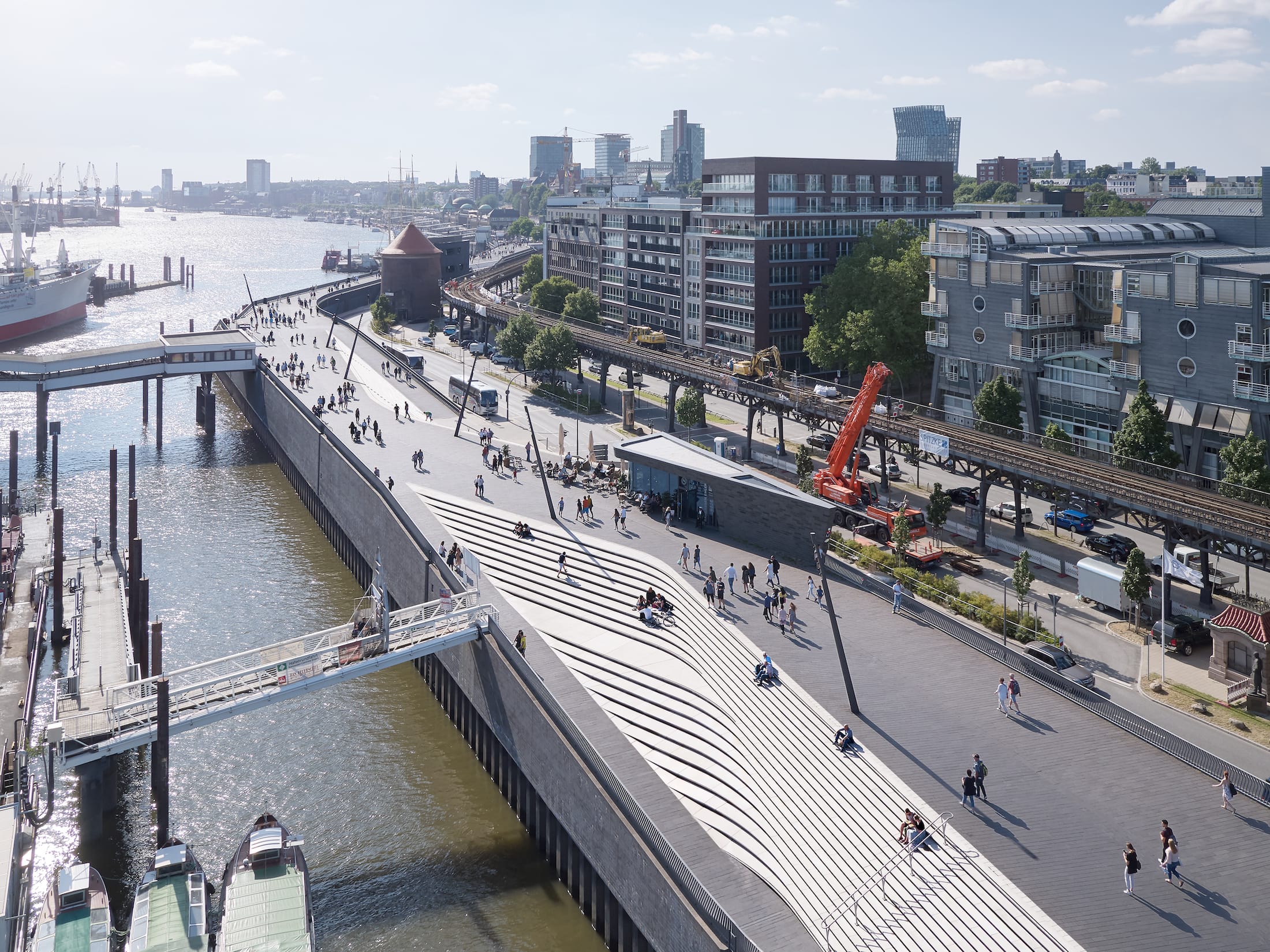
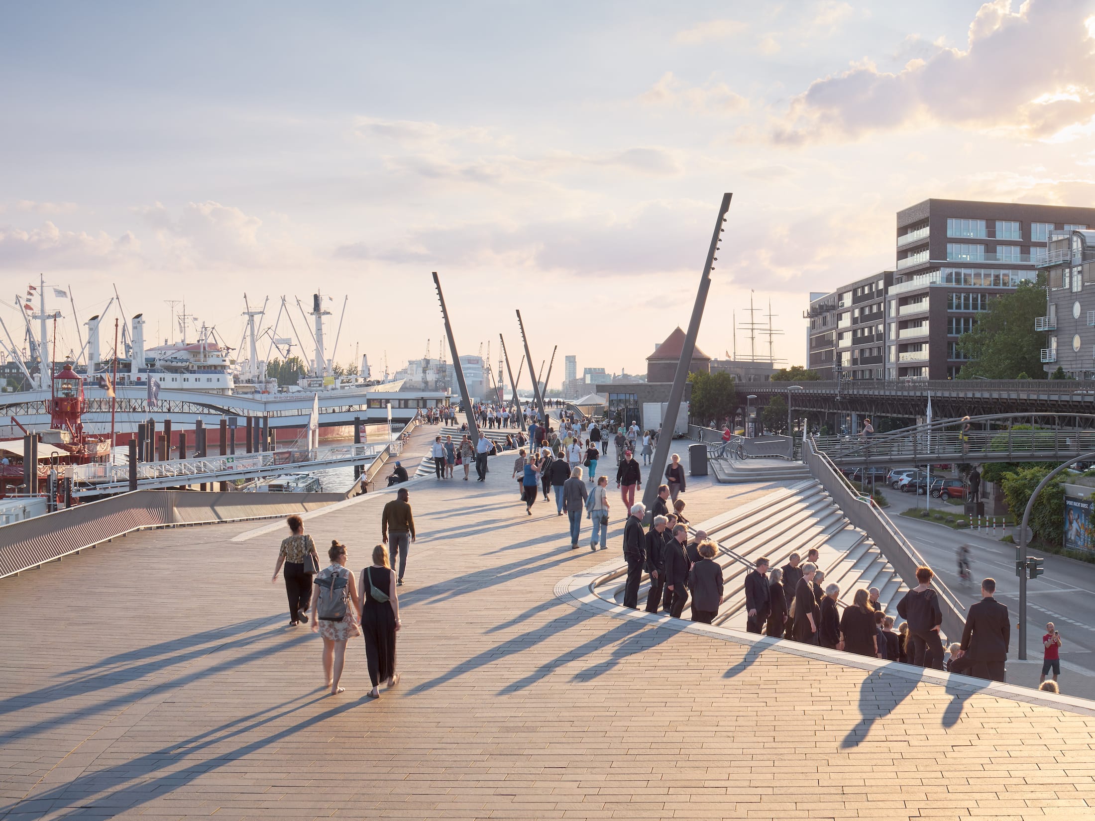
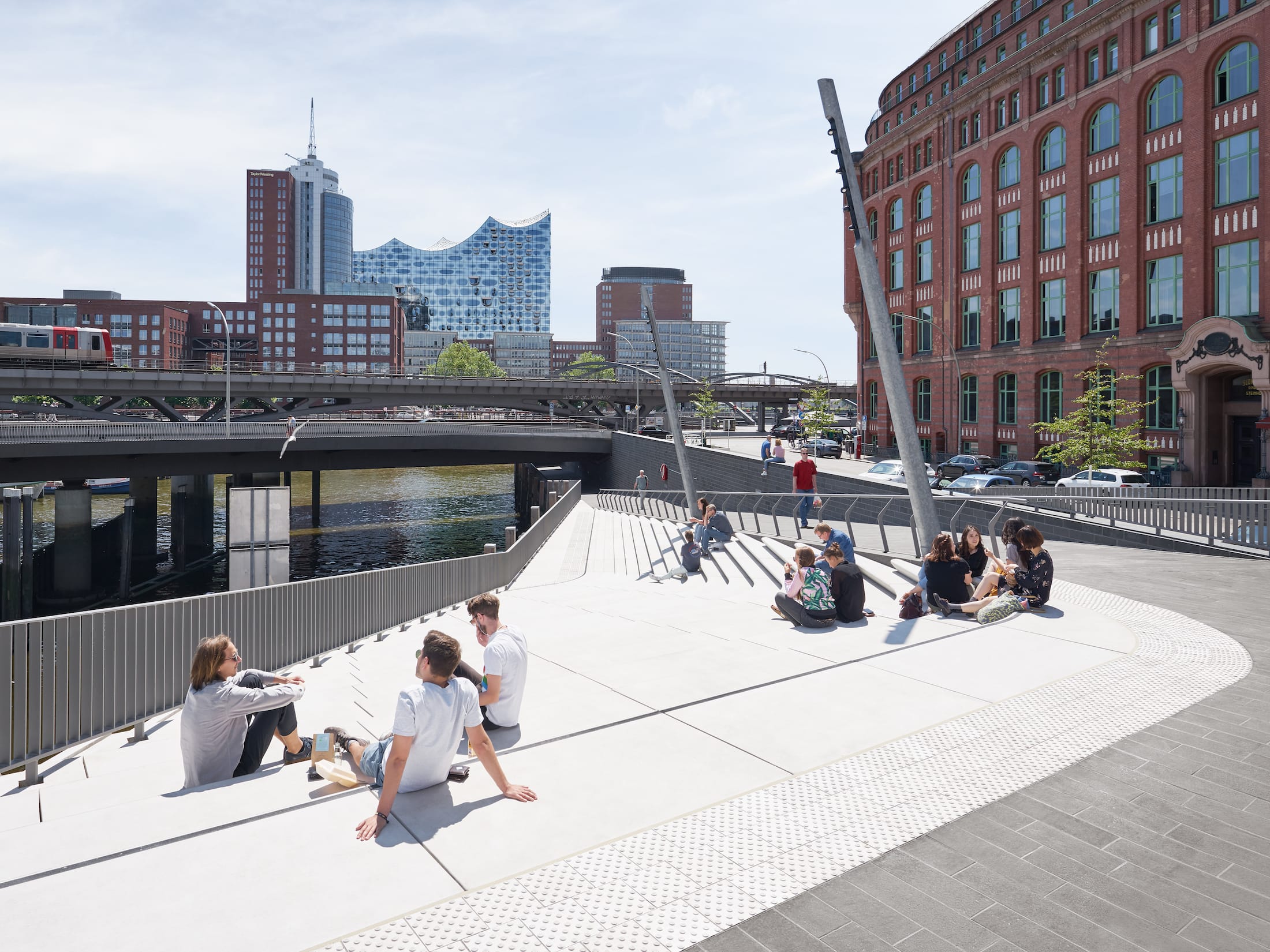
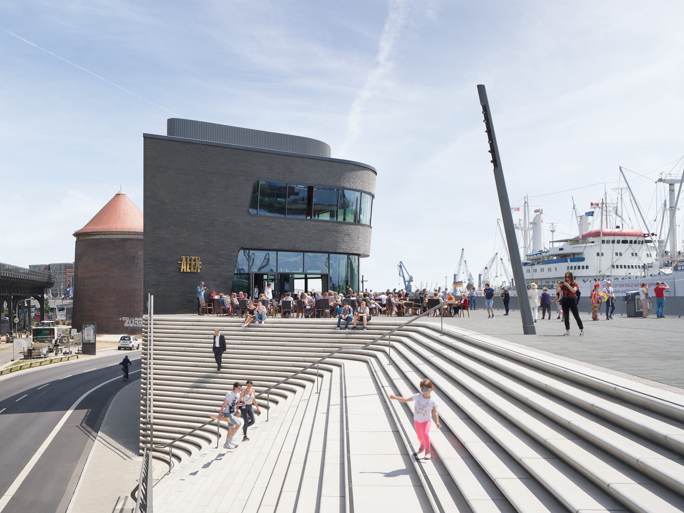
在防洪堤内邻近街道与建筑物交汇处,设有类似小型露天剧场的宽阔楼梯,街道上的行人可透过楼梯看到在长廊漫步的行人,以及易北河上的船只上部桅杆结构。
Wide staircases resembling small amphitheatres are carved within the flood protection barrier at points where streets from the adjacent neighbourhoods meet the structure; giving passers-by at street level views of the people strolling along the promenade at the top of the barrier as well as views of the masts and superstructures of ships in the Elbe.


这些面向河流的露天剧场与面向城市的楼梯交替出现在结构中,在宽窄不断变幻的河道中形成错落有致的振动序列。
Alternating with these city-facing stairs, similar amphitheatres facing the river are also carved within the structure; generating an oscillating sequence in the river promenade as it repeatedly widens and narrows.
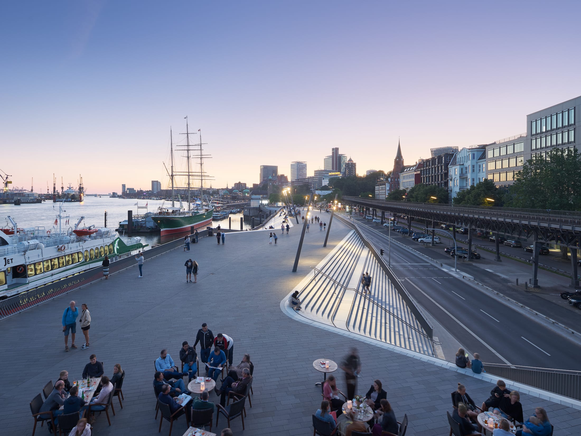
街道上的专用自行车道贯穿整个防洪堤。Baumwell和Landungsbrucken的宽阔坡道将河道长廊与街道连接起来,为所有人提供了无障碍通道。第三个中央坡道可使服务车辆能够进入步行街和Uberseebrucke。
Dedicated cycle lanes at street level run the length of the flood protection barrier. Wide ramps at Baumwell and Landungsbrücken connect the river promenade with street level and provide accessibility for all. A third central ramp enables service vehicles to access the promenade and Überseebrücke.

滨河步道分为具有不同的空间品质的两部分:西面区域的规模较大,视野开阔,可以看到河道下游的所有航运活动;东面的港口码头则创造了一个更加亲密的空间氛围,其圆形剧场旁边的长长坡道,引导游客来到水边。
The river promenade is divided into two sections with different spatial qualities. The zone to the west is at a larger scale, offering wide views downstream of all shipping activity on the river. To the east, the port’s marina creates a more intimate atmosphere with a long ramp alongside the amphitheatre leading visitors down to the water’s edge.


防洪堤结构内有一个三层餐厅和两个食品亭。餐厅的顶层悬挑在相邻的楼梯上,方便用餐者饱览易北河全景。
A three-storey restaurant and two food kiosks are integrated within the flood protection structure. The top floor of the restaurant cantilevers over its adjacent staircase and gives diners panoramic views of the Elbe.

长廊的行人区地面铺装是深色的无烟煤花岗岩,与楼梯的浅灰色花岗岩形成对比。
Pedestrian areas of the promenade are clad in a dark, anthracite-coloured granite that contrasts with the light grey granite of the staircases.
项目团队
委托方:汉堡路桥水运防汛局(LSBG)
建筑公司:Zaha Hadid Architects (ZHA)
设计(ZHA):Zaha Hadid & Patrik Schumacher
ZHA项目团队:Jan Hubener(项目负责人),Niels Kespohl, Cornelius Schlotthauer, Rassul Wassa, Walentina Tradowski, Gonzalo Carbajo, Eren Ciraci
项目及结构规划支持:Ingenieurburo Grassl Gmbh
道路与交通规划:Schmeck-Junker Ingenieurgesellschaft Mbh
建筑技术服务:Rmn Ingenieure
岩土工程咨询:Grundbauingenieure Steinfield and Partner Gbr
环境影响评估:Landschaft & Plan
汉堡的全面公共防洪系统
长度:103公里
堤坝:78公里
防洪堤:25公里
结构:77
风暴潮屏障:6
水闸:6
抽水站及潮汐闸:27个
大型河道闸门:38
Project Team
Client: Hamburg Road, Bridge, Waterways & Flood Protection Agency (LSBG)
Architect: Zaha Hadid Architects (ZHA)
Design (ZHA): Zaha Hadid & Patrik Schumacher
ZHA Project Team: Jan Hübener (project leader), Niels Kespohl, Cornelius Schlotthauer, Rassul Wassa, Walentina Tradowski, Gonzalo Carbajo, Eren Ciraci
Project & Support Structure Planning: Ingenieurbüro Grassl Gmbh
Road & Traffic Planning: Schmeck-Junker Ingenieurgesellschaft Mbh
Technical Building Services: Rmn Ingenieure
Geotechnical Consulting: Grundbauingenieure Steinfield Und Partner Gbr
Environmental Impact Assessment: Landschaft & Plan
Hamburg’s total public flood protection system
Length: 103km
Dykes: 78km
Flood protection: 25 km
Structures: 77
Storm surge barriers: 6
Locks: 6
Pumping stations and tidal gates: 27
Large river gates: 38
更多 Read more about: Zaha Hadid Architects


0 Comments