

本文由 civiliti 授权mooool发表,欢迎转发,禁止以mooool编辑版本转载。
Thanks civiliti for authorizing the publication of the project on mooool, Text description provided by civiliti.
civiliti:蒙特利尔在六七十年代经历了快速的经济增长,其中圣劳伦斯行政区受当时这种变化的影响最大,甚至因此失去了大部分的植被。由于圣劳伦斯地处国际机场附近,且又开发了一个主要的公路系统,这使得圣洛朗迅速扩张,将以前的农田变成了一片沥青海洋。
如今,这片42.8平方公里的土地上,有70%以上是用于工业和商业活动的空间,由易产生热岛效应的建筑或硬质铺装组成。圣劳伦斯有81%的居民来自移民或父母出生于另一个国家,所以这个超10万人口的地方是蒙特利尔最具多元文化的城市之一,同时也是魁北克主要的工业和技术中心之一,共拥有4500家公司和11万个工作岗位。
civiliti:Montréal experienced rapid growth in the 60’s and 70’s and Ville Saint-Laurent, as it was known at the time, was particularly affected by this change as it lost most of its plant cover. Proximity to an international airport and the implementation of a major highway system led to Saint-Laurent’s rapid expansion and the transformation of its former agricultural lands into a sea of asphalt.
Today, over 70% of this 42.8-square-kilometer territory is devoted to industrial and commercial activities and made up of built structures or paved surfaces that are prone to the creation of heat islands. With 81% of its residents being immigrants or having a parent born in another country, Saint-Laurent’s population of over 100,000 is one of the most multicultural in the City of Montréal. The Borough is one of Québec’s main industrial and technological hubs with 4500 companies and 110,000 jobs.
▼蒙特利尔岛的整体地图,标记点为蒙特利尔市区西北的圣劳伦斯区和蒙特皇家公园 Overall map of the island of Montréal, highlighting the Borough of Saint-Laurent north west of downtown Montréal and Mont-Royal Park.

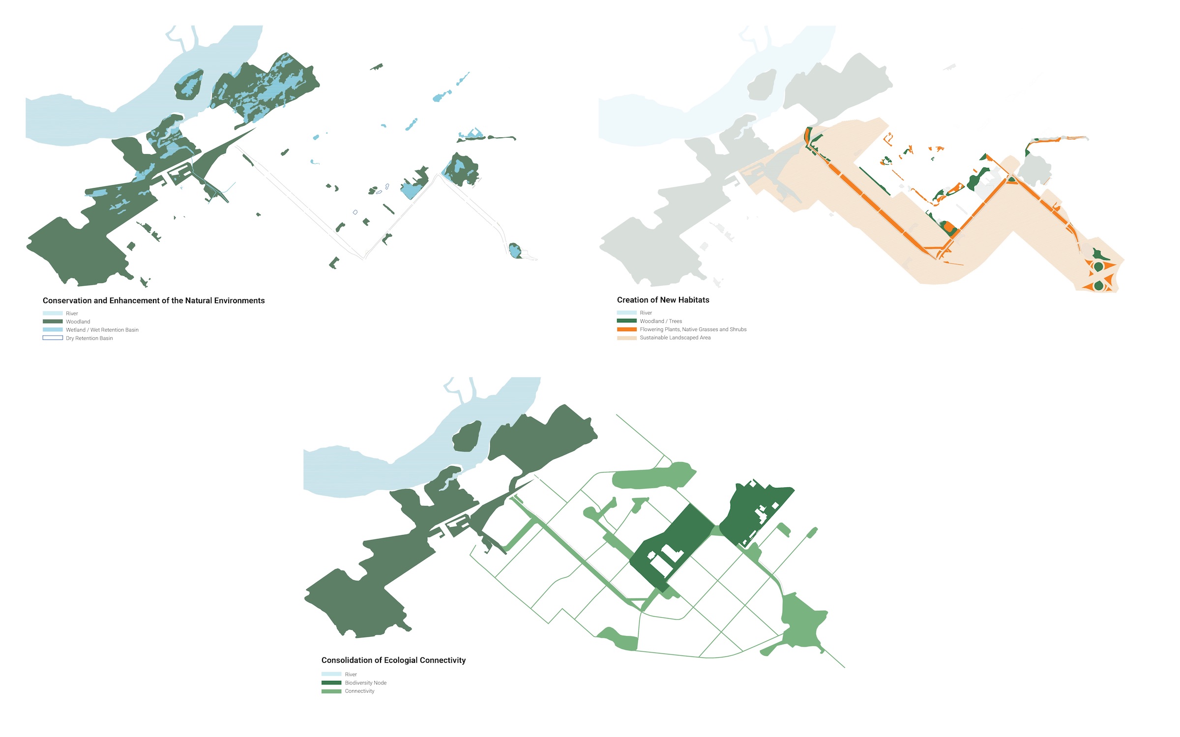
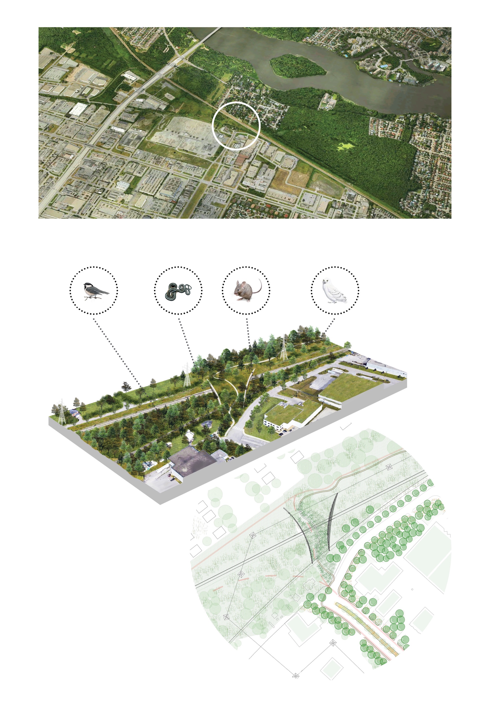
总体规划范围 SCOPE OF MASTER PLAN
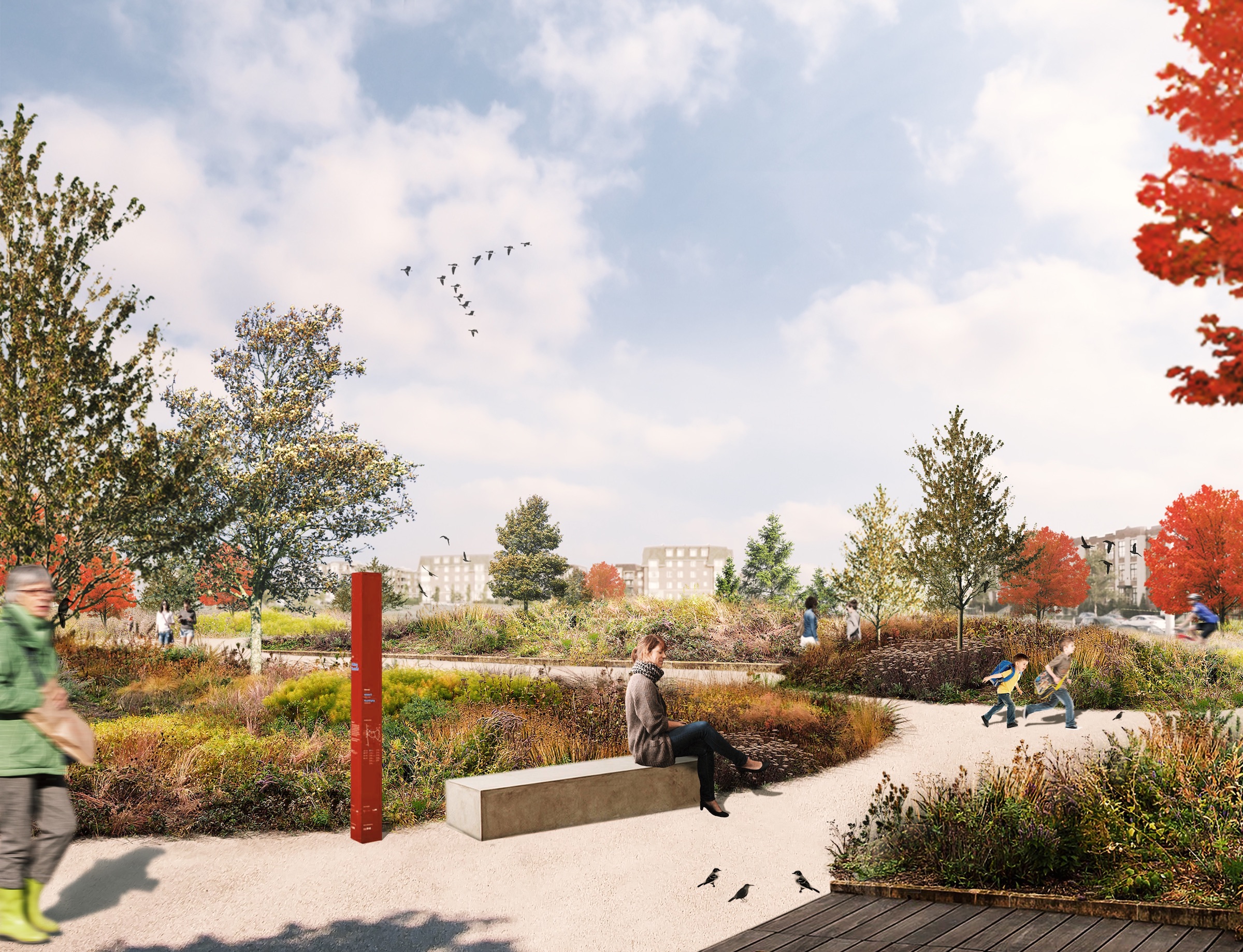
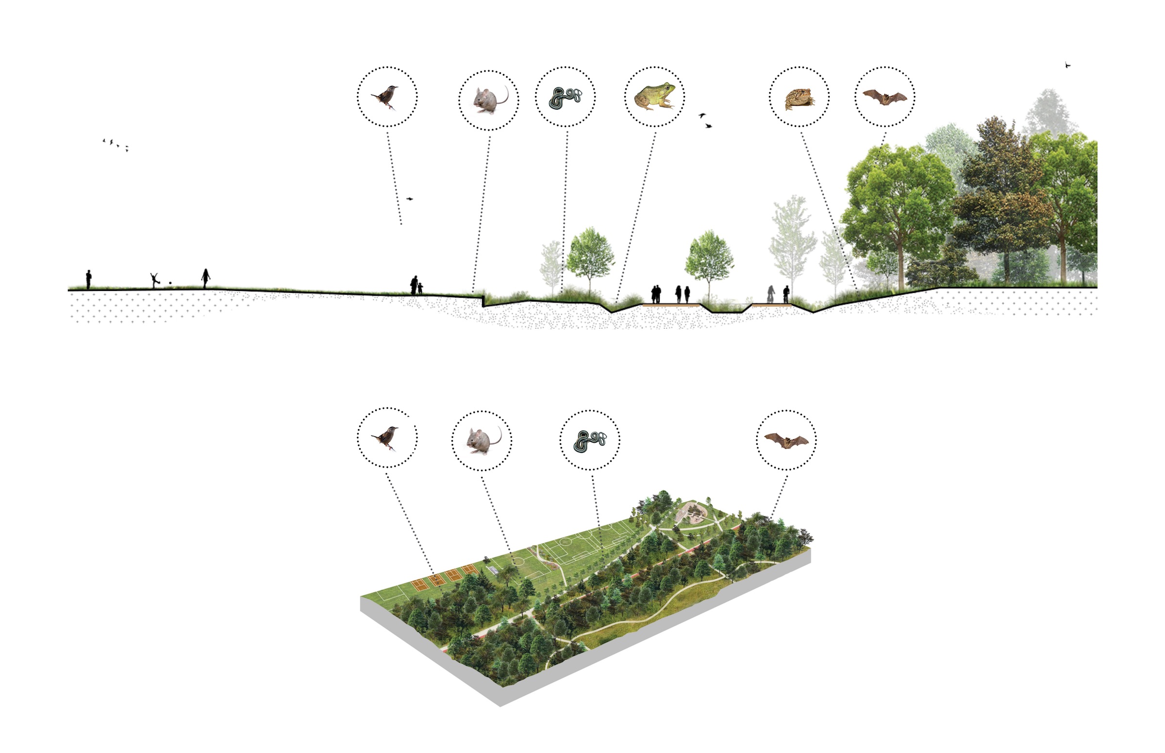
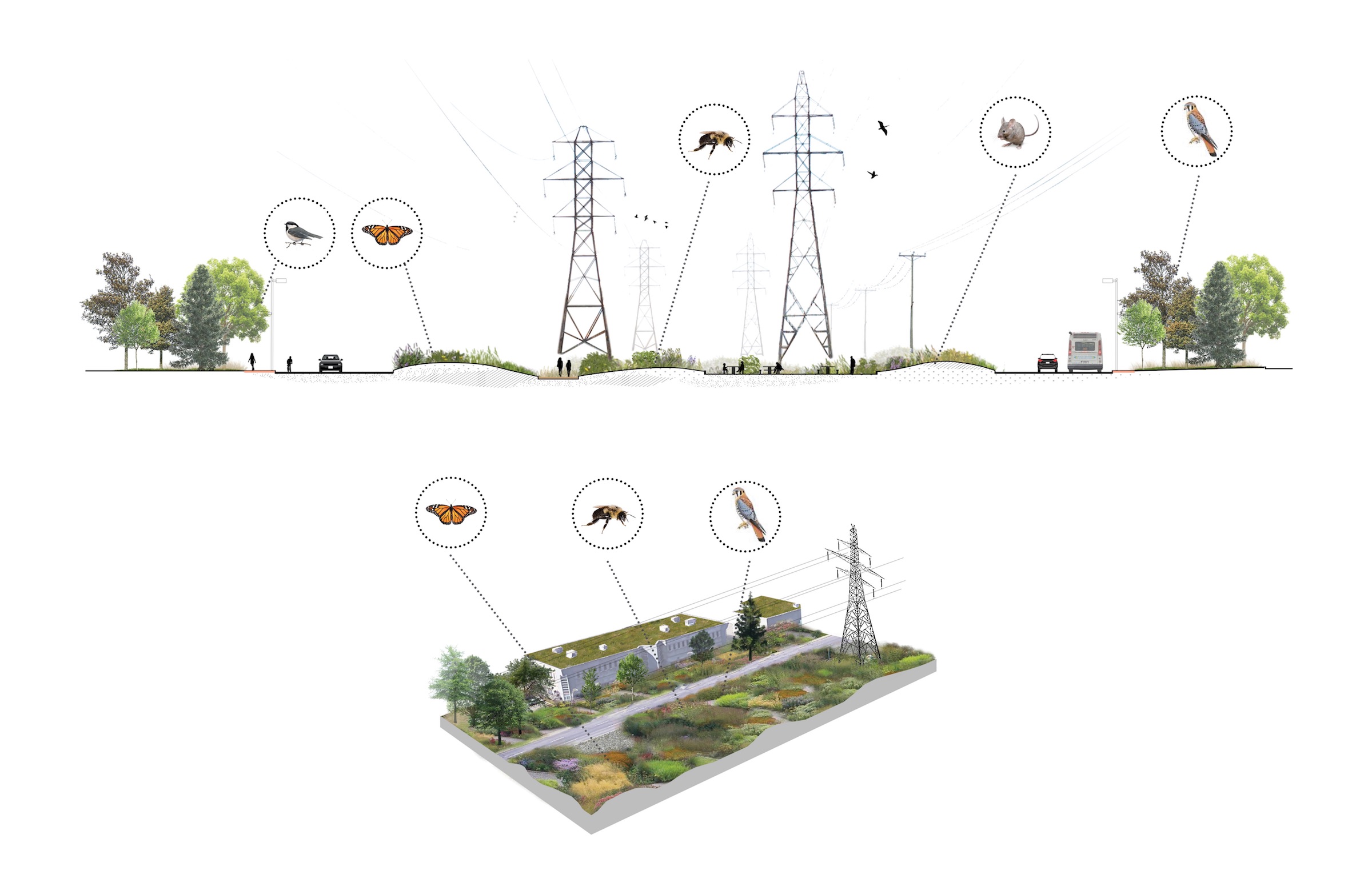
现有的高压电线,沿着卡文迪什大道、波伊耶大道和提门斯大道蜿蜒穿过该区,构成了该项目的设计“主链”。总规划设计的主要建议是对电线下方的区域进行绿化,让动物、鸟类和昆虫重新获得它们失去的栖息地。该干预措施的另一部分则集中在为圣洛朗的工人和居民引入新的步道和升级的自行车道,以及活动或休息区域。
位于卡文迪什大道和波伊耶大道交汇处附近的两个公园,马塞-劳林公园和菲利普-拉赫尔特公园,也将成为重大改造的对象。该项目总体规划还包括在Thimens大道上修建一座立交桥,将生物多样性走廊与里维埃拉-德-普拉亚里海岸的Bois-de-Saraguay生态区连接起来。
The existing high-voltage power lines, which zigzag through the Borough following Cavendish, Poirier, and Thimens boulevards, constitute the ‘backbone’ of the project. The Master Plan’s main proposal is the greening of the areas under the overhead power lines, allowing animals, birds, and insects to regain their lost habitat. Also part of this major intervention, is the introduction of new pedestrian trails and upgraded bicycle paths as well as activity or rest areas for Saint-Laurent workers and residents.
Two parks located near the intersection of Cavendish and Poirier boulevards, Marcel-Laurin Park and Philippe-Laheurte Park, will be the objects of substantial modifications. The Master Plan also includes the introduction of an overpass over Thimens Boulevard to link the Biodiversity Corridor with the Bois-de-Saraguay Ecoterritory along the shores of Rivière-des-Prairies.
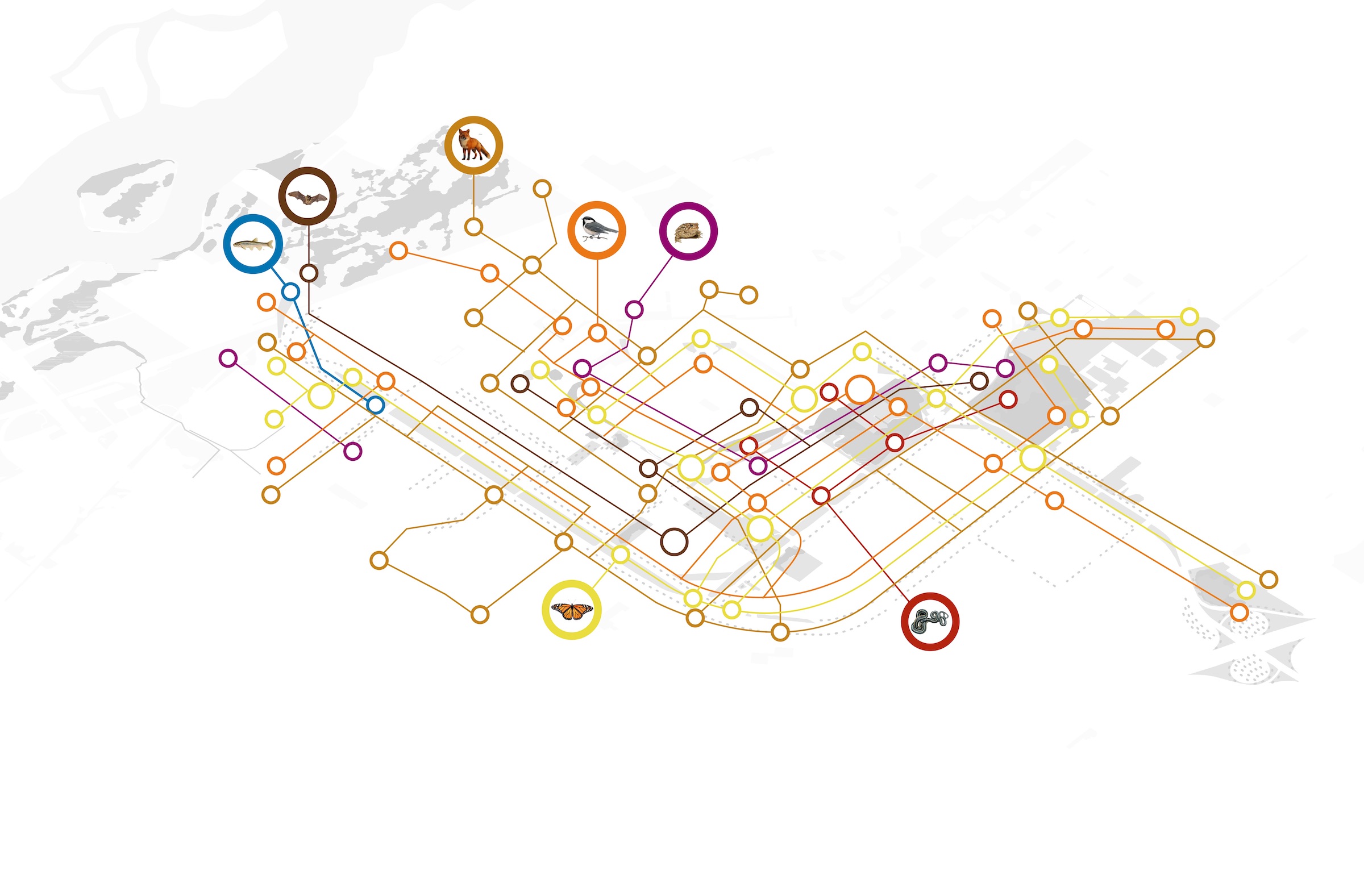
▼未来生物多样性走廊的主要干预地点 Main intervention sites along the future Biodiversity Corridor.

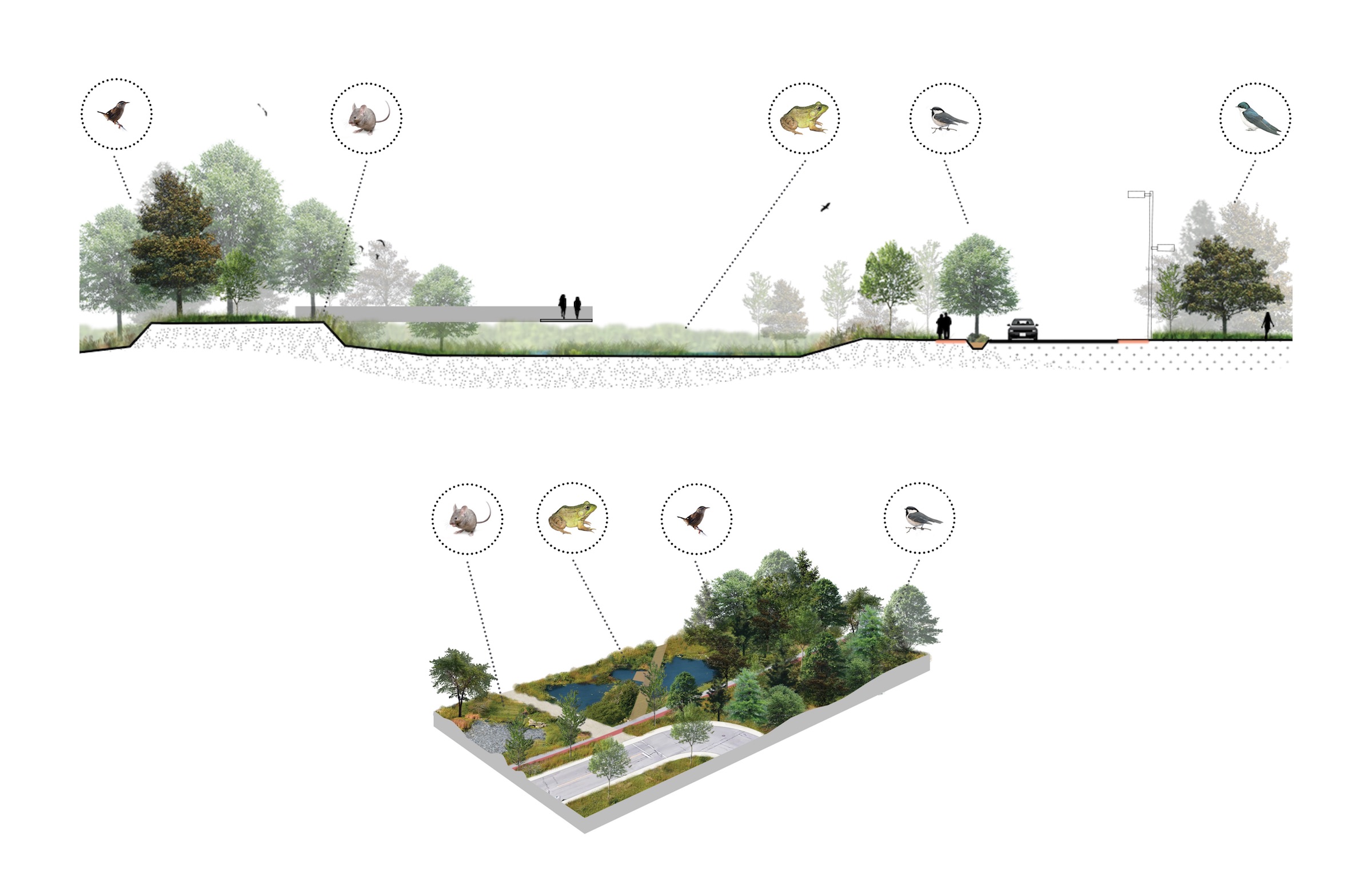
▼显示干预层次的专题地图 Thematic maps showing layers of intervention
▼现有及建议的生境图 Diagram of existing and proposed habitats
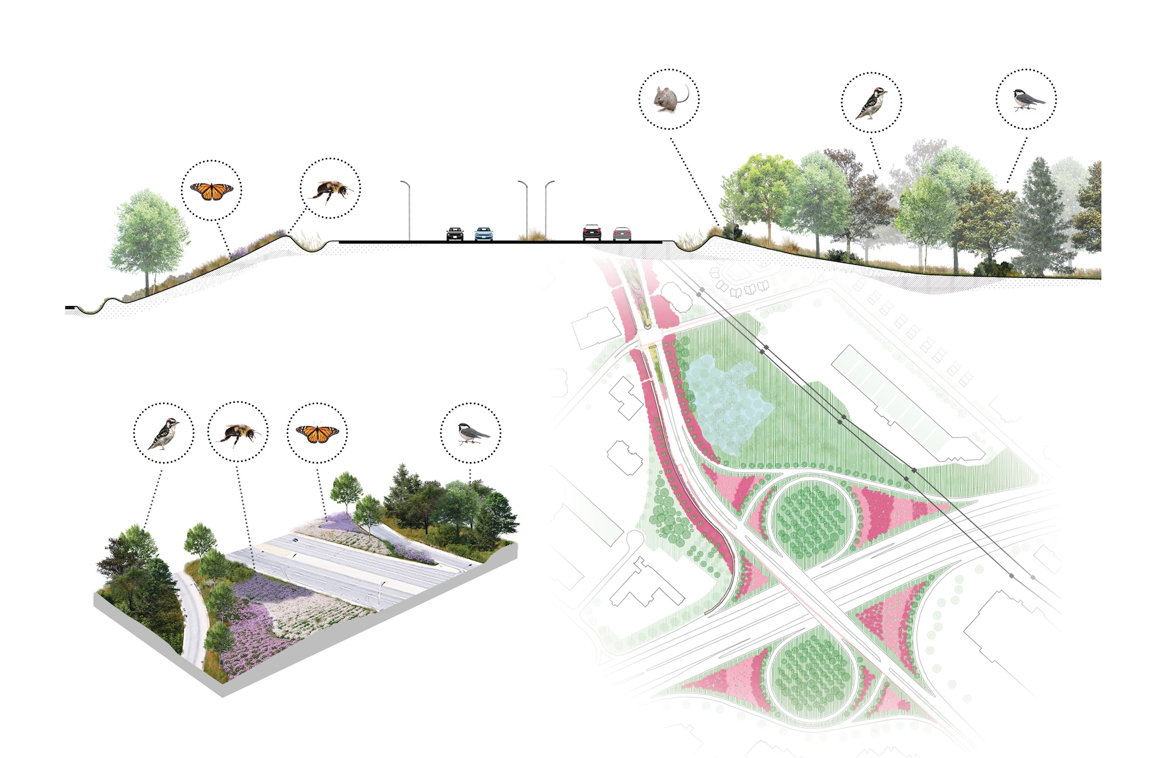
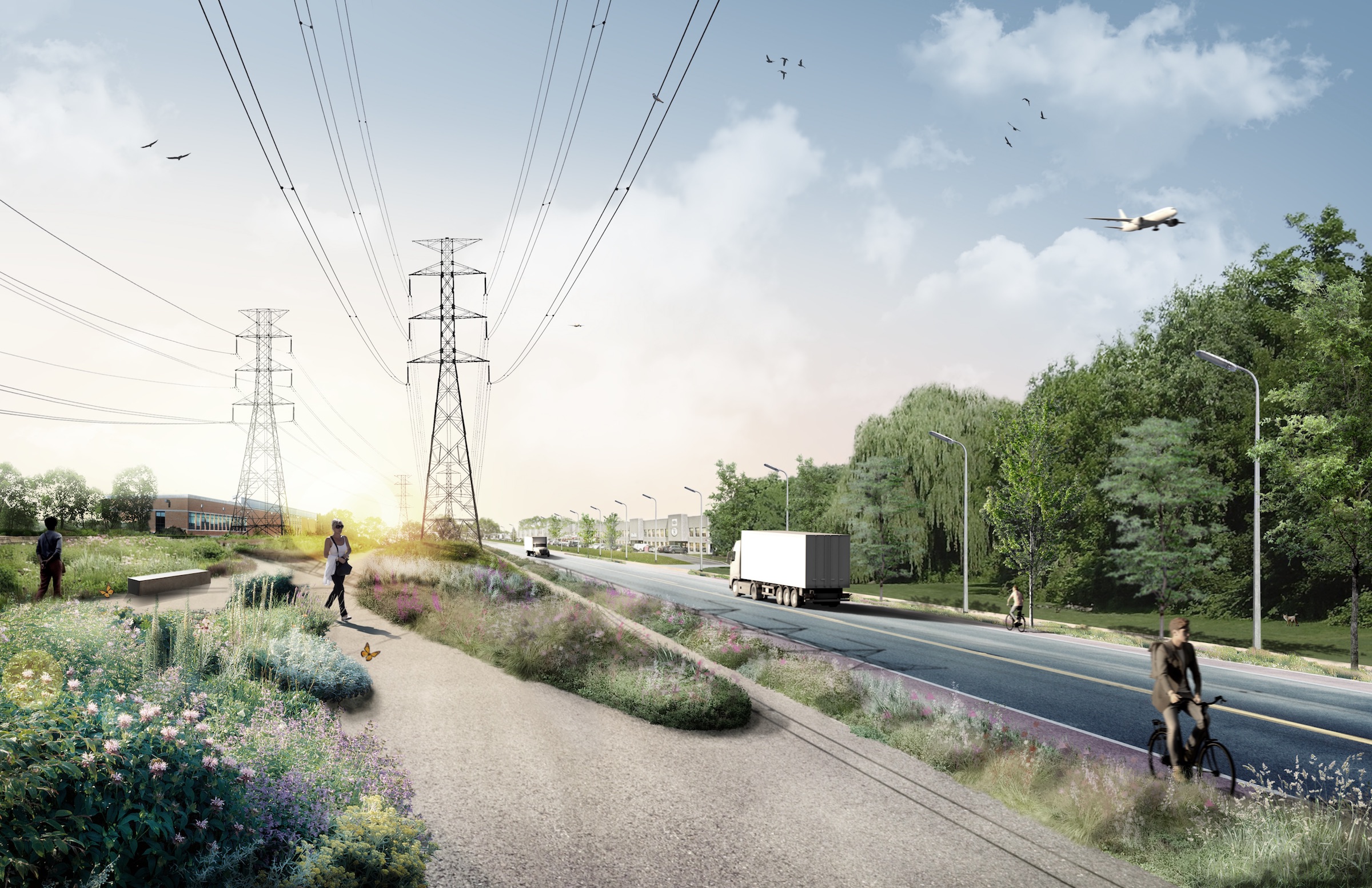
卡文迪什大道和40号公路 CAVENDISH BOULEVARD AND HIGHWAY 40
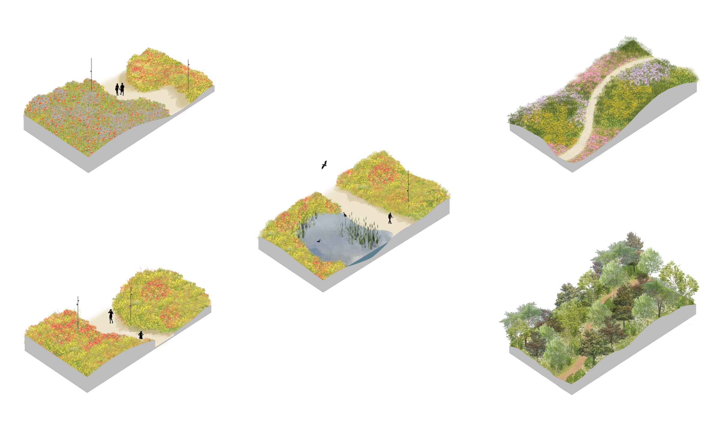
40号公路与生物多样性走廊的交界区域,在标志着生态走廊的存在的同时,也是卡文迪什大道线性公园的第一个入口。这个看似贫瘠的互通式立交桥及其周边环境将通过各种花卉、草类和树木进行改造,以适应该区最近的绿化举措。
Located at the junction of Highway 40 and the Biodiversity Corridor, this area will signal the presence of the corridor and act as the first access point to the Cavendish Boulevard linear park. The sterile-looking interchange and its immediate surroundings will be transformed through the introduction of a variety of flowers, grasses, as well as trees, in keeping with the Borough’s recent greening initiatives.
▼卡文迪什大道与40号公路交汇处的剖面图、概念图及详细位置图 Section, schematic concept, and site plan, Cavendish Boulevard and Highway 40 Interchange.
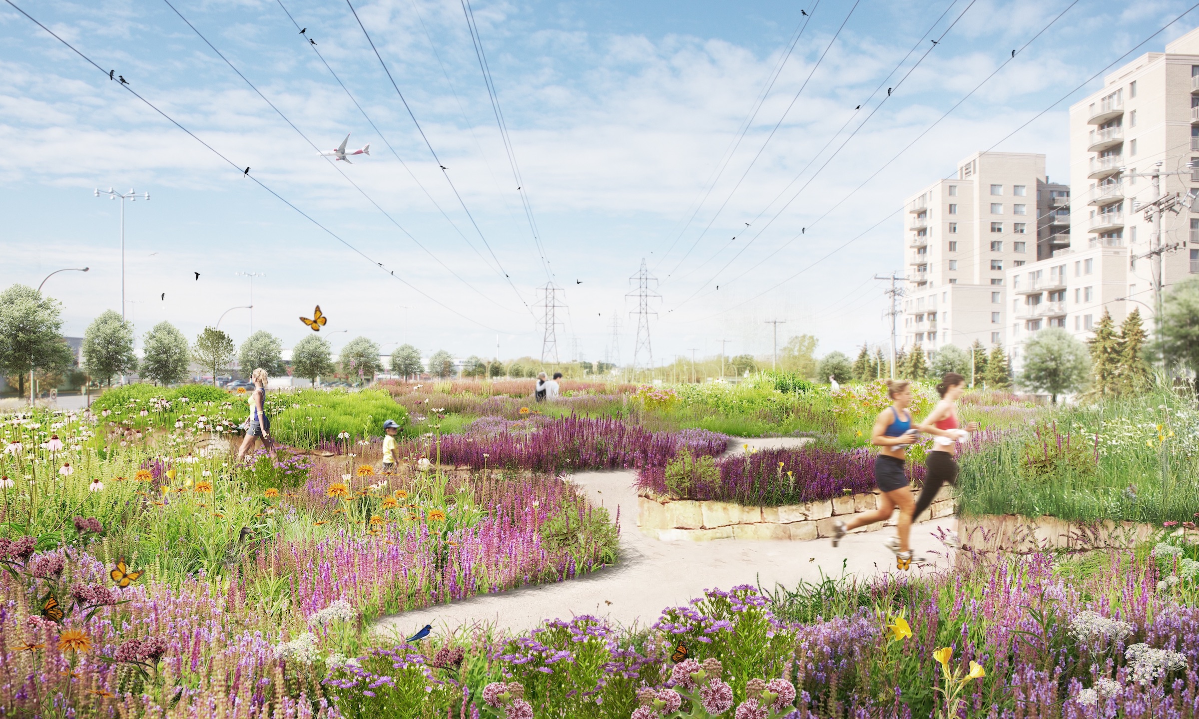
这幅效果图展示了现有电线下的荒地将如何转变成繁花盛开的草地。其引入的特色地形将赋予场地活力,打破现有的单调景观。当地的居民,以及他们的家人和附近企业的工人都将从这些新的绿色空间中受益。
The perspective shows how the wasteland under the existing overhead power lines will be transformed into flowery meadows. Topographical features will be introduced to enliven the grounds and break the monotony of the existing landscape. Borough residents, their families and workers from nearby businesses will finally be able to benefit from these new green spaces.
▼卡文迪什大道效果图 Perspective, Cavendish Boulevard.
▼卡文迪什大道剖面图、示意图 Section and schematic concept, Cavendish Boulevard.

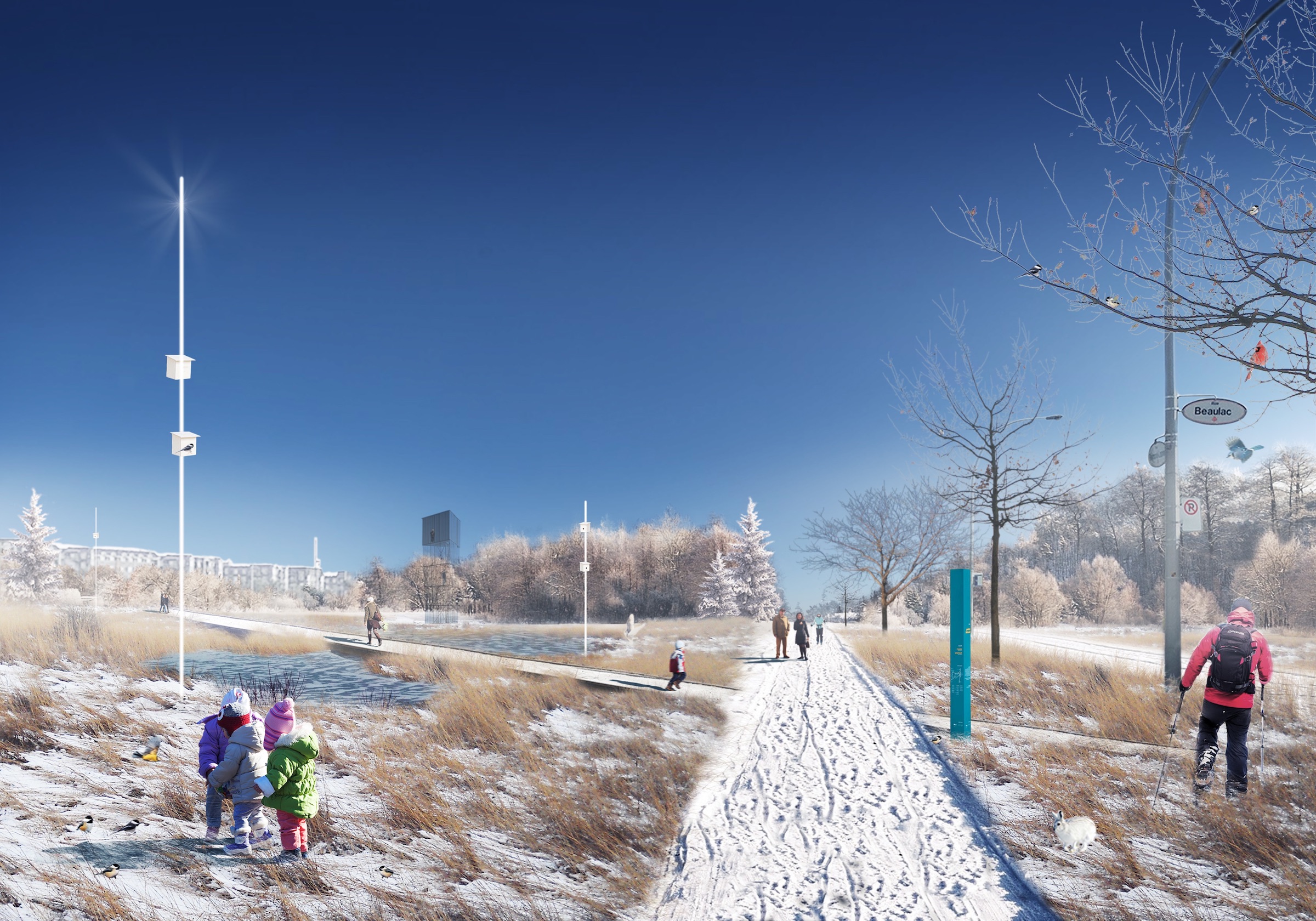
菲利普-拉赫尔特公园建造的湿地生物滞留池,旨在附近湿地和现有干式滞留池之间创造更好的连接。这块特殊的区域在吸引小动物和鸟类的停留栖息方面提供了巨大的潜力。新的道路和隐蔽的观察结构可以允许市民在观察周围自然了解生态的同时,又不会直接干扰它。
A wet bioretention basin will be implemented in Philippe-Laheurte Park to ensure better connection between nearby wetlands and an existing dry retention basin. This particular area offers great potential in terms of habitat for small animals and birds attracted to this territory. New pathways and unobtrusive viewing structures will allow citizens to learn about ecology as they watch the surrounding nature without directly interfering with it.
▼菲利普-拉赫尔特公园,冬季效果图 Philippe-Laheurte Park, Winter Perspective.
▼菲利普-拉赫尔特公园剖面图、示意图 Section and schematic concept, Philippe-Laheurte Park.
该设计规划还为卡文迪什大道附近的菲利普-拉赫尔特公园新建了一个入口。现有的游乐场设施也将会保留,并通过引入公园设施和改良的地形加以巩固。各类植物,例如卡文迪什大道电线下种植的植物,将有助于在这种混合环境中创造视觉和生物的过渡空间。游客也可以从这个入口轻松进入附近的林区。
The Master Plan proposes an entrance to Philippe-Laheurte Park off Cavendish Boulevard. Existing playground facilities will be kept and consolidated with the introduction of park furniture and modified topography. Species of plants, similar to these sown under the Cavendish Boulevard power lines, will help create a visual and biological transition in this hybrid environment. Visitors will be able to easily access the nearby wooded area from this entrance point.
▼从卡文迪什大道进入菲利普-拉赫尔特公园效果图 Perspective showing entrance to Philippe-Laheurte Park from Cavendish Boulevard.
▼从卡文迪什大道到菲利普-拉赫尔特公园的入口剖面图、示意图 Section and schematic concept, entrance to Philippe-Laheurte Park from Cavendish Boulevard.

雷蒙-拉斯尼埃街道的一部分未来将禁止车辆通行,只允许在菲利普-拉赫尔特公园的两个独立区域之间自由通行。现有的街道最终会消失,取而代之的将是一条对小动物威胁更小的人行道。该公园的规模将会扩大至两倍,展现出极高的生物多样性潜力。游客可以进入参观观察塔,帮助他们了解在城市环境中保护自然的重要性。
A segment of Raymond-Lasnier Street will be shut down to vehicular circulation allowing for free movement between two separate sectors of Philippe-Laheurte Park. The existing street will eventually disappear to be replaced by a pedestrian path, much less threatening to small animals. The park, which will double in size, presents a particularly high potential for biodiversity. Visitors will have access to an observation tower, which will help them grasp the importance of protecting nature in an urban environment.
▼菲利普-拉赫尔特公园生态链效果图 Perspective, Ecological link, Philippe-Laheurte Park.
▼菲利普-拉赫尔特公园生态链剖面图、示意图 Philippe-Laheurte Park_Ecological Link, section and schematic concept.
马塞尔-劳林公园所处的大地块上,还有一些文化、教育和体育设施。假以时日,该公园必将成为一个主要的生物多样性节点,让动植物与人类共存。其范围可能会一直延伸到各种机构周围的人行道上,比如布瓦西图书馆,它的设计也考虑到了它与自然环境的接近程度。
Marcel-Laurin Park is located on a large land parcel where several cultural, educational, and sports amenities can also be found. In time, the park could become a major biodiversity node where fauna and flora would cohabit with humans. Its limits could possibly be extended right up to the sidewalks surrounding the various institutions such as the Bibliothèque du Boisé, which was designed taking into account its proximity to the natural environment.
▼示意图 Schematic diagrams.
▼马塞尔-劳林公园剖面图 Section, Marcel-Laurin Park.

波伊耶大道作为卡文迪什大道和Thimens大道之间的过渡,也是生物多样性走廊的关键部分。未来的线性公园将与附近水库两侧的步行道相连,为游客提供一个进入菲利普-拉赫尔特公园的额外通道。
Poirier Boulevard is a crucial segment of the Biodiversity Corridor ensuring the transition between Cavendish and Thimens boulevards. The future linear park will connect with pedestrian paths located on either side of a nearby water reservoir thus giving visitors an additional access to Philippe-Laheurte Park.
▼波伊耶大道效果图 Poirier Boulevard, Perspective.
▼波伊耶大道剖面图、示意图 Section and schematic concept, Poirier Boulevard.

沿着提门斯大道的公园区域,作为三大线性景观之一,紧邻几家现有的企业区。该区域将呈波浪形,为游客和工作人员提供庇护空间,他们可以在午餐休息时间或其他任何时间放松。繁花似锦的草地会随着季节的变化而变化,为鸟类和昆虫提供新的栖息地。
One of three major linear landscapes, the park area along Thimens Boulevard is located in close proximity to several existing businesses. The area will be undulated offering visitors and workers sheltered spaces where they will be able to relax during lunchtime breaks or at any other time. Flowery meadows will change throughout the seasons, and provide birds and insects with new habitats.
▼提门斯大道效果图 Perspective, Thimens Boulevard.

▼提门斯大道剖面图、示意图 Section and schematic concept, Thimens Boulevard.
该总体规划在提门斯大道末端、铁路上方新建了一个多功能立交桥。这个位于生物多样性走廊最北端的新设施,将为人类和野生动物提供一座“绿色桥梁”,与此同时,将生物多样性走廊与Bois-de-Liesse和Saraguay自然公园,以及Riviere-des-Prairies海岸连接起来。
The Master Plan proposes a multi-use overpass, located at the end of Thimens Boulevard, above the railway line. This new amenity, at the northernmost part of the Biodiversity Corridor, will provide a “green bridge” for human and wildlife. It will also serve to link the Biodiversity Corridor to the Bois-de-Liesse and Saraguay nature parks as well as to the shores of Rivière-des-Prairies.
▼提门斯林荫大道立交桥的概念图和总平面图 Schematic concept and site plan, Thimens Boulevard Overpass.
客户:
蒙特利尔市圣劳伦斯行政区
环境和领土保护司
研究设计团队:
civiliti
LAND Italia
Table Architecture
Biodiversité Conseil
Clients:
Arrondissement de Saint-Laurent – Ville de Montréal
Division de l’environnement et de la protection du territoire
Research and Design Team:
civiliti
LAND Italia
Table Architecture
Biodiversité Conseil
更多 Read more about: civiliti


0 Comments