

ENOTA: Velenje市的“Promenada”是一个重要的城市空间和重要的城市大道。它是Velenje中心的中心轴线之一,Velenje是一个年轻的城镇,设计于20世纪50年代,以花园城市的现代主义理想为基础;因此,它在斯洛文尼亚空间中是独一无二的。Promenada的翻新是逐步恢复市中心活力的第一步。它的任务是向这座城市提供缺失的项,并帮助它恢复原来的公园小镇的特色。一项成功的翻新工程,基于对指定用于交通的过多路面的认识,必须将两个看似相互矛盾的要求结合在一起:“更环保,更有计划”。
ENOTA: The Velenje “Promenada” is an important city space and a vital city thoroughfare. It is one of the central axes of the centre of Velenje, a young town designed in the 1950s, based on the Modernist ideal of the garden city; as such, it is unique in the Slovene space. The renovation of the Promenada represents the first step towards the gradual revitalisation of the city centre. It’s tasks are to supply the city with the missing programmes and to help it reclaim its original character of a town-in-a-park. A successful renovation, informed by the awareness of the excessive surfaces designated for traffic, must bring together two requirements seemingly at odds with each other: “More greenery and more programme.”
平面图 Master Plan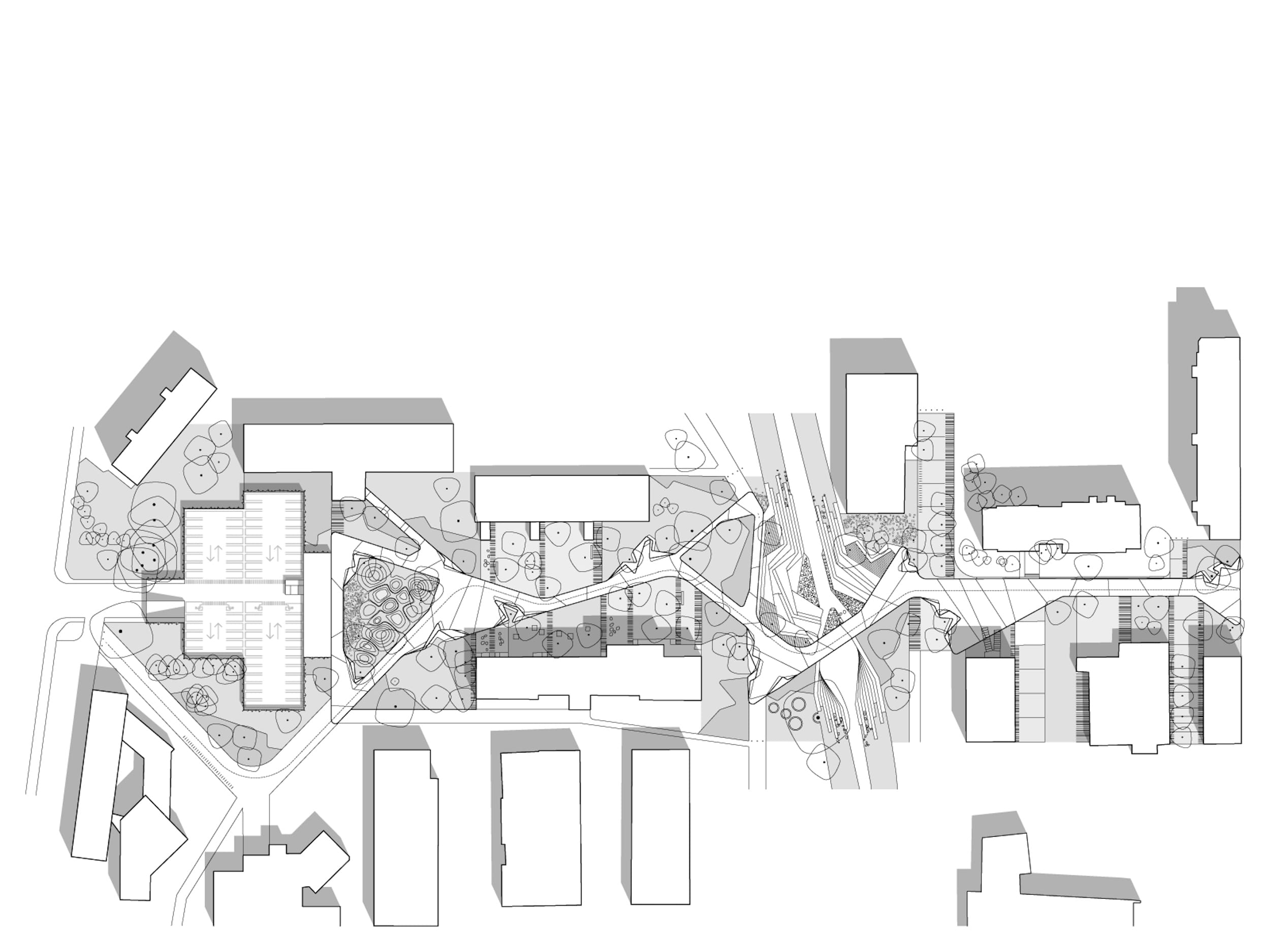


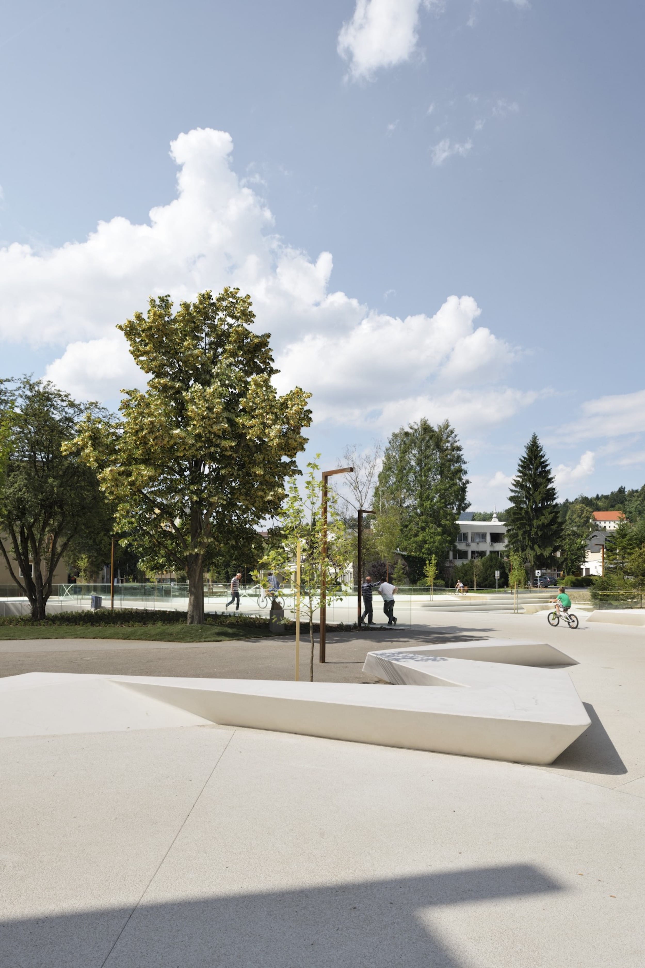
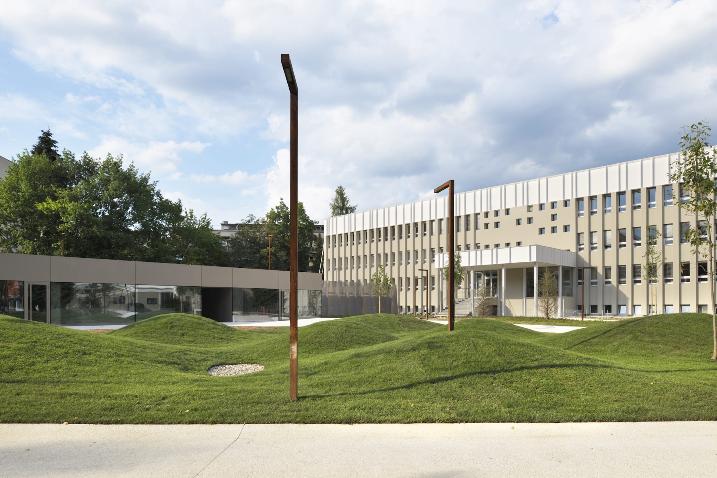
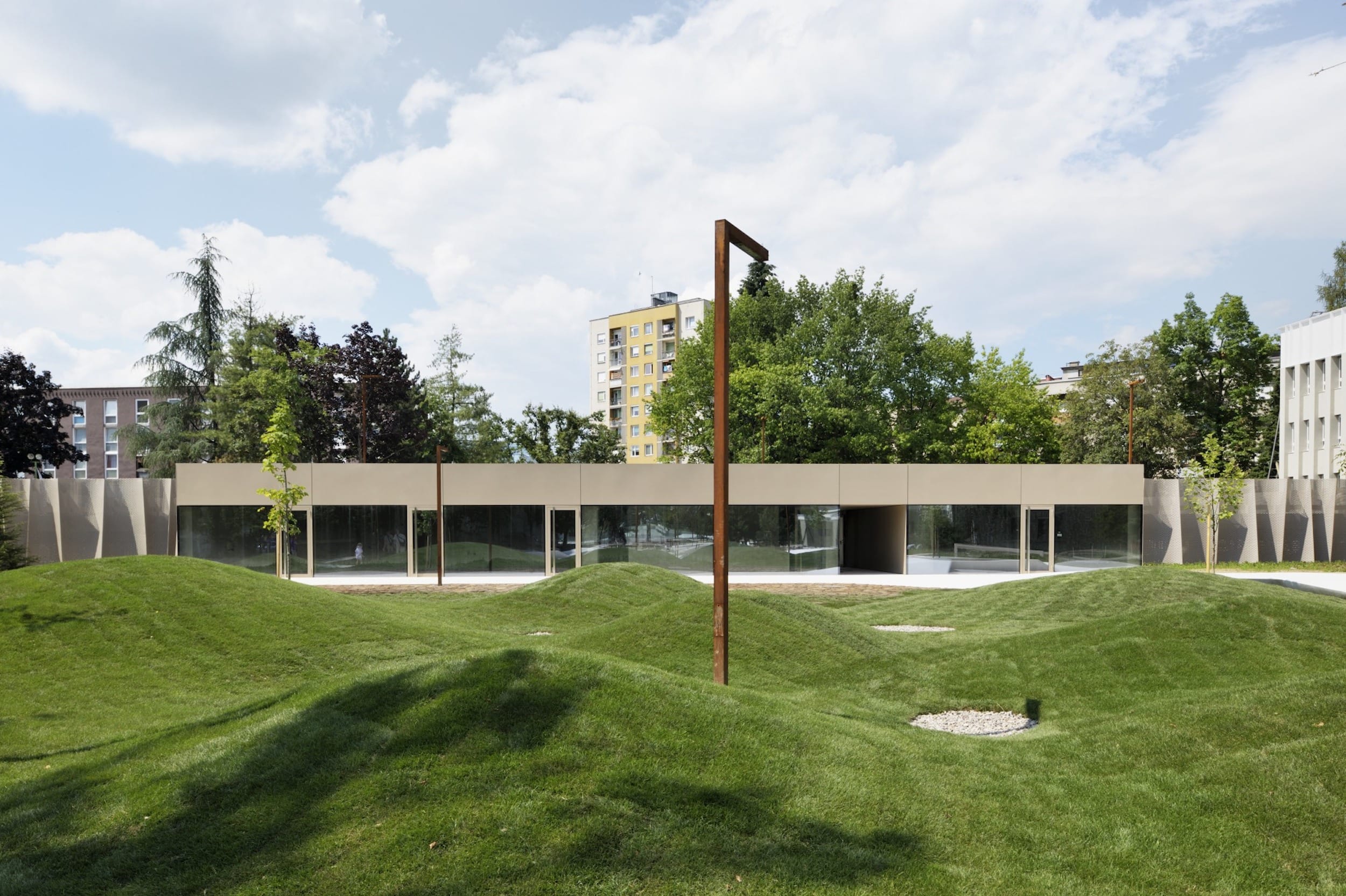
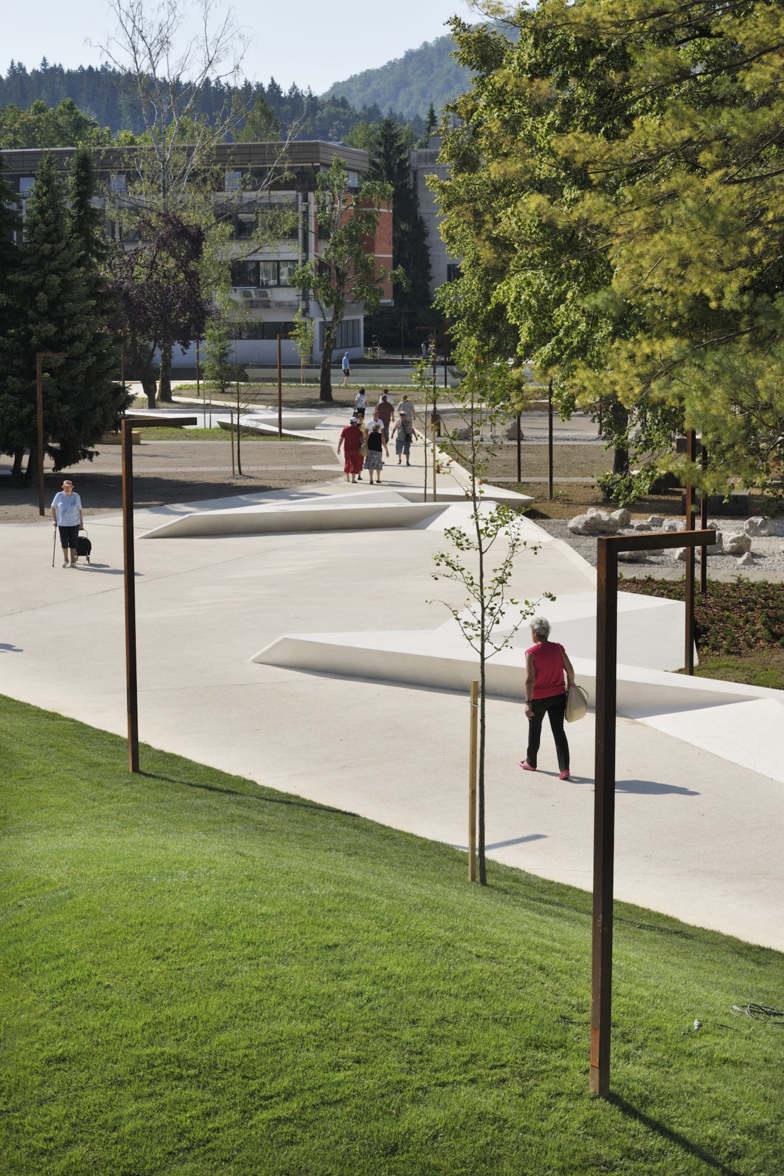
此外,现有的步行道是近30年前关闭以前的交通道路而建立的。尽管重新铺设了道路,但从未发生过充分彻底的改造,步行街保留了道路的特征,由于缺乏内容而显得过于宽阔和沉闷。这是道路和路面之间的一种混合空间,主要是供行人使用的——一条笔直的道路可以快速引导中学综合体和社区健康中心的使用者前往内中心,而不为外出散步的人提供任何动态效果。
Also the existing promenade was created by closing the erstwhile traffic road almost thirty years ago. Even though it was re-paved, a sufficiently thorough transformation never took place and the promenade has retained the character of a road, remaining too wide and rather dull due to the lack of content. It has been a kind of hybrid space between the road and the surface intended for pedestrians – chiefly a straight path quickly leading the users of the secondary-school complex and the community health centre to the inner centre without providing any animation for those out for a walk.

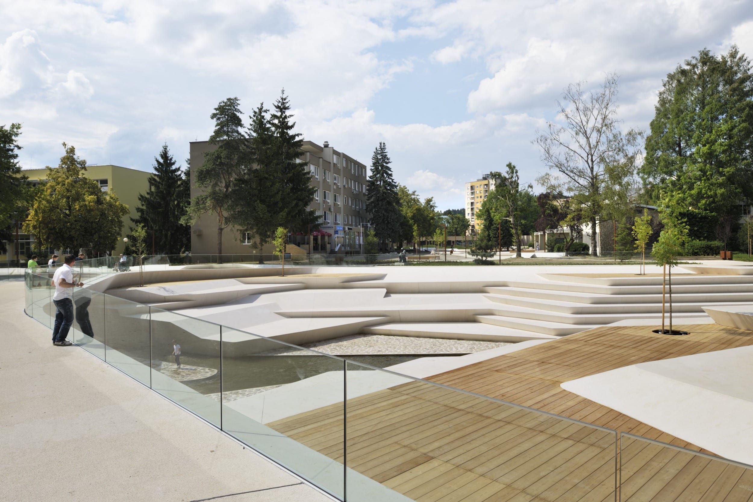
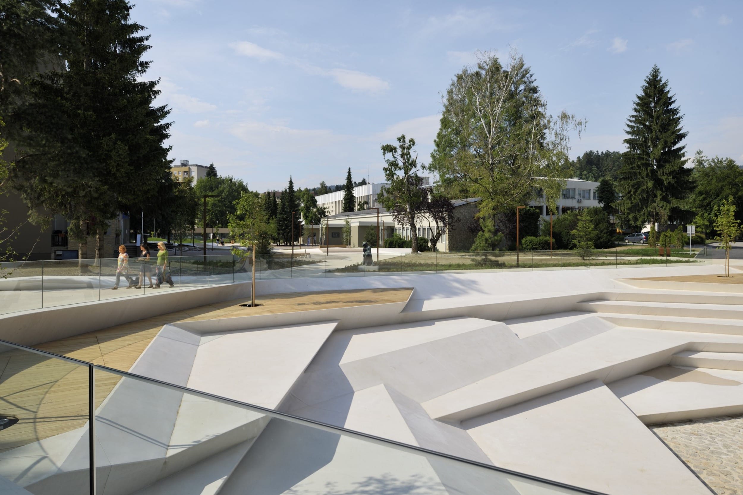
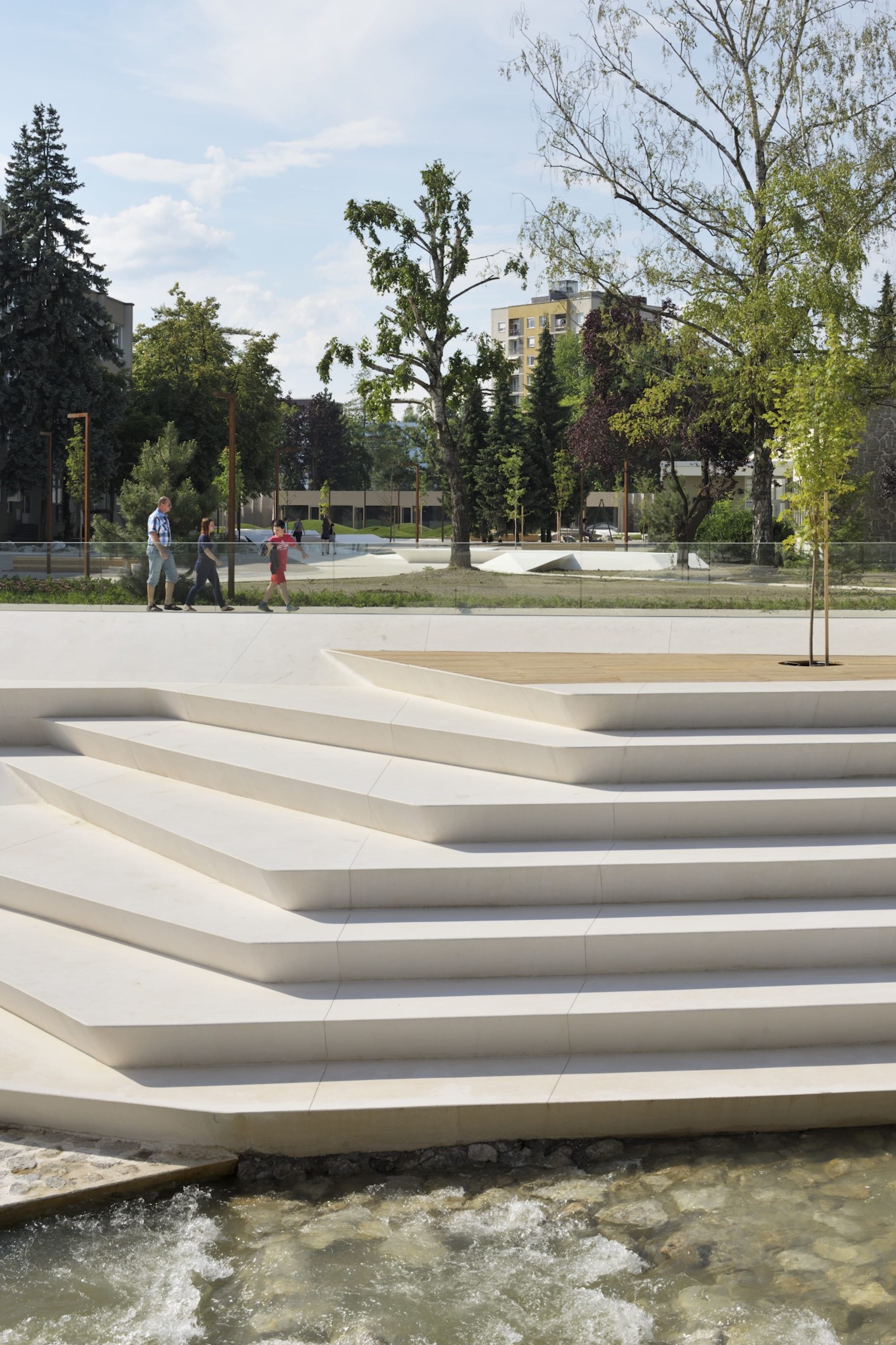
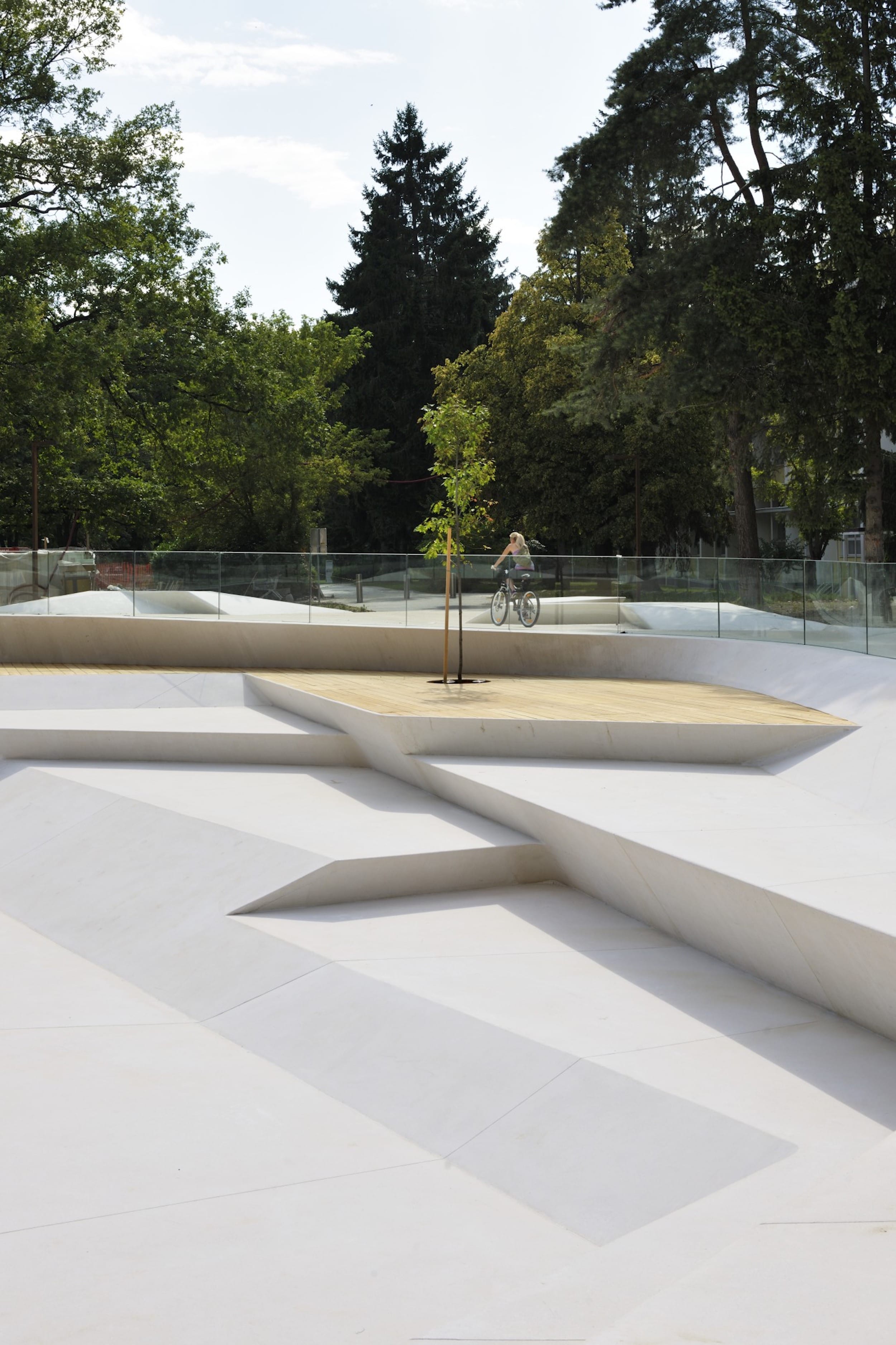
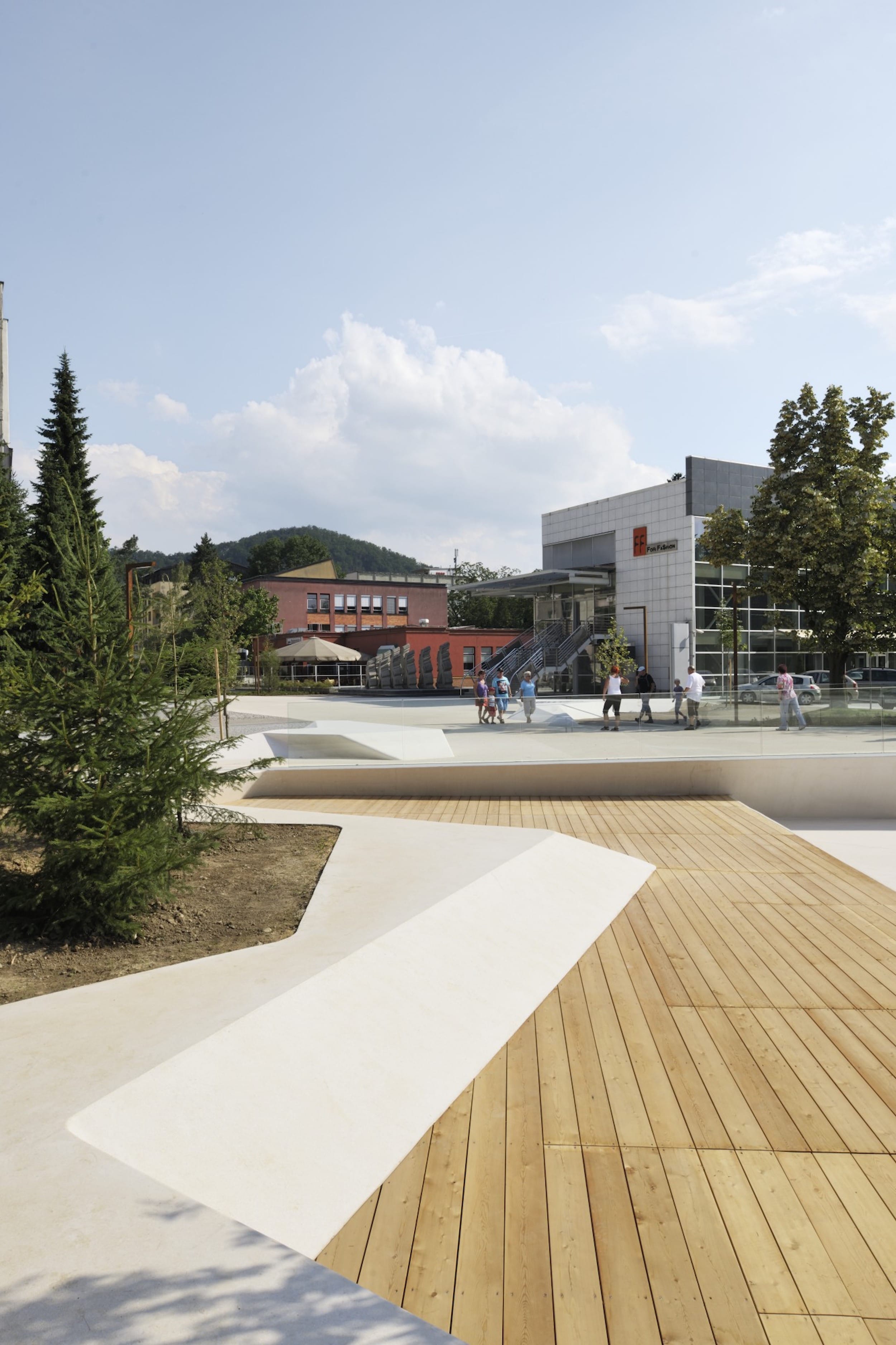
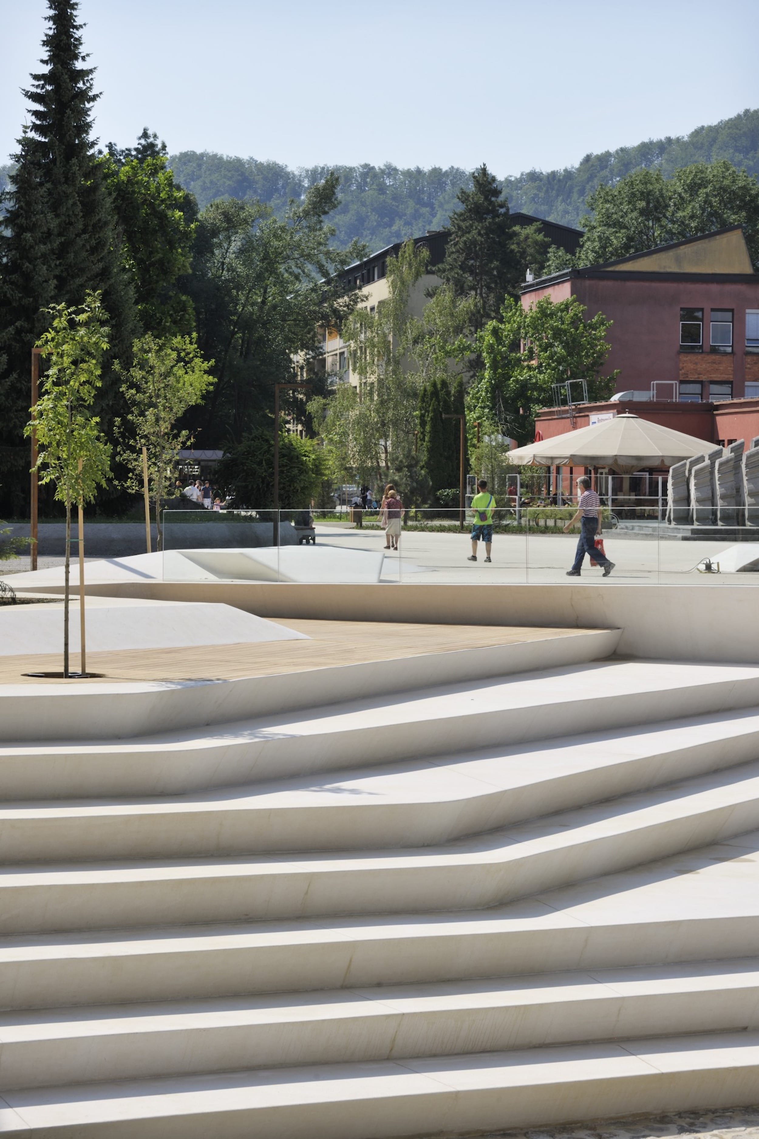
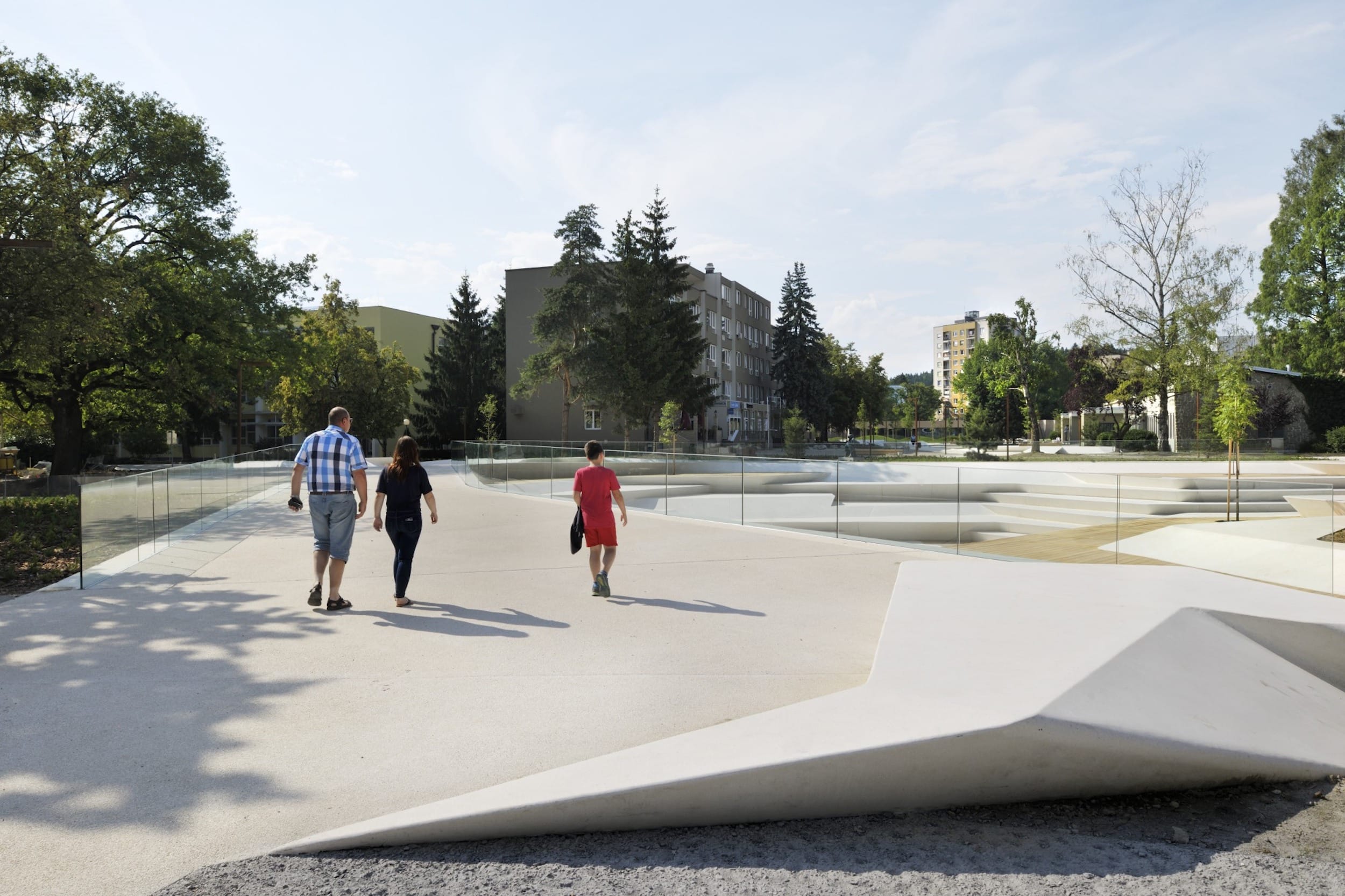
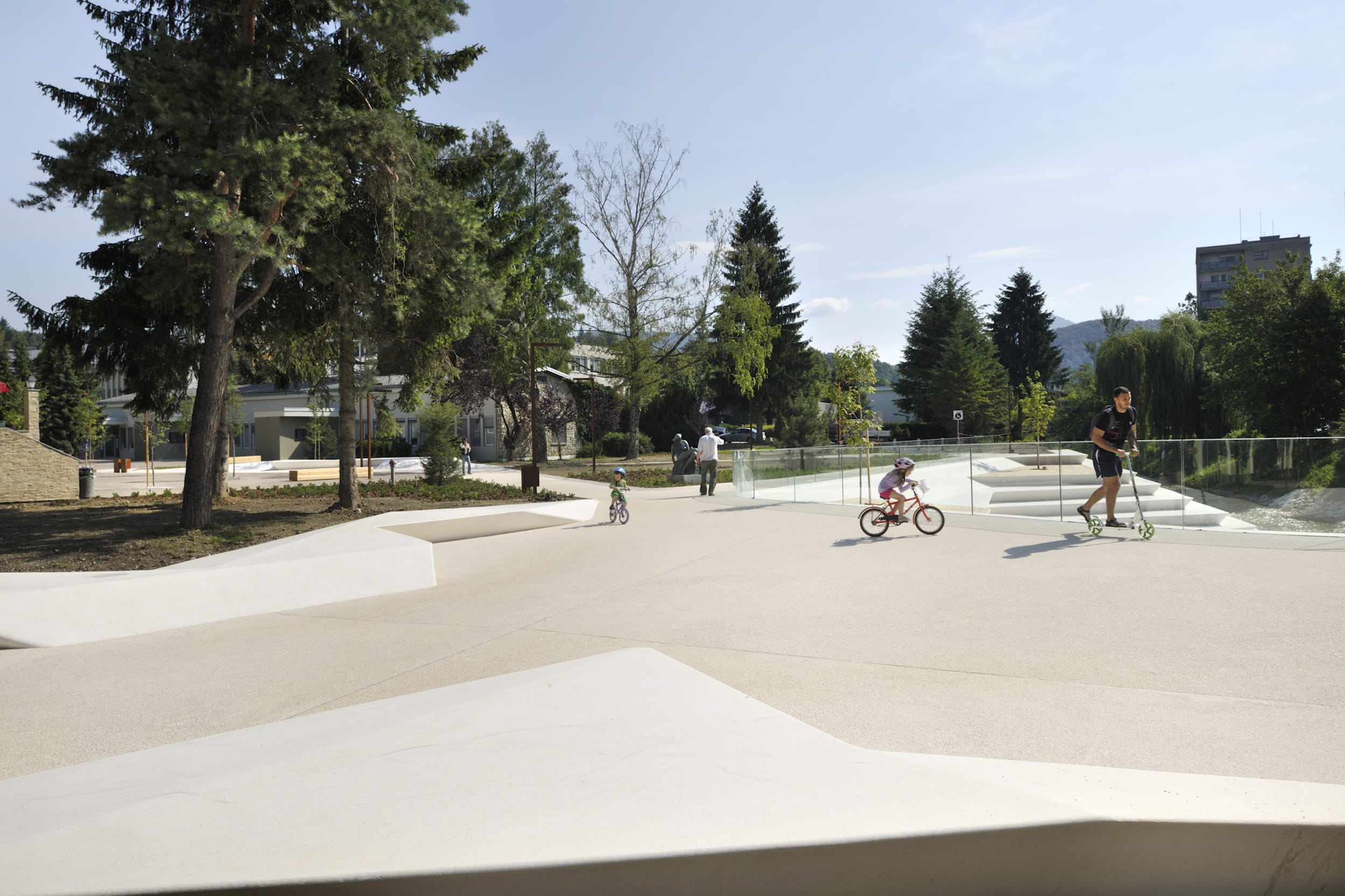
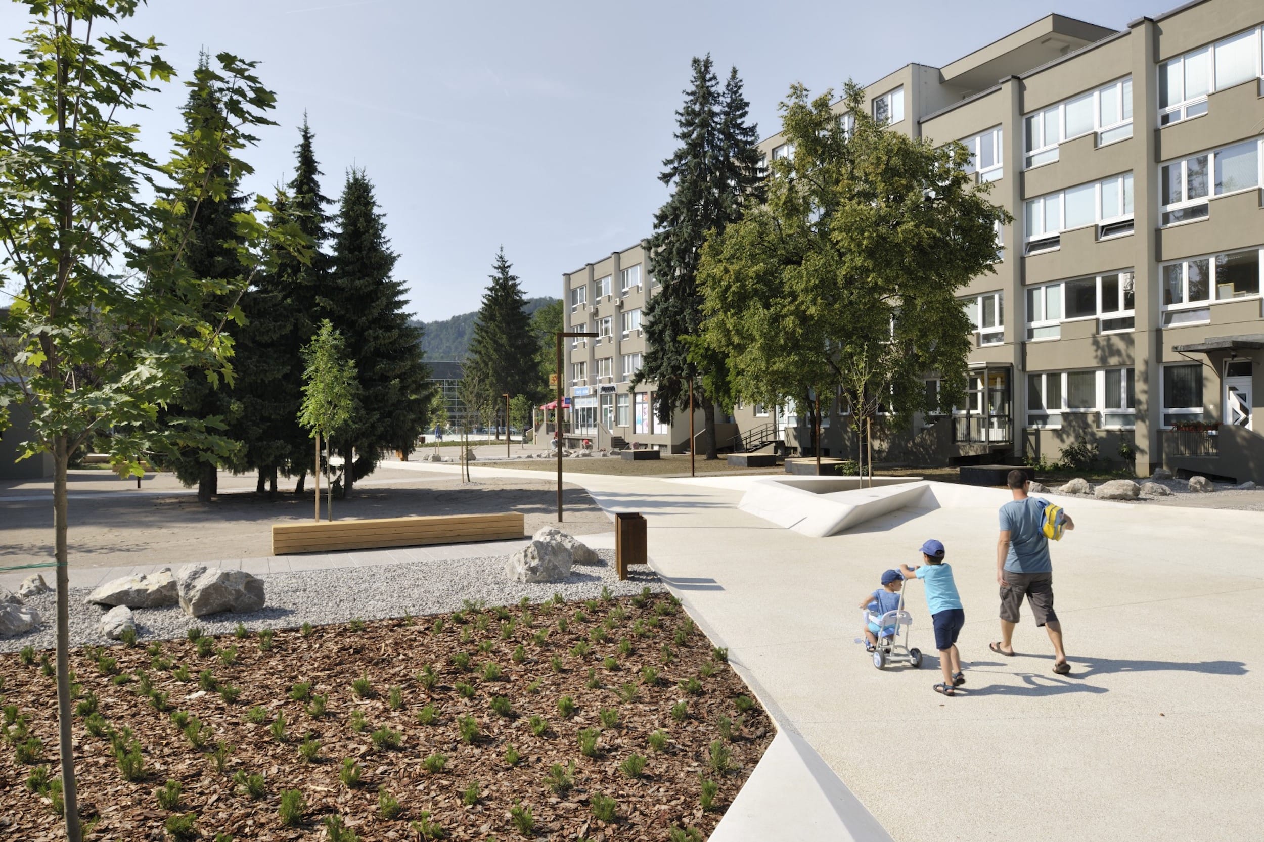
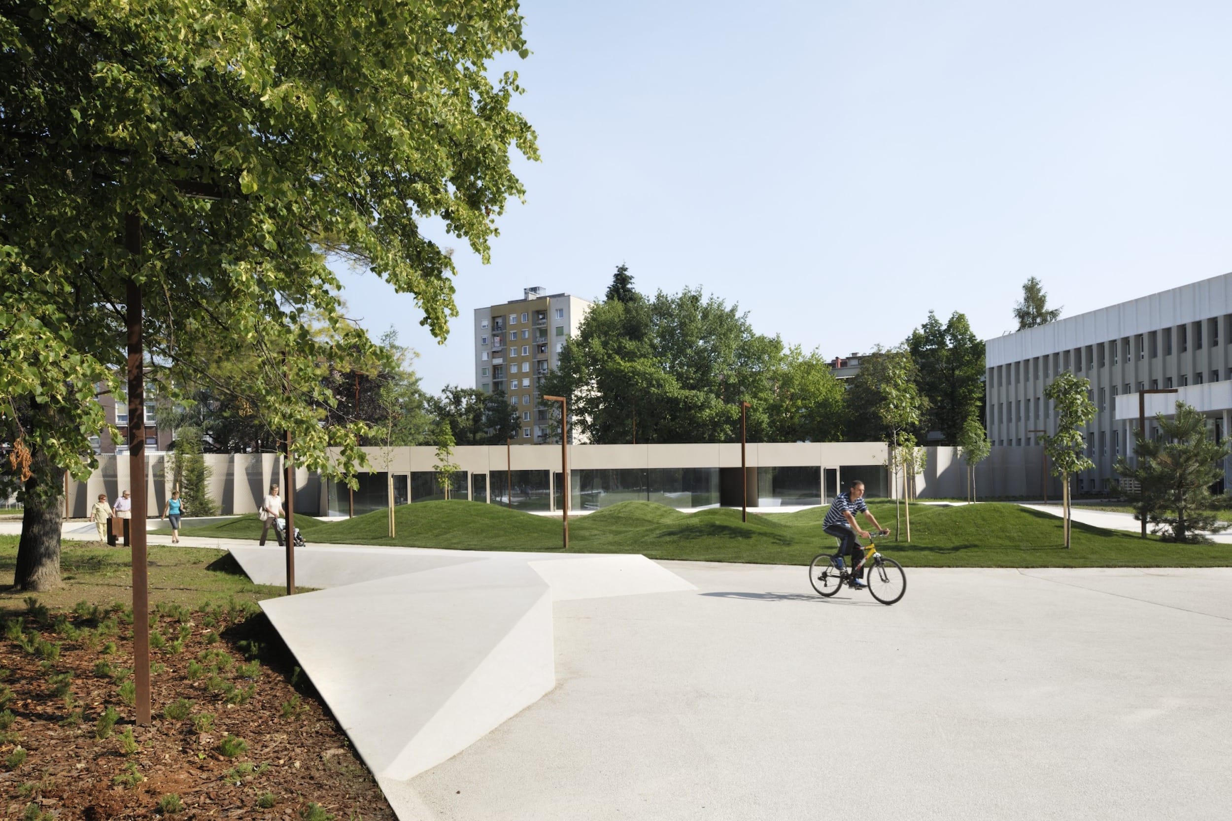
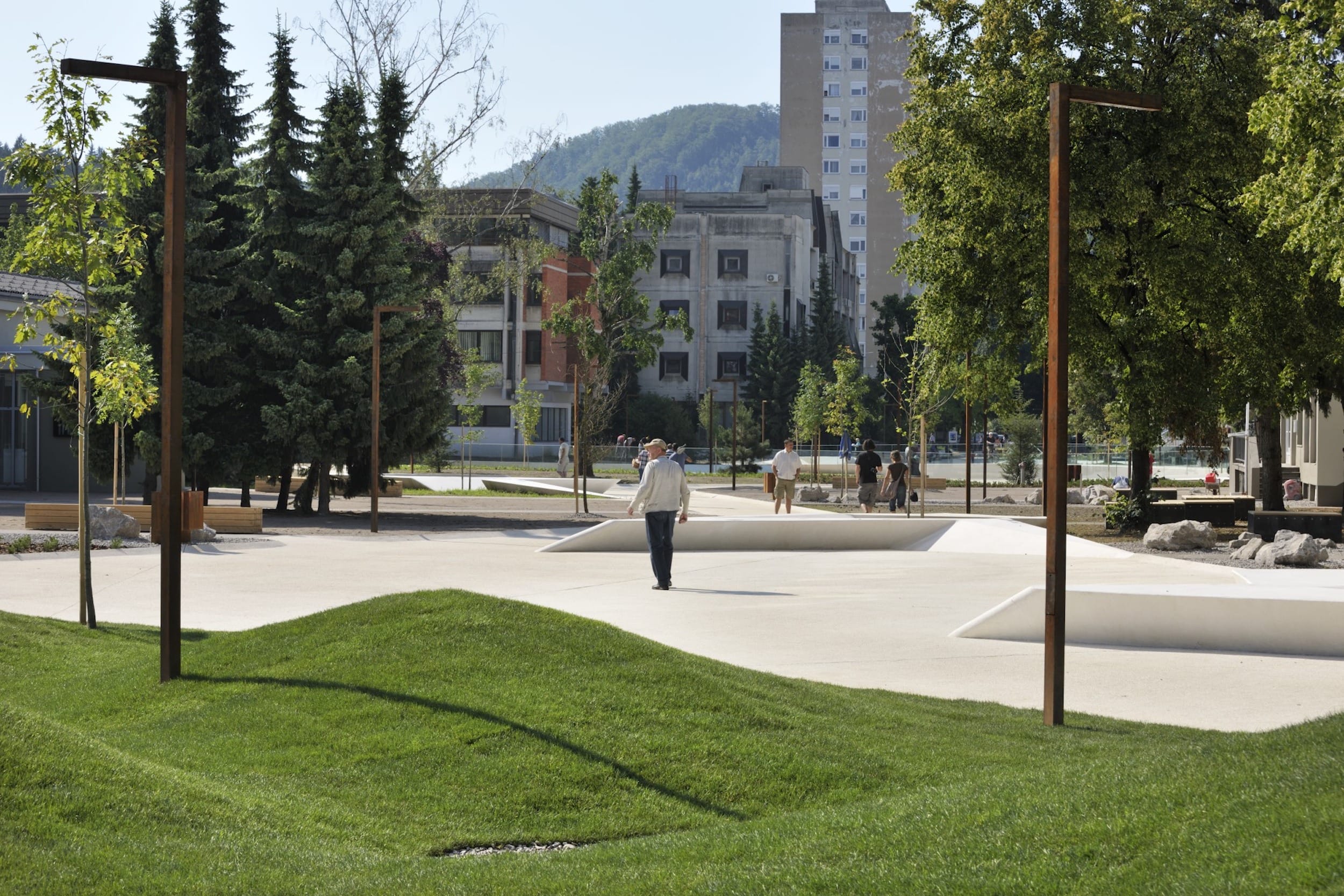
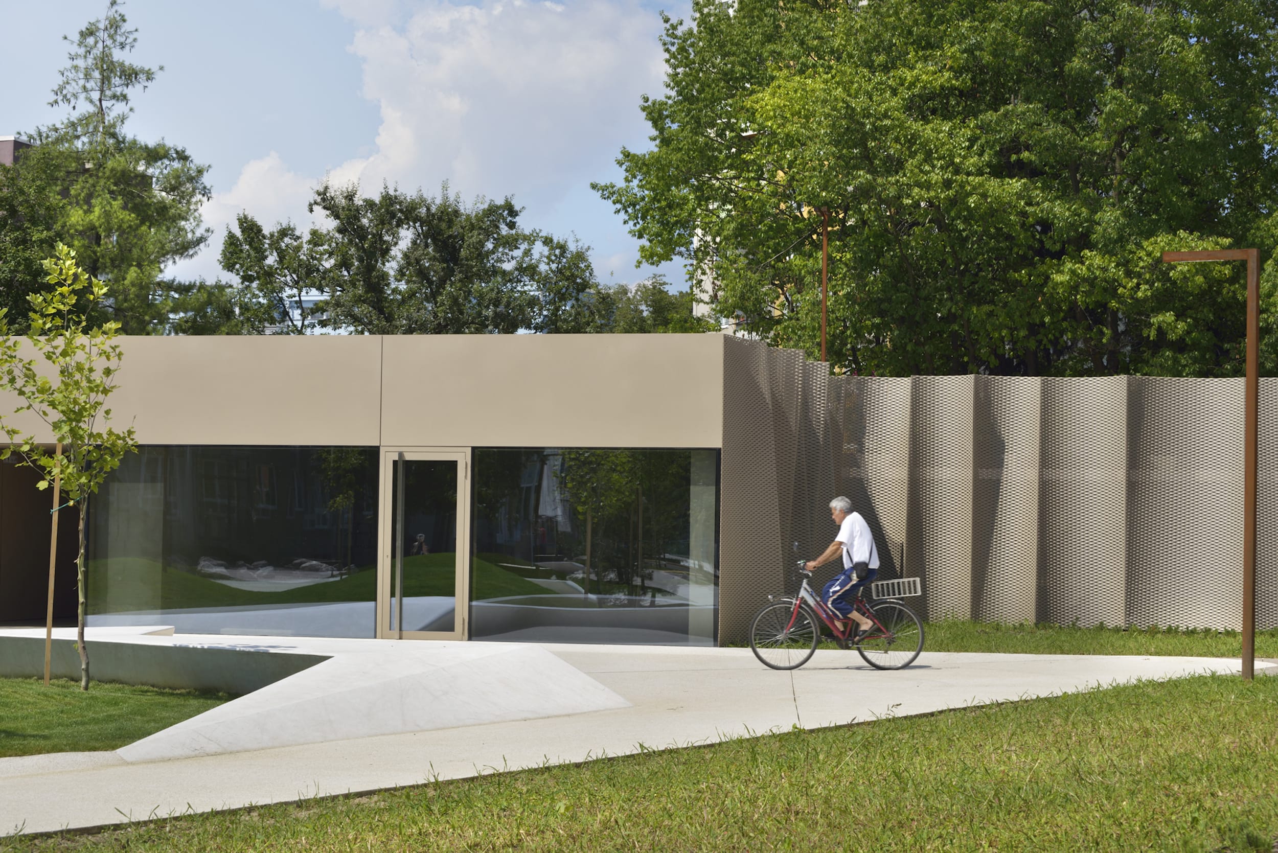
通过改造,这个有着清晰起点和终点的宽阔直线连接经历了一次转变,变成了一系列的微环境,由稍微扭曲的狭窄路径连接的局部加宽表面。这些扩展(实际上是广场)的实例以吸引人的具体城市元素(长椅)为特色,这些元素的精心安排减缓了用户的速度,并提供了焦点,为额外的项目内容创造了空间。随着路径沿着周围建筑局部弯曲,它产生了更大的包含开放空间,允许未来的内容从建筑向外扩展,或根据需要容纳其他额外内容。在初始阶段,所有这些新形成的公共空间都被简单而经济地布置成沙或草表面,特别是沙表面代表了一个成功的介于草和铺好的城市空间之间的中间地带,允许在有限的投资下进行广泛的使用。
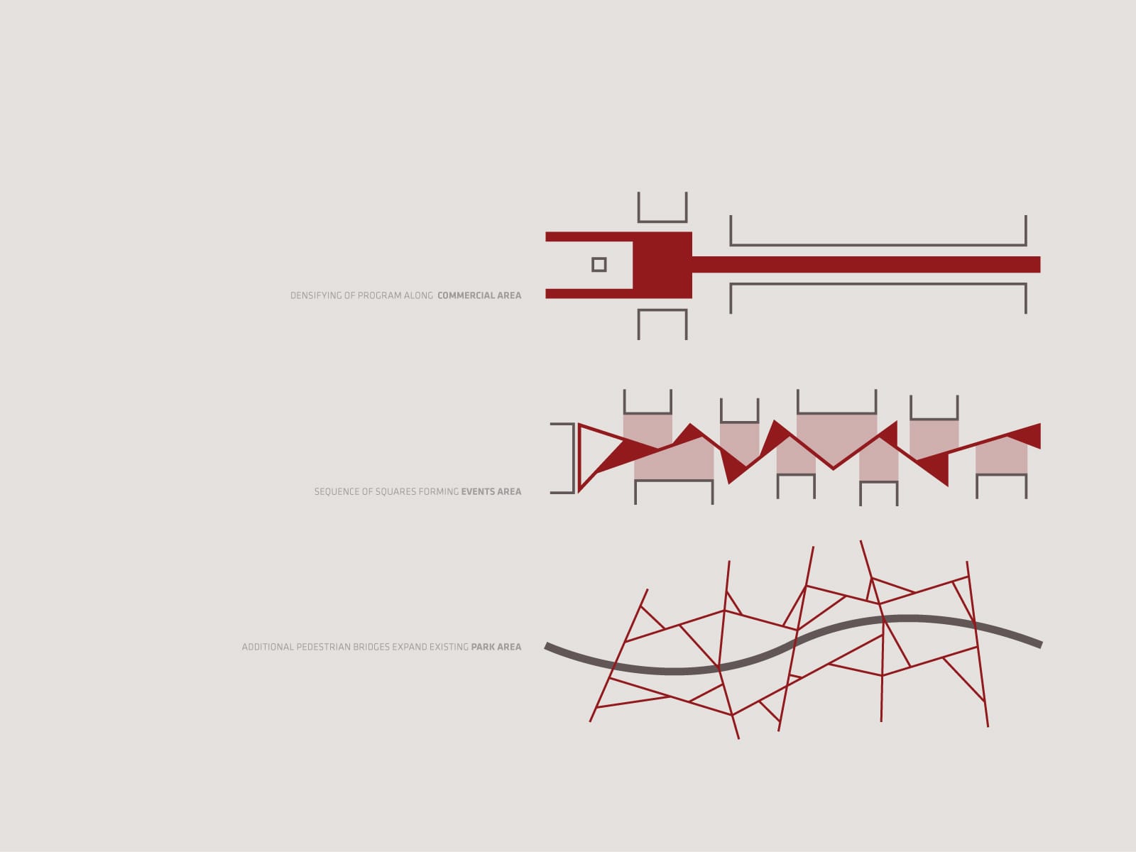
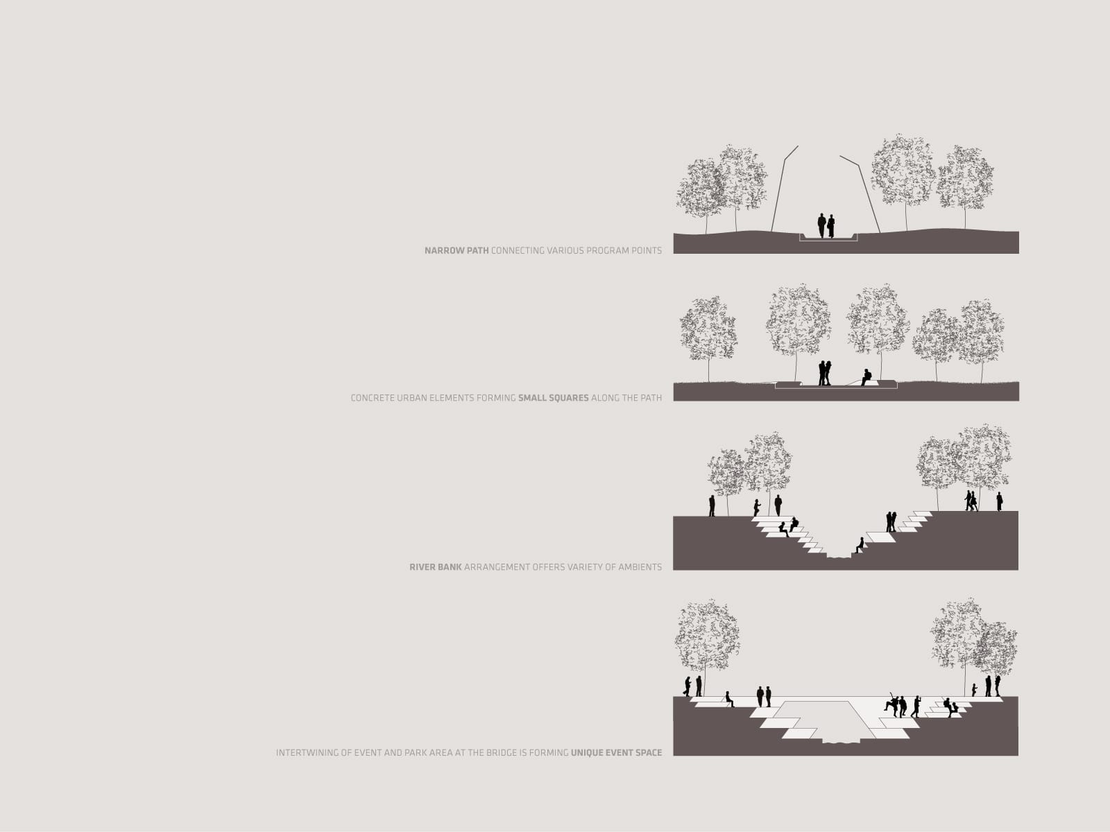
Through renovation, the wide straight connection with a clearly delineated beginning and termination underwent a transformation into a kind of sequence of micro-ambients, of locally widened surfaces connected by a slightly twisting narrower path. These instances of widening (in effect squares) feature attractive concrete urban elements (benches) whose careful arrangement slows down the users and provides focus, framing the space for the additional programme content to take place. As the path locally twists along the surrounding buildings, it gives rise to larger contained open spaces, allowing future expansion of the content from the buildings outwards, or the accommodation of other additional content as required over time. In the initial phase, all these newly-formed public spaces are simply and cost-effectively laid out as sand or grass surfaces, with sand surfaces in particular representing a successful middle ground between grass and paved city spaces and allowing a wide range of use with only modest investment.

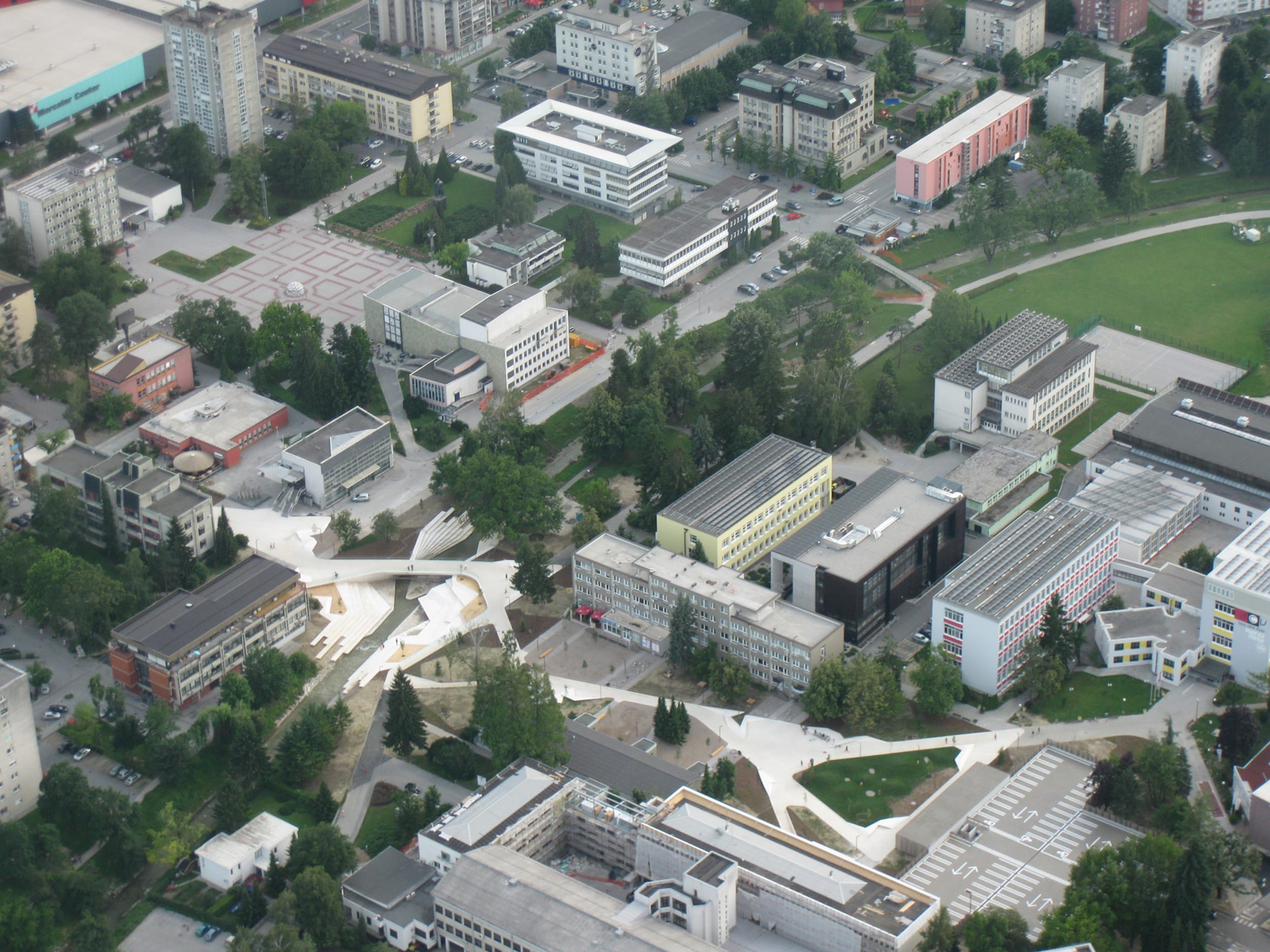
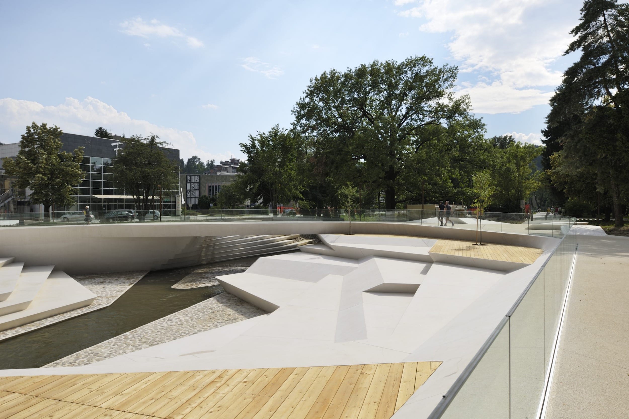
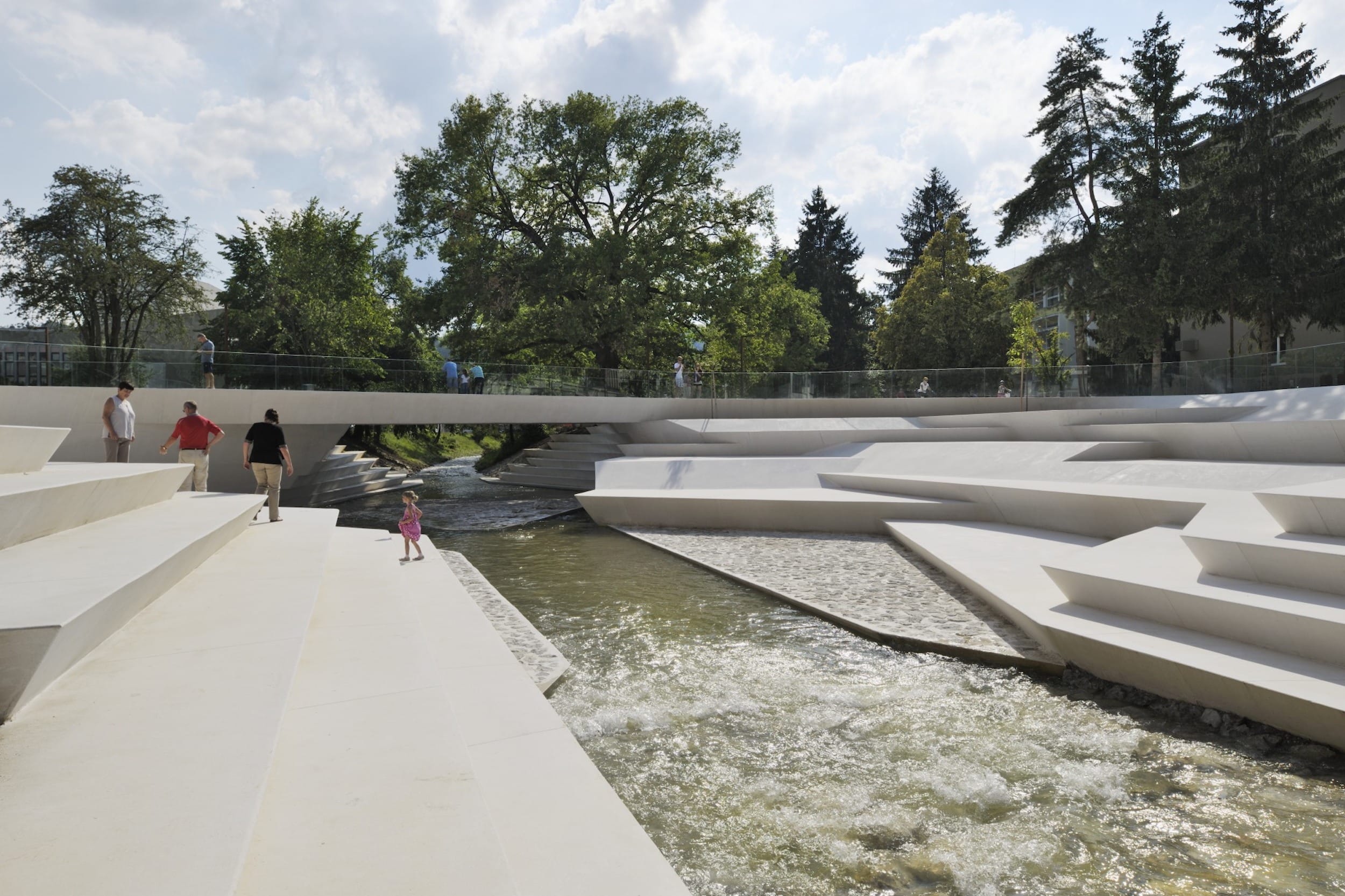
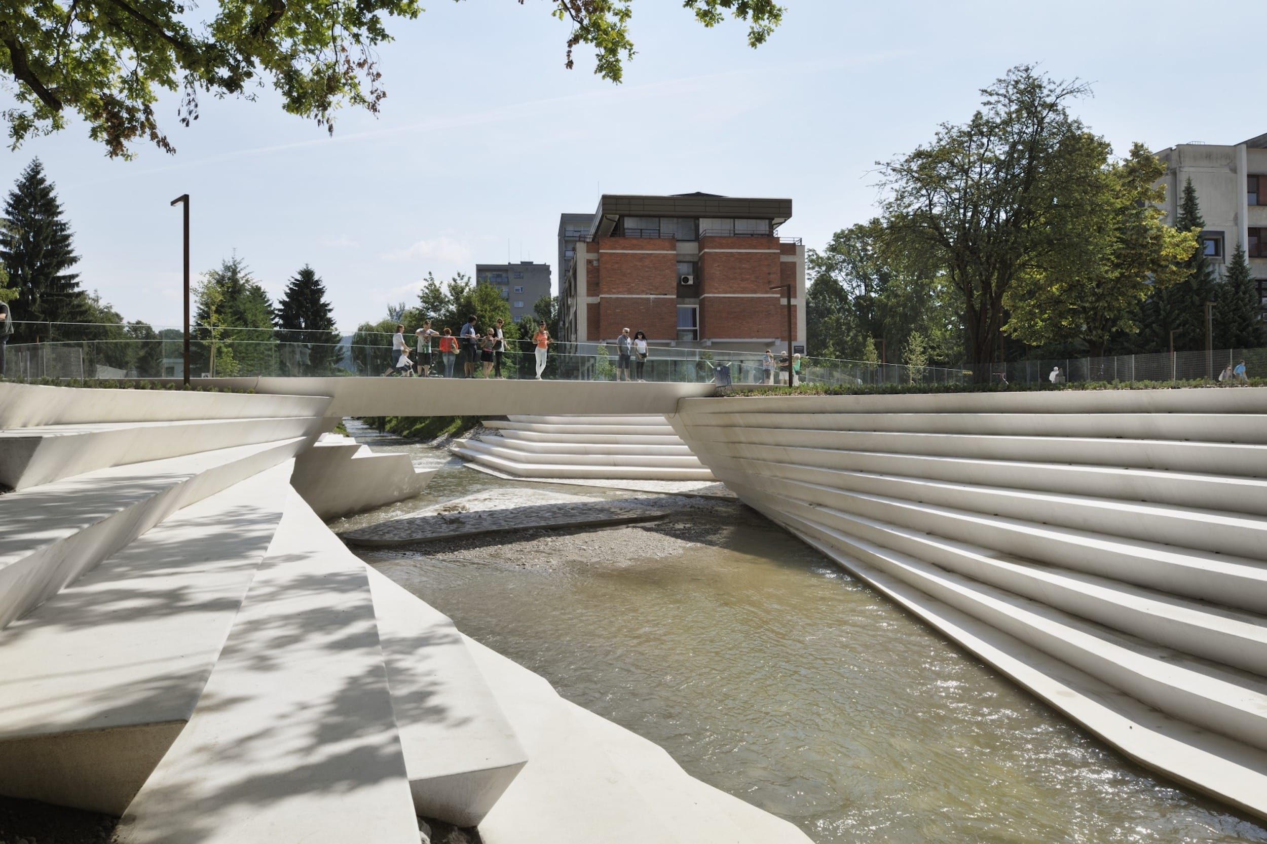
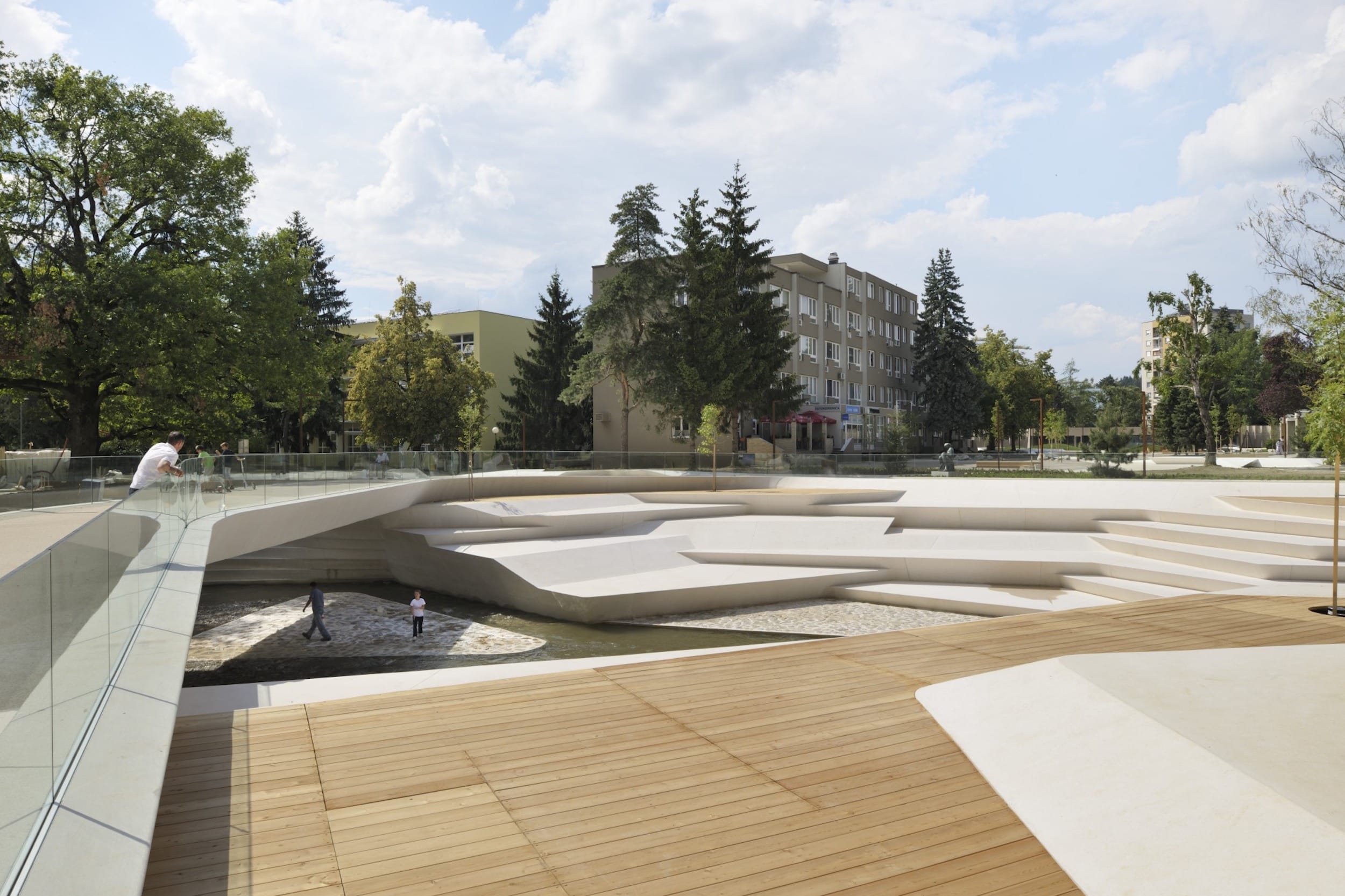
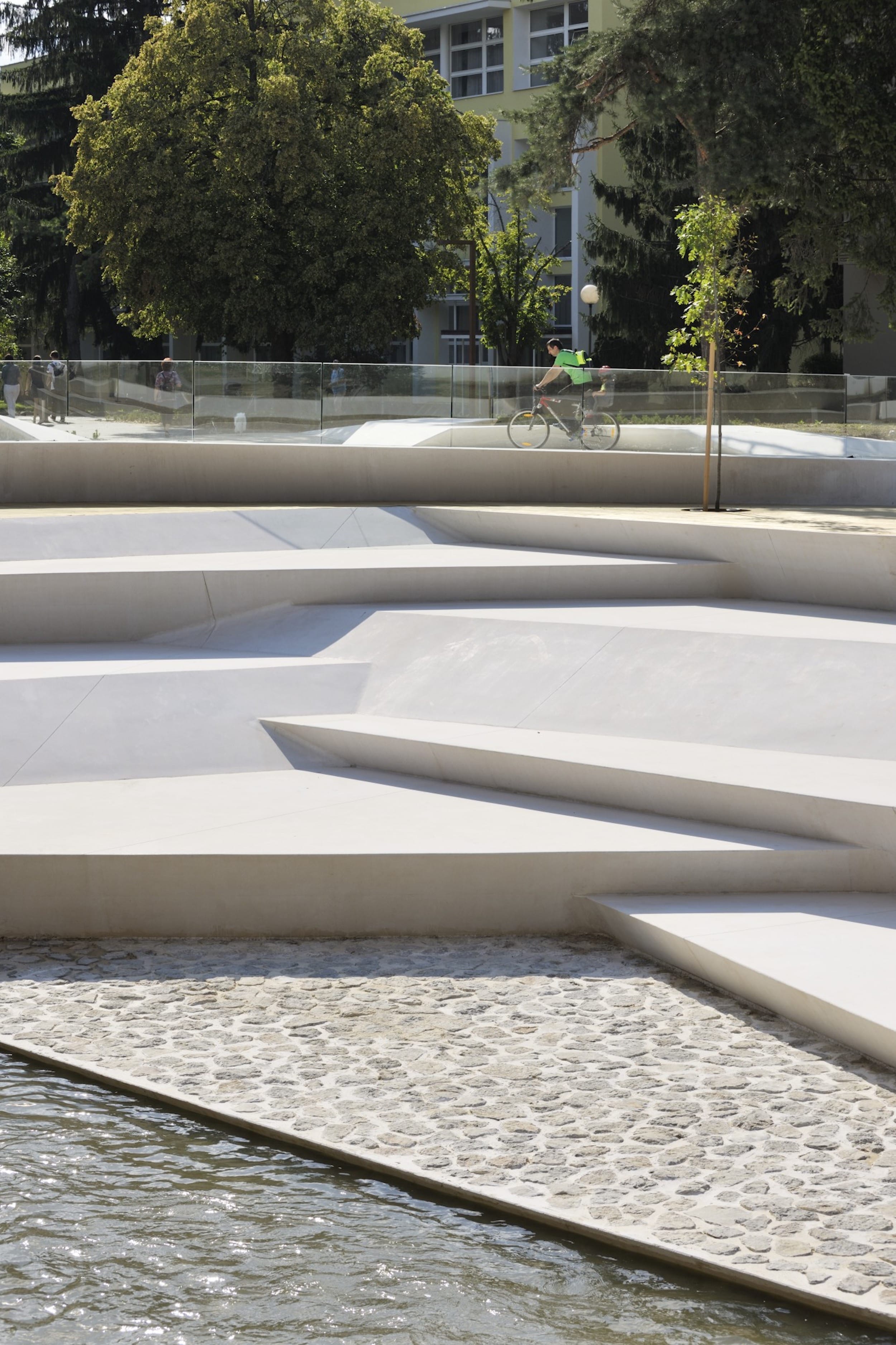
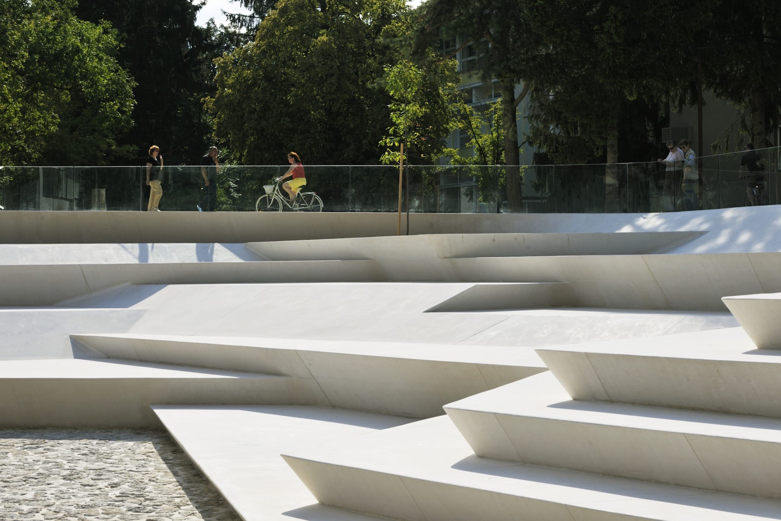
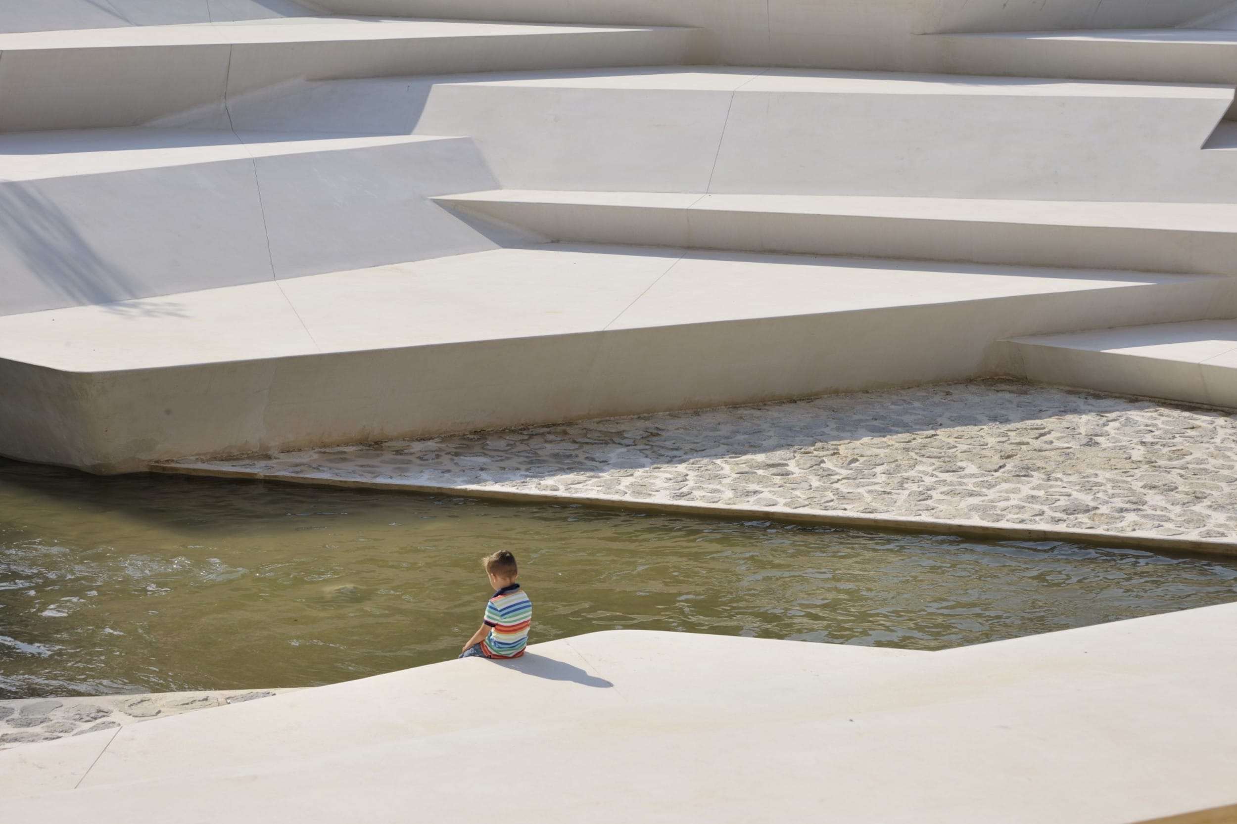
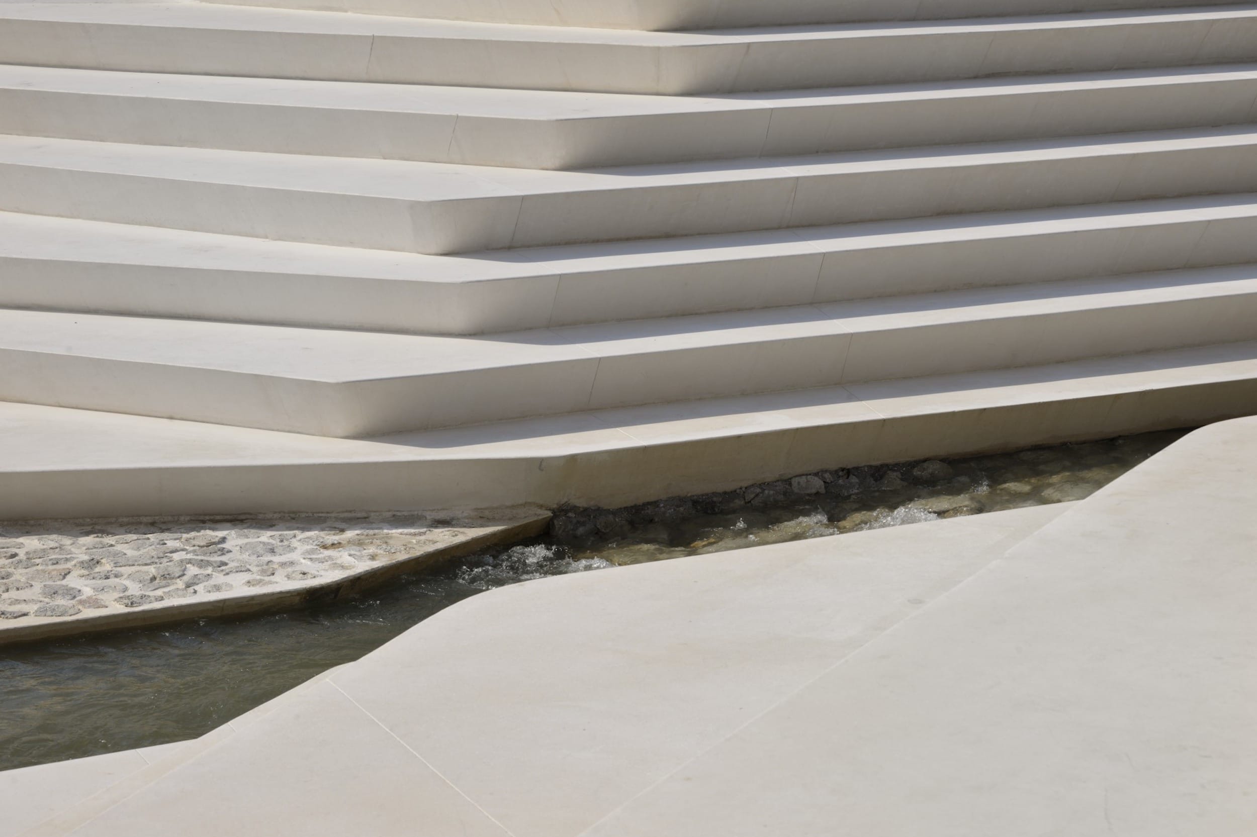
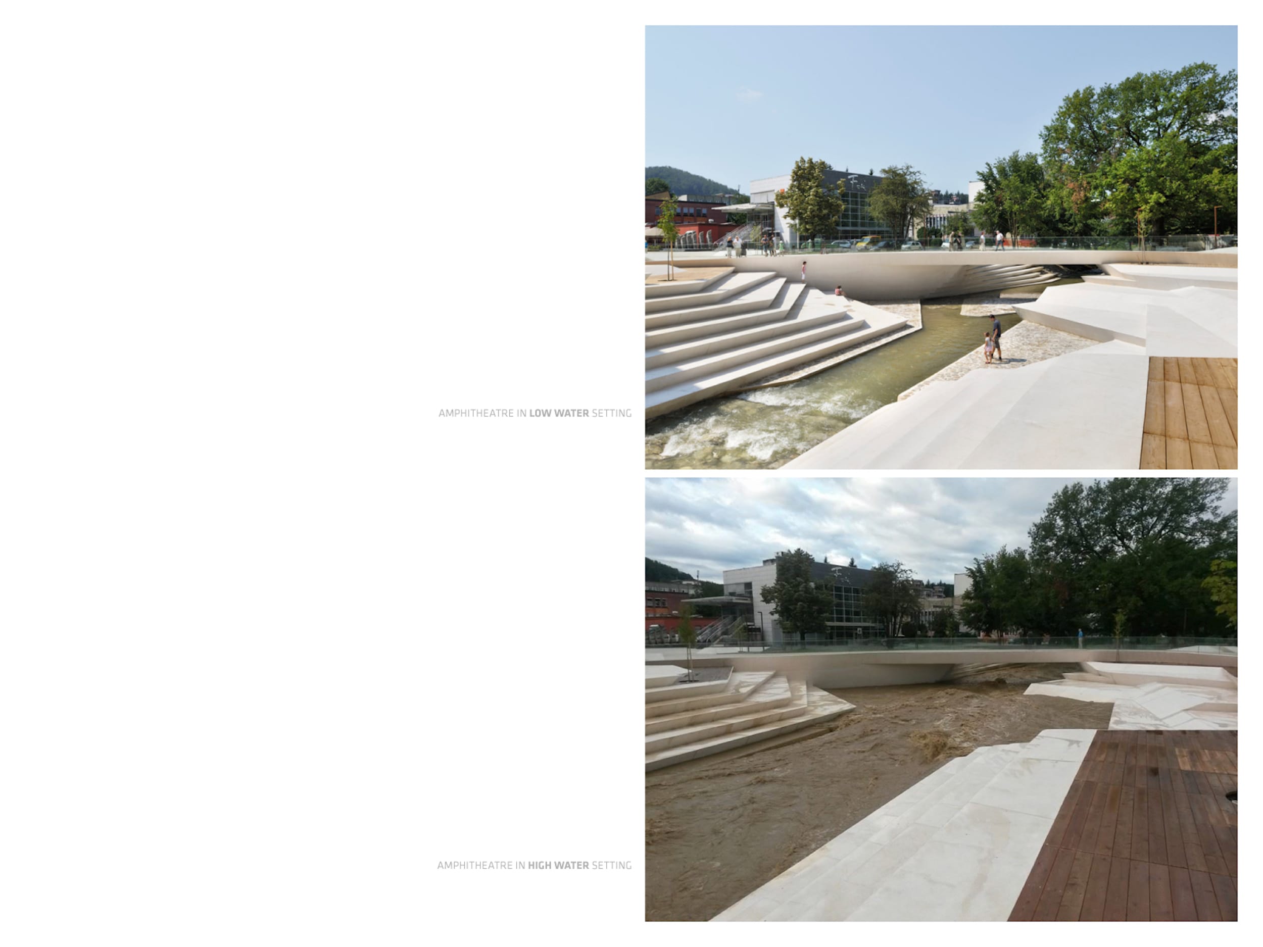
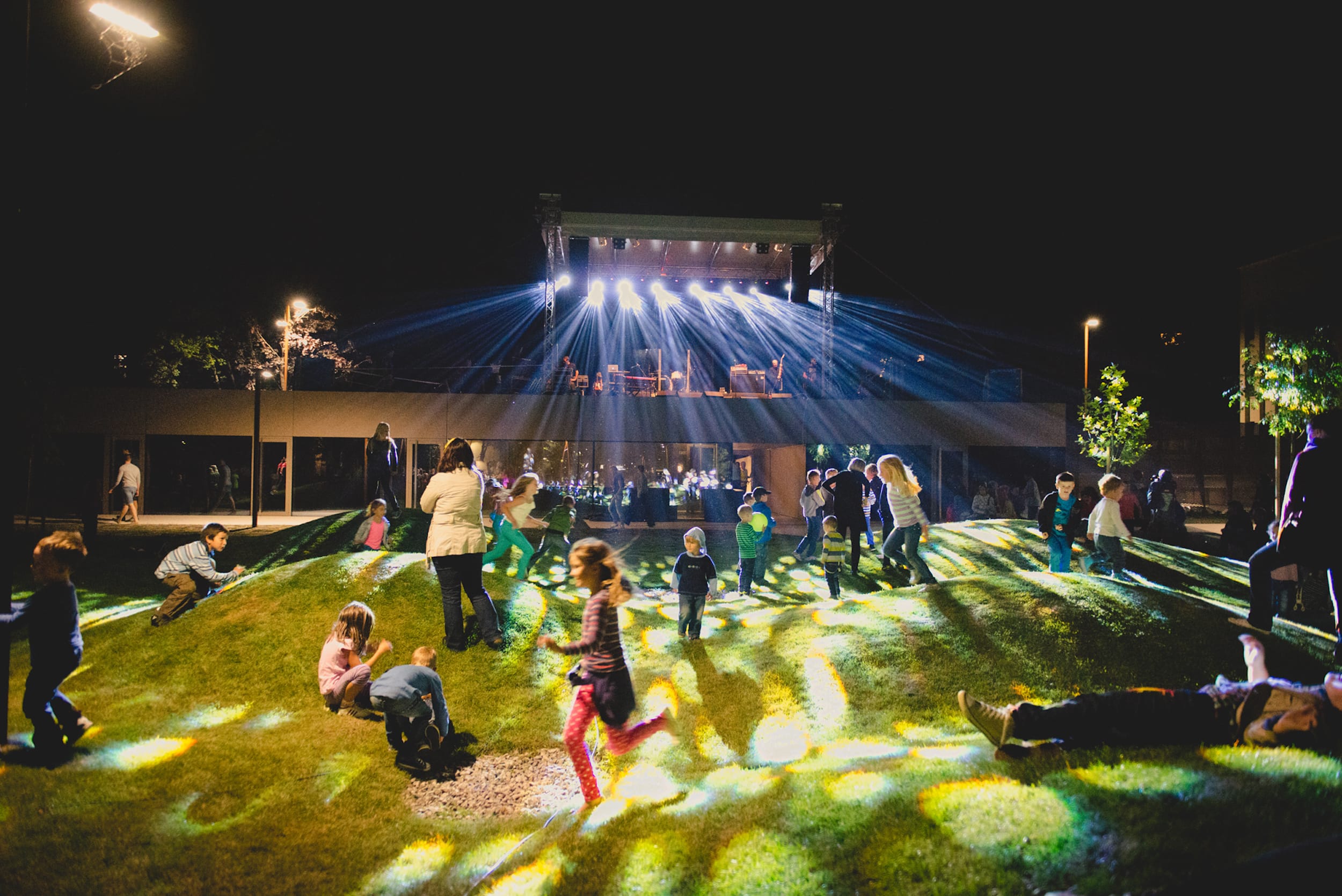
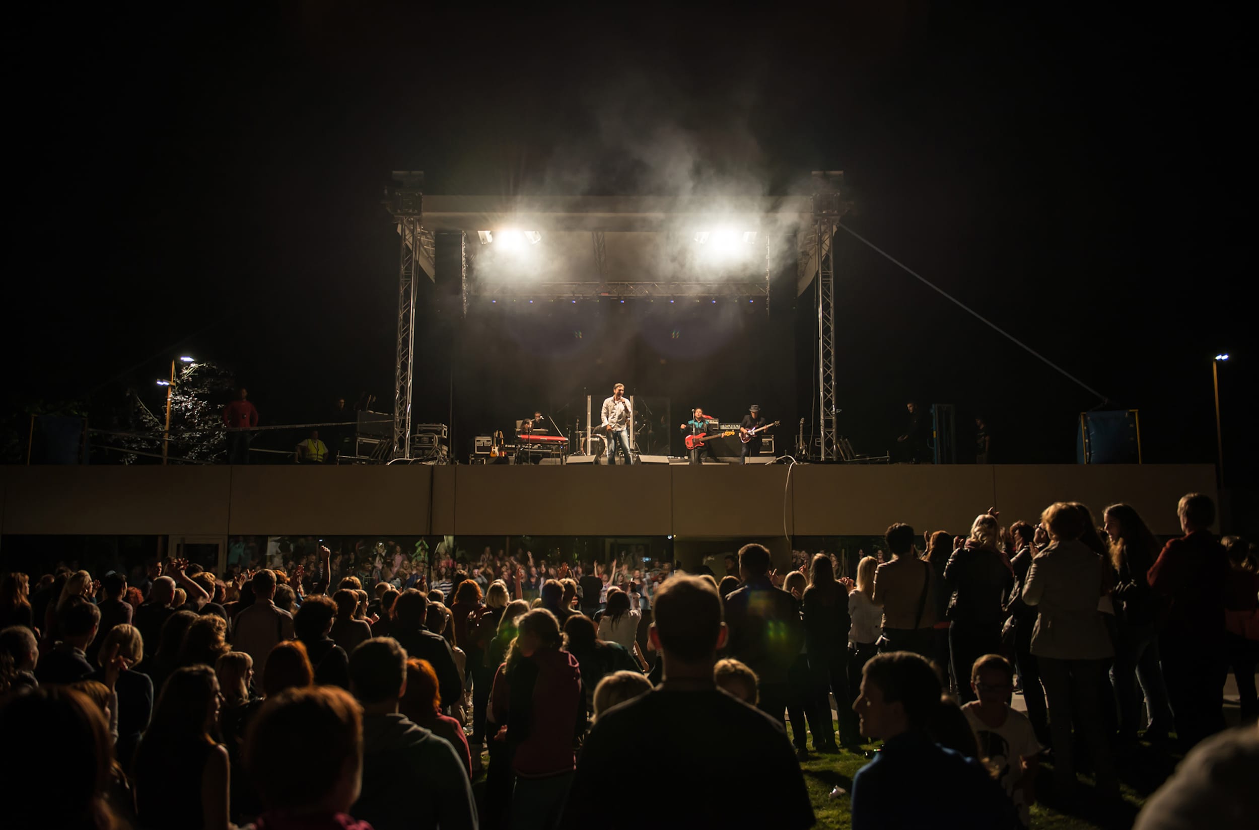
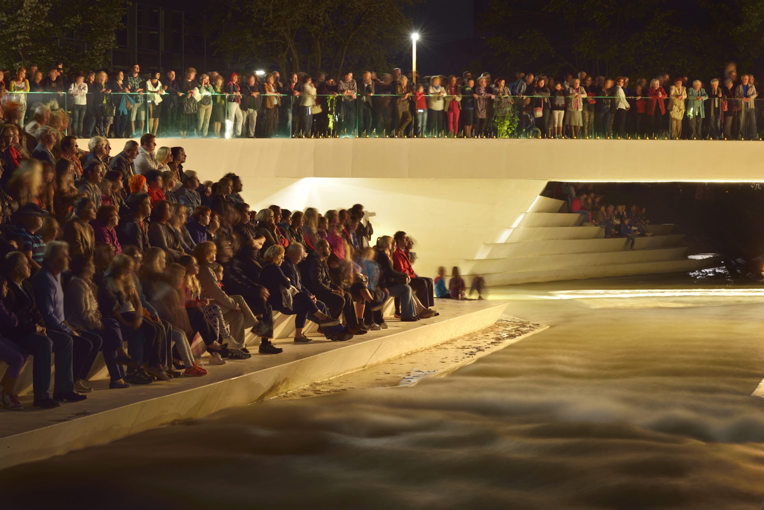
通过改造,Promenada将成为城市一个主要活动轴线,其中心将被放置在沿河新建的圆形剧场中。帕卡河是一条湍急的河流,这意味着它的河道每年都要涨水好几次,但在其他时候都相对较浅。因此,河床很深,直到现在,这条河流一直是个有吸引力的元素。这座宽桥也意味着任何走过它的人都很难看到这条河。通过缩小桥的范围并将其放置在离前一条轴线较远的地方,圆形剧场的建造空间因此得以恢复,该剧场慢慢向河流表面倾斜。河边迷人的圆形剧场,以新桥为背景,成为城市活动的中心,这条河可能再次成为市民意识中的一个重要场所。
With the transformation, the Promenada is turning into a main event axis of the city, its centre being placed into the new amphitheatre along the river. The river Paka is a torrential river, which means that its watercourse swells up significantly a few times a year, but remains relatively shallow at all other times. As a consequence, the riverbed is very deep and until now, the river, which is an attractive element of any city, flowed out of sight somewhere down below. The wide bridge also meant that anyone walking across it had a hard time seeing the river at all. By narrowing the bridge and placing it off the former axis, the space for the construction of an amphitheatre, which slowly slopes down towards the river surface, is recovered. The attractive amphitheatre by the river, with the new bridge serving as its backdrop, becomes the centre of the activity in the city, and the river may once again claim an important spot in the townspeople’s consciousness.


新住宅开发
为了增加市中心的全职居民数量和改善居住结构,需要建造新的、更高质量的公寓。对于年轻的家庭来说,他们必须提供目前只能由单个家庭提供的东西,即充足的生活空间和优质的私人和公共空间。然而,即使在目前,住在市中心的公寓也意味着住在幼儿园和学校、城市游乐场和青少年休闲场所附近。
新建住宅的选址必须考虑到城镇现有的城市设计,在这些设计中,典型的高层建筑占据的地面相对较少。新的住宅建筑也应该是高的,以大的绿色梯田和内部的生活空间为特色,有水平的衔接。居民的停车场位于地下停车场。除了年轻的家庭,这样的公寓结合了个人发展和集中发展的优势,也会吸引其他类型的活跃居民。
New residential development
In order to increase the number of full-time residents of the city centre and improve the inhabitant structure, new, higher-quality flats need to be constructed. To young families, they must offer what can currently be provided only by an individual family home, i.e. sufficient living surfaces and quality private and public space. Even at present, however, a flat in the city centre means living close to kindergartens and schools, city playgrounds and youth leisure spaces.
The sitting of new residential capacities must take into account the town’s existing urban design where typically tall buildings occupy relatively little ground surface. New residential buildings should also be tall and are to feature large green terraces and interior living spaces with level articulation. The residents’ parking is made available in an underground parking garage. Beside young families, such flats, incorporating the advantages of individual and condensed development, will also attract other active categories of residents.


公园
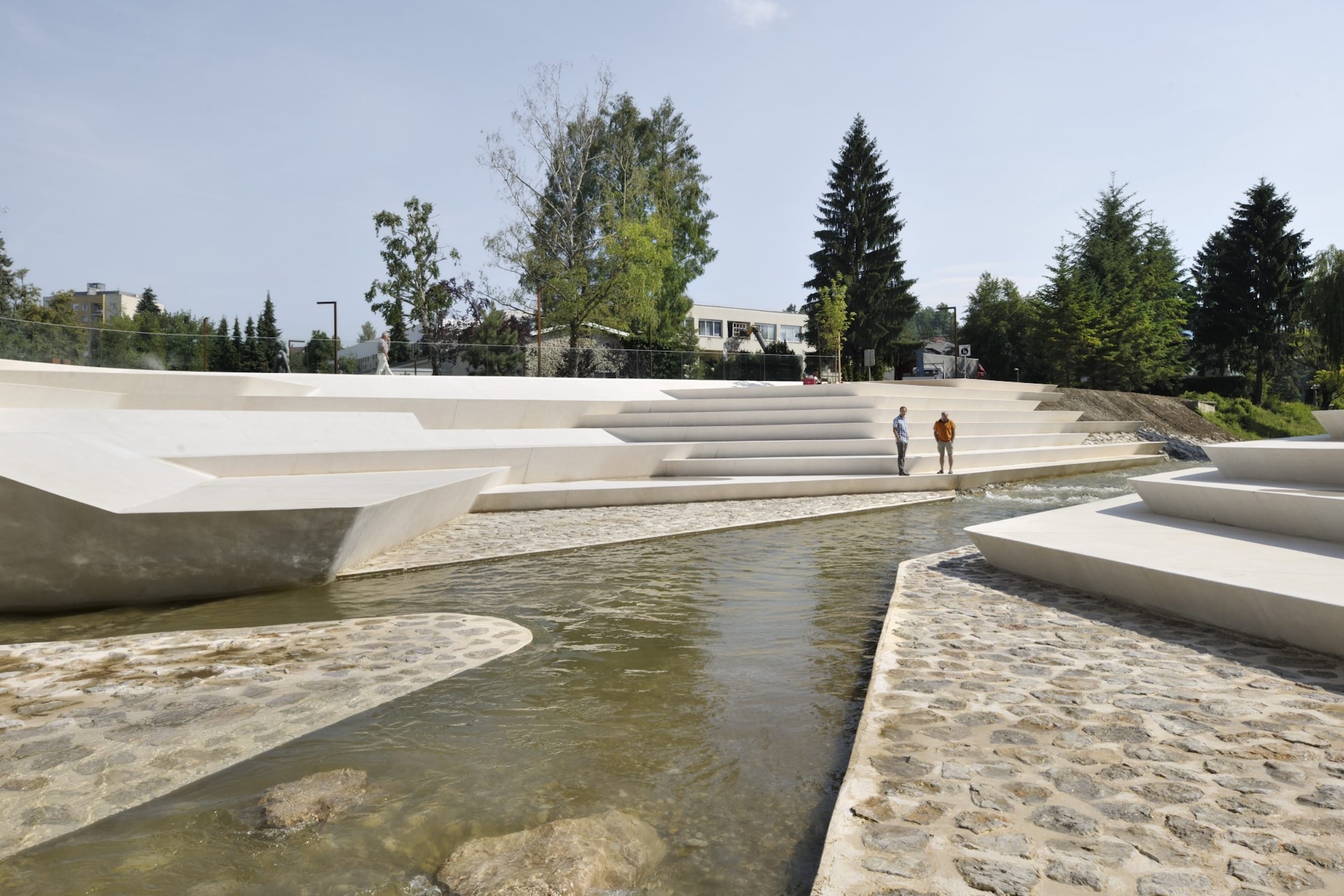
目前,公园位于帕卡河北岸,一边是河流,另一边是通往学校综合体的运输道路。公园里的游客并没有真正接触到这条河,因为帕卡河被大量的植被覆盖。河的南岸是一个公共停车场。根据从市中心拆除交通和停车面的计划,公园的绿色区域将延伸到卡帕两岸,从一面是学校综合楼,另一面是文化中心和前煤矿管理大楼。帕卡相对较深的河床现在将这个区域分成了两半,但是通过修改河岸并形成一个朝向水位的台阶,它成为了该地区的中心元素。在好几个地方和层次上,都是riverf
The Park
At present, the area of the park is on the northern bank of the Paka, enclosed by the river on one side and by the delivery road to the school complex on the other. The visitors to the park don’t have a real contact with the river, as the torrential canal of the Paka is liberally overgrown with vegetation. The southern bank of the river serves as a public car park. In accordance with the projection of removing the traffic and parking surfaces from the inner city centre, the green area of the park is to be extended across both banks of the Paka, all the way from the school complex buildings on one side and the Cultural center and the former coal-mine administration building on the other. Paka’s relatively deep riverbed now divides the area into half, but by modifying the riverfronts and creating a stepped approach towards the water level, it becomes the area’s central element. In several places and on several levels, both riverf


市中心的三个乐队
为行人而设的三个主要方向横跨市中心:帕卡河两岸的“公园”;终止于铁托广场的“商业街”;与前两个垂直的是“Promenada”,它也将它们连接起来。这三个波段都提供了明显不同的空间使用方式,所以它们各自接收到不同的视觉特征是很重要的。在他们聚集在一起的点上,乐队在视觉上互相补充,并将中心连接成一个逻辑整体。因此,城市中心所有可用的节目内容都集中在这三个波段是有道理的。通过这种方式,空间的使用者可以在穿越城市的过程中不断地活跃起来,从而防止“灰色地带”的产生——否则的话,这些区域可能会导致城市某一部分的退化。因此在为每个乐队分配不同类型的节目内容时需要特别注意。
Three programme bands of the city centre
Three main directions intended for pedestrians cross the area of the city centre: the “Park” on both sides of the river Paka; “Commercial Street” terminating in Tito’s Square; and, perpendicular to the first two, the “Promenada”, which also connects them. Each of these three bands offers a markedly different use of the space, so it’s important that they each receive a distinct visual character. At the points where they come together, the bands visually complement each other and tie the centre together into a logical whole. It therefore makes sense that all the available programme content of the city centre is condensed precisely in these three bands. This way, the users of the space can be constantly animated as they pass through the city, which prevents “grey zones” from being created – these could otherwise lead to the degradation of a given part of the town. Special care is required in allocating the different types of programme content to each of the bands.


项目名称: 韦莱涅市中心步行区Promenada
年份: 2012年
现状: 2014年完成
面积: 17020平方米
预算: 2 700 000欧元
客户: 韦莱涅市
地点:斯洛文尼亚韦莱涅
建筑: ENOTA
项团队: Dean Lah, Milan Tomac, Tjaž Bauer, Andrej Oblak, Polona Ruparčič, Nuša Završnik Šilec, Alja Černe, Nebojša Vertovšek
结构工程:Elea iC
机械服务:Nom biro
电气规划: Elsing
照片: Miran Kambič,Roman Bor , Edita Fric
奖项:
国际建筑奖
The Plan Awards,公共空间获奖者
欧洲公共空间奖决赛选手
second特别提名
建筑A +奖项,建筑+Water finalist
建筑A +大奖,公共公园决赛选手
10个欧洲风景园林最佳旅游景点排名第三
Piranesi奖提名
绿叶奖,年度城市设计入围
Plečnik奖入围
project name: Velenje City Center Pedestrian Zone Promenada
year: 2012
status: completed 2014
size: 17020 m2
budget: 2.700.000 EUR
client: Velenje Municipality
location: Velenje, Slovenia
architecture: ENOTA
project team: Dean Lah, Milan Tomac, Tjaž Bauer, Andrej Oblak, Polona Ruparčič, Nuša Završnik Šilec, Alja Černe, Nebojša Vertovšek
structural engineering: Elea iC
mechanical services: Nom biro
electrical planning: Elsing
photos: Miran Kambič,Roman Bor , Edita Fric
Awards:
The International Architecture Award
The Plan Awards, Public Space winner
European Prize for Public Space finalist
S.ARCH special mention
Architizer A+ Awards, Architecture + Water finalist
Architizer A+ Awards, Public Park finalist
10 of The Best Tourist Spots for Landscape Architecture in Europe 3rd place
Piranesi Award nomination
Leaf Awards, Urban Design of the Year shortlisted
Plečnik Award shortlisted
更多 Read more about: ENOTA


0 Comments